Tête de l’Arpettaz via the Passage de la Bourse

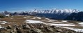
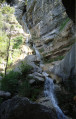
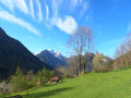
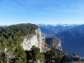
It is a varied hike, part of which takes place through woodland, whilst another section crosses a large cliff face – the Passage de la Bourse – and, after passing through the Ablon mountain pasture, the final stretch leads to a breathtaking panorama, which one would never have suspected during the long ascent. From Lake Geneva to Mont Blanc, from the Chablais to the Bauges and from the Aravis to the Grand Combin, nothing will escape your view.
Please read the practical information and the safety warning regarding the Passage de la Bourse carefully.

Details

41300262
Creation:
Last update:
Last review:
  • Walking
    Activity: Walking
  • ↔
    Distance: 6.74 mi
  • ◔
    Average duration: 6h 50 
  • ▲
    Difficulty: Difficult

  • ⚐
    Back to start: Yes
  • ↗
    Ascent: + 4,311 ft
  • ↘
    Descent: - 4,311 ft

  • ▲
    Highest point: 6,030 ft
  • ▼
    Lowest point: 2,323 ft

Description of the walk

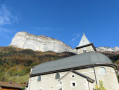
The starting point is in La Balme-de-Thuy, at a place called Les Challes. From Annecy, leave the D46 at the Saint-Clair bridge. Take the D216 and, just after the church at La Balme-de-Thuy, take the small road to Les Challes which climbs to the left and stop at the hairpin bend to the right where the start of the path is marked by a signpost indicating: Les Challes 705 m. Coming from Thônes, take the D216 at the Morette bridge towards La Balme-de-Thuy. The Les Challes road branches off to the right before the church.

(S/E) Follow the track and then the path as it climbs northwards through the beech and spruce forest: the gradient is steep. You’ll emerge from the forest at the foot of the cliff at an altitude of around 1,400 m. The path is beautifully marked out and time flies by.

(1) As this section is rarely used, it has not been cleared: take care where you step so as not to dislodge any stones. Signs indicate that this section is dangerous
This is where the Passage de la Bourse begins, protected by a series of chains and a few bolts to secure children if necessary. Return to the forest to reach the Col de la Bourse at an elevation of 1,663 metres.

(2) About a hundred metres past the pass, the path turns sharply to the right, heading north towards the Vallon d’Ablon, before reaching a fork.

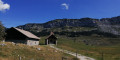
(3) Continue above the path, following the existing track, to avoid losing too much altitude. In October 2023, wild boars had ravaged the mountain pasture. About 400 metres further on, join a path.

(4) Follow it to the right, climbing steadily but at a leisurely pace through the forest. As you emerge from the forest, the slope becomes steeper and, after a few hairpin bends, you’ll reach the unnamed pass below the summit.

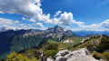
(5) From the pass, you need only turn your head to see the Tête de l’Arpettaz. Follow the south-west-facing summit ridge to reach the summit of the Tête de l’Arpettaz.

(6) The view is a lovely 360°. Head back down to the Col de la Bourse.

(2) Take care on the descent down the Passage de la Bourse, which can prove tricky for a group. Signs indicate that this section is dangerous.

(1) Then return via the same route you took on the way there (S/E).

Waypoints

  1. S/E : mi 0 - alt. 2,326 ft - Les Challes 705 m
  2. 1 : mi 1.5 - alt. 4,623 ft - Start of the Passage de la Bourse
  3. 2 : mi 1.99 - alt. 5,377 ft - Col de la Bourse
  4. 3 : mi 2.25 - alt. 5,200 ft - Junction, unmarked path
  5. 4 : mi 2.4 - alt. 5,171 ft - Junction for the summit.
  6. 5 : mi 3.28 - alt. 5,981 ft - Unnamed pass beneath the Tête de l’Arpettaz.
  7. 6 : mi 3.39 - alt. 6,027 ft - Tête de l'Arpettaz (1840m)
  8. S/E : mi 6.74 - alt. 2,323 ft - Les Challes 705 m

Notes

The Passage de la Bourse is not technically demanding but requires you to be attentive and vigilant. It is not recommended for those prone to vertigo.
The ‘difficult’ rating is justified by the length and elevation gain, rather than by the difficulty of the route itself.

Worth a visit

Places to visit in La Balme-de-Thuy: the Notre-Dame de Lourdes Grotto, the Nant Debout Waterfall, the Resistance Museum and the Military Cemetery.

Reviews and comments

4 / 5
Based on 1 review

Reliability of the description
4 / 5
Ease of following the route
3 / 5
Route interest
5 / 5
FlickaPatsy
FlickaPatsy
• Edited:

Overall rating : 4 / 5

Date of your route : Oct 12, 2025
Reliability of the description : ★★★★☆ Good
Ease of following the route : ★★★☆☆ Average
Route interest : ★★★★★ Very good
Very busy route : No

We wanted to make this hike circular by continuing along the ridges and passing through the peaks of Tête Ronde and Tête Noire, descending via the lapiaz to the chapel of Notre Dame Des Neiges, then returning to the starting point via the GR 96. I recommend using a track, especially for the route through the lappiaz, which can be tricky even though cairns show the way.
In total, 17.7 km and an elevation gain of approximately 1,550 m.
Be careful at point 1, where the Bourse passage and the chains that facilitate the ascent begin: at the end of the stony path, continue straight ahead for a few metres towards the cliff (yellow square painted on the cliff) and follow the direction indicated by a yellow arrow on a green background fixed to the bottom of a rock. Do not turn right immediately to climb up the cliff and follow it, as the GPS track might suggest (this is not the right path at all and is dangerous, especially when turning back).
Be careful at point 3, where you have to leave the path you have been following to join another higher up, cutting across the valley: the GPS track is very useful here.
It is worth noting that there is a small, easy climb (approximately 3 metres / level 3) before the summit of Tête Noire.
All in all, a superb hike which, although not technical, is still physically demanding.
The hike was done in beautiful autumn sunshine above the sea of clouds in the valleys.
Superb panoramic views and very few people until the top of Arpettaz (three trail runners encountered). A little more crowded (about ten hikers) on the way back, as the route crosses other less physically demanding hikes.

Machine-translated

Other walks in the area

For more walks, use our search engine .

The GPS track and description are the property of this route's author. Please do not copy them without permission.