Country:

 City:
City:


Drive through Le Chinaillon after Le Grand Bornand. On leaving Le Chinaillon, a few metres past what looks like a roundabout painted on the road, take the Route de Samance, which climbs to the left. Follow it for 900 metres and park wherever you can at the side of the road. This starting point is accessible by shuttle bus.
(S/E) Take the Chemin de la Gaudinière, a track suitable for vehicles, signposted for Lac de Lessy and the ‘Le Passe Montagne’ refreshment bar. Leave it very soon after, turning left onto the nature trail. You’ll pass close to Samance Farm and continue westwards, then northwards. You’ll reach a junction with a signpost indicating Lac de Lessy to the right and La Gaudinière to the left.
(1) Turn right, following the signs for Lac de Lessy.
(2) Turn left, following theGR® 96 (and theGRP® Massif de Tournette-Aravis).
(3) Leave theGR® andGRP® trails, which go round a small hill, and take a path on the right shown on the IGN map but not very visible at first. It becomes better marked and climbs quite steeply due north to the Col Sous Buclon (elevation 1902). Pronounced ‘Buquion’!
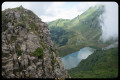
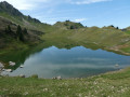
(4) From Col Sous Buclon, rejoining theGR® andGRP® routes, you descend along a good path to the magnificent Lac de Lessy, which looks like a true mirror.
(5) From Lac de Lessy, you leave theGR® andGRP® trails again and head off to the right, north-north-east, towards the Col de Sosay.
(6) At the Col de Sosay, you find yourself facing the Aiguilles Vertes, which you should note for later. The descent skirts a ravine to the right along an uneven path. You need to be careful. At the 1919-metre mark, on the right, a path crosses the Combe du Rasoir. At this point, we prefer to continue the descent towards the Cenise plateau.
A huge rockfall has damaged the path for a few dozen metres, but it is marked by cairns and paint markings. You’ll pass two small pools. At an elevation of 1,868 metres, you’ll join the path that climbs from the Chalet de Cenise to the Col du Rasoir. We continue the descent, keeping to the left (heading north), and after skirting a chasm, we carry on towards the Cenise mountain pasture along a path where the herd guards have been removed from a section carved into the rock.
(7) Turn right off the main path that would lead to the Cenise chalet to reach, ideally, the clearly visible ridge of the Arête de Chevry, as marked on the IGN map. Here you’ll find the path coming from Le Reposoir. In season, you’ll be walking through the grazing grounds of Abondance cows, which produce excellent milk for making Reblochon and Tomme cheeses.
(8) A ‘hunting reserve’ sign marks the start of the Aiguilles Vertes trail, which continues along the Arête de Chevry. You’ll find yourself facing a cliff face, but the path through the forest is easy to follow. You’ll need to pay close attention to stay on track, especially as it’s sometimes quite vertiginous.
When the path leaves the forest, you’ll come across a sheep track, which you should follow to the left to reach the ridge, where the Aiguilles Vertes path is clearly marked but very narrow and often vertiginous. It’s possible to join this sheep track at the bottom of the descent from the Col de Sosay, from where it’s clearly visible. Follow this ridge, which crosses valleys where ibex are abundant and where you may be flown over by the bearded vulture from Le Reposoir.
(9) About 200 m below the Col du Rasoir, you join the path coming from the Chalet de Cenise and leading to the Col du Rasoir. The ibex in the upper part of the valley on the left often dislodge stones.
(10) From the Col du Rasoir (2,250 m), follow an almost horizontal, tapering ridge to the right for about a hundred metres. Do not attempt this if you are afraid of heights. The route continues via the Cravate pass and then climbs to the left (eastwards), first along a stony path and then through some easy, narrow gullies. You emerge at a cross. The summit is reached a few metres further on.
(11) From the summit of the Pic de Jallouvre, the view is sublime and spans 360°. Return to the Col du Rasoir by the same route.
(10) The descent is via the southern gully. The start is tricky. You must keep close to the cliff on the left until you see a cairn. Then, follow the cairns carefully through the scree. At around 2,000 metres, you’ll come to the via ferrata descent route and, 50 metres further down, you’ll be on a good path. Continue in this direction towards the Col de la Colombière.
(12) Leave this path at around 1,700 m, where a footpath is signposted to the right by a pedestrian arrow. Head for the car park for the via ferrata and the climbing walls at the Tour de Jallouvre. If you miss this junction, you’ll find the right path a few dozen metres further on.
(13) Just before the car park, turn right onto the path leading to the climbing routes. Follow this path, which passes above the two-hundred-year-old village of Cuillery, and you’ll reach the junction above the Samance farm, which you passed earlier that morning.
(2) From there, turn left to follow the path taken that morning in the opposite direction.
(1) Turn left again and head back to the car park (S/E).

 Visorando Member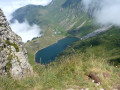
 Difficult
 Moderate
 Association / Club / Walk leader