Pointe de la Québlette and Pointe de Puvat

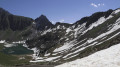
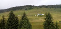
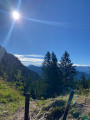
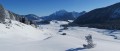
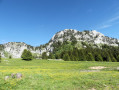
A lovely walk through the mountain pastures. You first follow a wide path that passes through small hamlets. The two peaks on the route offer a sweeping 360° panorama of the Jura to the north and the Aravis range and the Mont Blanc massif to the south. It makes for a lovely day’s family walk, although there are a few rocky sections at the Pointe de Puvat that may put off those who are prone to vertigo. This description takes you back along the route of an old path, which is, however, marked on the IGN map.

Details

n°110827091
Creation:
Last update:
Last review:
–
  • Walking
    Activity: Walking
  • ↔
    Distance: 9.05 mi
  • ◔
    Average duration: 7h 20 
  • ▲
    Difficulty: Difficult

  • ⚐
    Back to start: Yes
  • ↗
    Ascent: + 3,629 ft
  • ↘
    Descent: - 3,648 ft

  • ▲
    Highest point: 6,276 ft
  • ▼
    Lowest point: 3,068 ft

Description of the walk

Once in Entremont, head for the traffic lights. Then continue left or right – depending on which direction you’re coming from – along the small road leading to Malvoisin. The recommended car park is just before the bridge over the Overan.

(S/E) Cross the Overan and take the track on the right, which passes through several small hamlets whilst following the stream.

(1) Ford the Overan and navigate the numerous bends of the Chemin des Auges until you reach the junction for the Col de la Buffaz.

(2) Take the balcony path on the left which leads to the Col de la Buffaz.

(3) Turn right onto the path, which levels out to reach the Chalet de l’Ovine.

(4) Carry on straight ahead, leaving the chalet on your left, until you reach a three-way junction.

(5) Keep to the right to head north-east along a narrow path. Pass the Pointe de l’Ovine, which rises to the left, and reach the Col de l’Ovine: signpost.

(6) Continue north-east, leave the path on your left and continue climbing straight ahead over the rocks to the Pointe de Puvat: cross and panoramic view.

(7) Descend back to the Col de l’Ovine.

(6) Carry on for about a hundred metres to reach the junction with the ascent path. Ignore this path and head straight on, starting an uphill traverse along a faintly marked path. This path straightens out to reach the ridge, which you follow to the summit of the Pointe de la Québlette: panoramic views.

(8) Descend for about 300 metres, then turn right to rejoin the ascent path.

(5) Follow it to the right to return to the Chalet de l’Ovine.

(4) Turn left at a 90° angle to follow the traces of an old path as closely as possible. Pass the ruins and continue straight ahead: the path soon becomes more visible. Carry on to the Chemin des Auges, which is in fact a wide track.

(10) Take a sharp right-hand bend to return to the junction with the Chemin du Col de la Buffaz.

(2) Go straight on to retrace the ascent route in the opposite direction, heading back down to the car park (S/E).

Waypoints

  1. S/E : mi 0 - alt. 3,104 ft - Malvoisin car park
  2. 1 : mi 0.84 - alt. 3,576 ft - Ford on the Overan
  3. 2 : mi 2.3 - alt. 4,803 ft - Junction: 1st circular loop
  4. 3 : mi 2.77 - alt. 4,938 ft - Col de la Buffaz (1501m)
  5. 4 : mi 3.21 - alt. 5,761 ft - Chalet de l’Ovine
  6. 5 : mi 3.39 - alt. 5,843 ft - Junction for the circular loop around the two peaks
  7. 6 : mi 3.95 - alt. 5,850 ft - Col de l'Ovine (1786m)
  8. 7 : mi 4.24 - alt. 6,260 ft - Pointe de Puvat
  9. 8 : mi 5.25 - alt. 6,276 ft - Pointe de Queblette
  10. 9 : mi 5.91 - alt. 5,371 ft - Ruins
  11. 10 : mi 6.33 - alt. 5,003 ft - Chemin des Auges
  12. S/E : mi 9.05 - alt. 3,081 ft - Malvoisin car park

Notes

(1) Ford on the Overan: you can cross without getting your feet wet a little further up.

The section between (2) and (3) is not recommended in wet weather.

Between (5) and (6) and after the Col de l’Ovine, the route may be difficult for those who are prone to vertigo. However, it is always possible to stop before these sections.

(4) Chalet de l’Ovine: you can retrace the route taken on the ascent via the Col de la Buffaz.

You can choose to do just one or the other of the two peaks as a round trip if the route seems too long.

Worth a visit

The village of Entremont has a bakery where you can buy local sandwiches, and a bar.

Other walks in the area

For more walks, use our search engine .

The GPS track and description are the property of this route's author. Please do not copy them without permission.