Fenêtre de Sereina

The route starts from the car park at the Saint-Rhémy-en-Bosses ski resort, which is easily reached from Aosta.

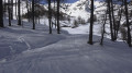
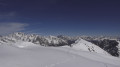
You quickly reach the mountain pastures after an initial climb through a larch forest. You pass a group of stone houses with slate roofs at the Arp du Bois Desot. Then, the landscape opens out onto the ridge of a vast mountain pasture which leads easily to the Fenêtre de Serena, where the view stretches across the French and Italian Alps as far as the eye can see.

Details

92917457
Creation:
Last update:
Last review:
  • Skiing
    Activity: Skiing
  • ↔
    Distance: 6.17 mi
  • ◔
    Duration according to the author: 5 hrs 
  • ▲
    Difficulty: Difficult

  • ⚐
    Back to start: Yes
  • ↗
    Ascent: + 2,930 ft
  • ↘
    Descent: - 2,930 ft

  • ▲
    Highest point: 8,333 ft
  • ▼
    Lowest point: 5,404 ft

Photos

Description of the walk

(1) From the village, head south then south-east to point 2.

(2) Head due south towards the last trees, then follow the route to the pass by taking the ridge of the mountain pasture, heading south-east.

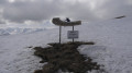
(3) A sign indicates the finish. From there, the descent roughly follows the ascent route.

Waypoints

  1. S/E : mi 0 - alt. 5,404 ft - Car park
  2. 1 : mi 1.51 - alt. 6,371 ft - Former village of Arp du Bois Desot
  3. 2 : mi 1.68 - alt. 6,621 ft - Junction
  4. 3 : mi 3.11 - alt. 8,333 ft - Summit of Fenêtre de Serena
  5. S/E : mi 6.17 - alt. 5,404 ft - Car park

Notes

On the map, the valley is marked as "Col Serena", but the summit is written as "Fenêtre de Sereina" with an "i". This is not shown on the summit sign!

For more walks, use our search engine .

The GPS track and description are the property of this route's author. Please do not copy them without permission.