Crossing Roche Parnal from Morat

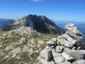
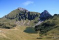
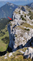
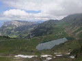
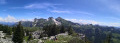
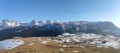
A very pleasant hike through woods and mountain pastures, followed by some steeper sections. At the summit, the stunning panoramic views of the Aravis and the Mont Blanc massif to the south, and the Jura to the north, make you forget just how long the walk has been. The sight of numerous ibexes brightens up the hike.

Details

n°14492815
Creation:
Last update:
Last review:
  • Walking
    Activity: Walking
  • ↔
    Distance: 6.86 mi
  • ◔
    Average duration: 6h 10 
  • ▲
    Difficulty: Difficult

  • ⚐
    Back to start: Yes
  • ↗
    Ascent: + 3,458 ft
  • ↘
    Descent: - 3,428 ft

  • ▲
    Highest point: 6,234 ft
  • ▼
    Lowest point: 2,812 ft

Photos

Description of the walk

In Le Petit-Bornand, in the commune of Glières-Val-de-Borne, head down towards the church and then up the Route de Morat. Park your car just before Morat.

(S/E) Take thePR® trail, starting point marker. Follow the well-marked path, which is sometimes a little steep. You’ll reach the Chalet du Lova.

(1) Continue along the winding path, then cross the Ravin des Fringles before reaching a crossroads of paths.

(2) Leave the Lavouillon path on your left and continue straight on, following the Ruisseau de la Fontaine Froide. You’ll soon reach another junction.

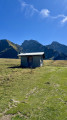
(3) Keep to the left along the stream, then head up to the right and head straight for the Tinnaz chalets (pronounced ‘Tâne’). Continue on to reach the bank of the stream.

(4) You will then enter the beautiful pastureland of the Tinnaz plateau, where several hundred heifers are grazing for the summer. Continue the climb until you reach a stream (see § Practical Information), which is usually dry. Turn right and you will very quickly come to a crossroads of paths.

(5) Follow the signposts to the right to reach the Col du Freu.

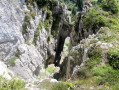
(6) Turn left, heading due west, onto a path that is sometimes steep. Do not continue towards La Balme or Bellajoux. Take care at a section crossing a recent rockfall. Emerge onto the ridge; follow it to reach the summit of La Roche Parnal.

(7) Descend a steep path to arrive just above the Col du Câble.

(8) Follow one of the paths heading east: there are several running parallel to one another. Then, via a slight circular loop, return to the crossroads you passed on the way up.

(5) Retrace your steps along the route you took on the way there to reach the crossroads before the Tinnaz chalets.

(4) Turn left, pass the chalets and continue on to reach the junction you also passed on the way there.

(3) Then head into the woods, following the route back in the opposite direction to the one taken on the way there, until you reach the car park on the Route de Morat (S/E).

Waypoints

  1. S/E : mi 0 - alt. 2,812 ft - Car park on Route de Morat
  2. 1 : mi 0.9 - alt. 4,114 ft - Lova
  3. 2 : mi 1.73 - alt. 4,875 ft - Lavouillon crossroads
  4. 3 : mi 2.03 - alt. 5,036 ft - Fontaine Froide stream
  5. 4 : mi 2.42 - alt. 5,089 ft - Fontaine Froide stream
  6. 5 : mi 2.93 - alt. 5,417 ft - Crossroads – circular loop
  7. 6 : mi 3.09 - alt. 5,558 ft - Col du Freu (1694m)
  8. 7 : mi 3.42 - alt. 6,234 ft - Summit of the - Roche Parnal (1896m)
  9. 8 : mi 3.63 - alt. 5,600 ft - Col du Câble (1693m)
  10. S/E : mi 6.86 - alt. 2,818 ft - Car park on Route de Morat

Notes

A water source at the Tinnaz chalets.
The term ‘stream’, from the Gaulish ‘nanto’ (cf. Welsh ‘nant’, meaning ‘valley’), refers in Savoie and Switzerland to a stream or torrent in a steep-sided valley (source: Wikipedia).

Worth a visit

Between (3) and (4) Tinnaz chalets: three chalets remain from the reconstruction following the fire caused by Nazi troops in 1944.

Between (6) and (8) Plenty of ibex.

In Le Petit-Bornand, Julie’s bakery, Le Fournil de Julie, is well worth a visit.

Always be cautious and plan ahead when you're outdoors. Visorando and the author of this route cannot be held responsible for any accidents occurring on this route.

The GR® and PR® markings are the intellectual property of the Fédération Française de Randonnée Pédestre.

Reviews and comments

5 / 5
Based on 1 review

Reliability of the description
5 / 5
Ease of following the route
5 / 5
Route interest
5 / 5
ficom
ficom

Overall rating : 5 / 5

Date of your route : Apr 30, 2023
Reliability of the description : ★★★★★ Very good
Ease of following the route : ★★★★★ Very good
Route interest : ★★★★★ Very good
Very busy route : No

A really lovely walk today in fairly average conditions: the clouds never cleared over the surrounding mountains and there was still quite a lot of snow. I’ll do it again when the weather’s fine. Thanks for the description – it matched the route perfectly.
I found parking difficult: there’s no proper car park, just makeshift spaces along the road. I parked further down the road.

Machine-translated

Other walks in the area

For more walks, use our search engine .

The GPS track and description are the property of this route's author. Please do not copy them without permission.