Chez Liadet - CAF Gros Morond Refuge

This third stage leads to Mont d'Or, from where the view stretches across the French and Swiss Alps. The route passes by the source of the Doubs, winds through forests and mountain pastures, and climbs to the summit of Mont d'Or before descending to the CAF refuge at Gros Morond.

This walk is part of a multi-day hike: Des Rousses à Labergement-Sainte-Marie

Details

45332989
Creation:
Last update:
Last review:
  • Walking
    Activity: Walking
  • ↔
    Distance: 12.78 mi
  • ◔
    Average duration: 7h 35 
  • ▲
    Difficulty: Difficult

  • ⚐
    Back to start: No
  • ↗
    Ascent: + 1,998 ft
  • ↘
    Descent: - 1,266 ft

  • ▲
    Highest point: 4,790 ft
  • ▼
    Lowest point: 3,071 ft

Photos

Description of the walk

(S) From the Chez Liadet lodge, take the road that descends gently westwards then due north. Follow the D389 in parallel here, veering off it slightly to reach the junction withthe GR®®5.

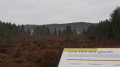
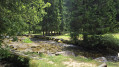
(1) Turn right onto it, following the northern edge of the Noirmont National Forest. Leave theGR®® at the junction with the D389, continue straight ahead to reach a large peat bog.

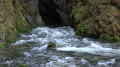
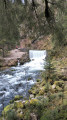
(2) Continue straight ahead, then turn right to reach the remarkable site of the Source du Doubs, which emerges from the rock at the base of a cliff.

(3) Take the path, cross the Noirmont ski lifts, then rejoin theGR®®5, which is shared with theGR®®509and the GTJ. Continue the climb until you reach a T-junction.

(4) Keep straight ahead on theGR®, walk past the Sapeau Léger farm to reach the Grange Bousson further on.

(5) Continue up a gentle slope, leaving the woods just before reaching the Vannode crossroads.

(6) Turn right, still on theGR®® and the GTJ, and begin a short descent to reach the Corneau barn.

(7) Take the wider track to the left, reach the edge of the woods, then turn right onto the road leading to the Granges Raguin.

(8) Continue along the road for about 500 m, then leave it to take the path uphill on the left. Passing through a succession of woods and clearings, go past the Boissaude crossroads to reach the old Blonay farm.

(9) Continue the climb, still following the GTJ GR®5 and GR®509 route, to reach the crossroads at the foot of Mont d'Or.

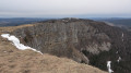
(10) Turn right before a car park. Leave theGR®® route briefly to reach the ridge. Turn left onto it to complete the climb to the summit of Mont d'Or, the highest point of this hike.

(11) Continue following the ridge downwards; you will soon rejoin the GR®® route. Follow it to the top of the Bellevue ski lift. Reach a reservoir on the same ridge. Head straight down to the left to reach the Chalet du Gros Morond (E), today’s stop.

Waypoints

  1. S : mi 0 - alt. 3,543 ft - Chez Liadet
  2. 1 : mi 1.3 - alt. 3,136 ft - GR
  3. 2 : mi 2.36 - alt. 3,074 ft - Peat bog educational site
  4. 3 : mi 2.75 - alt. 3,094 ft - Source du - Doubs (rivière)
  5. 4 : mi 4.36 - alt. 3,579 ft - T-junction
  6. 5 : mi 5.29 - alt. 3,681 ft - Grange Bousson
  7. 6 : mi 6.03 - alt. 3,845 ft - La Vannode
  8. 7 : mi 7.21 - alt. 3,878 ft - Corneau
  9. 8 : mi 8.12 - alt. 3,763 ft - Les Granges Raguin
  10. 9 : mi 9.57 - alt. 4,075 ft - La Blonay
  11. 10 : mi 10.81 - alt. 4,642 ft - Crossroads below the - Mont d'Or
  12. 11 : mi 11.36 - alt. 4,790 ft - Mont d'Or
  13. E : mi 12.78 - alt. 4,275 ft - Gros Morond Chalet

Notes

(E) The CAF chalet is very well equipped but unstaffed in February. You must notify them of your visit to obtain the access code for the chalet key.
(10) Before reaching the CAF refuge, you can, from the 1343-metre altitude, continue climbing via the summit of several ski lifts to 1419 m for a superb panoramic view.

This route passes through a protected area, which may be subject to special regulations:

Worth a visit

(2) Peat bog: stopping here to read the information boards allows you to admire a superb peat bog. In the distance, you can see the village of Mouthe.
6:: At Les Granges Raguin, you can stop for a bite to eat. The welcome here is very warm.
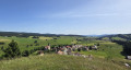
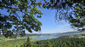
(11) Summit of Mont d’Or: it overlooks a vast panorama of the Alps and the Métabief ski resort,
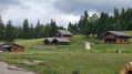
(E) Chalet du Gros Morond
(E) The restaurant Le Flocon is located about 800 m or 1 km from the refuge, at the foot of the Longevilles-Mont-d'Or resort.

Always be cautious and plan ahead when you're outdoors. Visorando and the author of this route cannot be held responsible for any accidents occurring on this route.

The GR® and PR® markings are the intellectual property of the Fédération Française de Randonnée Pédestre.

Other walks in the area

For more walks, use our search engine .

The GPS track and description are the property of this route's author. Please do not copy them without permission.