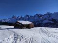
The two peaks of the Roc des Charmieux

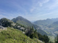
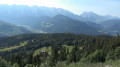
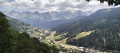
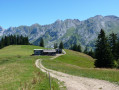
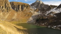
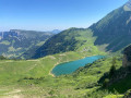
A lovely, easy hike, suitable for children used to walking on mountain trails. It is a round trip. You can simply head for the northern summit, which is the highest. The 360° view from the summits stretches, on one side, across the Aravis with Mont Blanc in the background, and, on the other, across Lake Geneva and the Jura.

Details

58863200
Creation:
Last update:
Last review:
  • Walking
    Activity: Walking
  • ↔
    Distance: 3.95 mi
  • ◔
    Average duration: 3h 40 
  • ▲
    Difficulty: Moderate

  • ⚐
    Back to start: Yes
  • ↗
    Ascent: + 2,123 ft
  • ↘
    Descent: - 2,116 ft

  • ▲
    Highest point: 6,158 ft
  • ▼
    Lowest point: 4,236 ft

Photos

Description of the walk

From Le Grand Bornand, head up towards Chinaillon. At Les Nants, take a narrow road on the left, towards the hamlet of Le Mont. The car park is at the end of this road.

(S/E) From the car park, follow a forest track suitable for vehicles on the right-hand side, as you approach. Take a few bends before reaching the junction with another forest track.

(1) Carry on straight ahead, passing the turn-off for Sur le Mont on your right. Continue uphill until you reach the junction marked by the ‘Cotagne’ sign.

(2) From there, take the path that climbs to the right towards the north, through the forest, towards Les Mouilles. Further up, pass the turn-off to the hamlet in question on your right, cross a mountain pasture, then cross through a wooded area again.

(3) Once at the edge of the woodland, go through the small gate and immediately leave the path that descends towards La Culaz. Head left, due north: there is no longer a path, so you’ll need to follow a sloping rock and climb towards a clearing in the woodland. You’ll soon rejoin the path that climbs up from La Culaz: this path isn’t shown on the IGN map but is marked on OSM. There’s an old tree trunk lying across the path, which will help you find your way on the descent.

(4) Turn left onto this well-marked path, which initially heads south-east, then due north. After climbing up a scree slope, you’ll reach an unnamed pass.

(5) Turn right, heading north, and reach the main summit of Les Charmieux, marked by a cross.

(6) Descend back to the pass. From there, it is possible to continue the descent via the ascent route. However, it is well worth climbing to the little-visited secondary summit. To do this, head south-east, finding the best route through a small rocky outcrop which can be crossed without difficulty.

(7) From the secondary summit, return to the pass.

(5) Turn right and follow the path you took on the way up, in the opposite direction, until you reach the fallen tree trunk across the path.

(4) Turn right off the path.

(3) Turn right again and follow the ascent route back down to return to the car park (S/E).

Waypoints

  1. S/E : mi 0 - alt. 4,236 ft - Mont car park
  2. 1 : mi 0.31 - alt. 4,554 ft - Crossroads, go straight on
  3. 2 : mi 0.76 - alt. 4,875 ft - Cotagne signpost.
  4. 3 : mi 1.21 - alt. 4,948 ft - Leave the path to the left.
  5. 4 : mi 1.3 - alt. 5,059 ft - Junction with the La Culaz path
  6. 5 : mi 1.77 - alt. 5,942 ft - Unnamed pass
  7. 6 : mi 1.91 - alt. 6,158 ft - Main summit of Les Charmieux
  8. 7 : mi 2.11 - alt. 6,079 ft - Secondary summit of Les Charmieux
  9. S/E : mi 3.94 - alt. 4,242 ft - Mont car park

Notes

Make sure you bring water as you’re on limestone terrain with sharp limestone pavement and there are no springs or fountains.

Worth a visit

(4) You can also continue to the right towards La Culaz: this path is poorly signposted and does not appear on the IGN map. La Culaz is a climbing spot and there is also a restaurant there.

Reviews and comments

4.4 / 5
Based on 3 reviews

Reliability of the description
4 / 5
Ease of following the route
4.3 / 5
Route interest
5 / 5
Didier B3.
Didier B3.

Overall rating : 3.3 / 5

Date of your route : Sep 06, 2025
Reliability of the description : ★★☆☆☆ Disappointing
Ease of following the route : ★★★☆☆ Average
Route interest : ★★★★★ Very good
Very busy route : No

PLEASE NOTE: this hike is not easy at all. Personally, I would classify it as difficult (we do a lot of hiking and some hikes classified as difficult that we have done were easier than this one). I would not do it with children. My wife, who is 1.57 metres tall, had a lot of trouble on several steep sections.
The description is not precise enough and led us to make a mistake that took us to the second summit instead of the pass.
At point 1: you have to leave the track and take a small path that leads into the forest (pushing a small gate).
At point 3, you can continue on the path that leads to the Culaz chalet rather than scratching your legs and struggling up a very steep slope. It's a little longer but much more comfortable (this is the path we took on the way back).
Between points 4 and 5, don't climb all the way up the scree slope, but take a path on the right! We made this mistake, and another hiker was about to do the same, but we were able to show him the right way. As a result, we didn't climb all the way to the main summit.
But it's true that the view from the summit is splendid. (See my Facebook page Les Photos de Didou)

Machine-translated

Joëlle C1.
Joëlle C1.

Overall rating : 5 / 5

Date of your route : Nov 10, 2024
Reliability of the description : ★★★★★ Very good
Ease of following the route : ★★★★★ Very good
Route interest : ★★★★★ Very good
Very busy route : Yes

The description of the walk is spot on
We didn’t go to the south-western headland as we didn’t find it particularly interesting and the path was barely marked
The viewpoint at the first headland is much easier to reach and absolutely stunning
However, it’s worth pointing out that the slope is very steep, stony and has quite a few rocky sections where you have to lift your body right up

Machine-translated

Cindy hike
Cindy hike

Overall rating : 5 / 5

Date of your route : Aug 29, 2024
Reliability of the description : ★★★★★ Very good
Ease of following the route : ★★★★★ Very good
Route interest : ★★★★★ Very good
Very busy route : No

A lovely walk; it starts straight away with a bit of a climb along a wide, moderately steep, shaded path.
However, as for the section that goes off the beaten track – although the description says it’s suitable for children – the final climb is still along a path on the mountainside where you need to be careful and lift your whole body weight in several places. It’s easy to slip; the path is steep and very narrow.
We didn’t tackle the first summit as it seemed a bit tricky to find our way through the sharp limestone pavement on that rocky peak.
Otherwise, there are no particular difficulties if you’re used to the mountains, and the view from the top is lovely, with a 360° panorama.

Machine-translated

Other walks in the area

For more walks, use our search engine .

The GPS track and description are the property of this route's author. Please do not copy them without permission.