Country:

 City:
City:


To reach the start point from Annecy or the Arve Valley, drive via Saint-Jean-de-Sixt, through La Clusaz, and up to Les Confins, in the Aravis mountains, at the end of the road. Shuttle buses run to this location from Thônes, Saint-Jean-de-Sixt, La Clusaz and Le Grand Bornand.
(S/E) From the car park, take the correct path.
(1) Leave the Combe de Grand Crêt on your right and continue straight on to reach the Paccaly chalet.
(2) Just before you reach it, take the small path on the right, which crosses the Combe de Paccaly, and follow it to Paccaly d’en haut.
(3) Ignore the path veering right into the Combe de Paccaly and take the one running alongside the Paccaly d’en haut chalet. Join the access path to the Chalets de Tardevant and head towards them.
(4) Just before the chalets, take the path on the left heading south-east into the Combe de Tardevant and climb up to Lac de Tardevant.
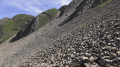
(5) Continue above the lake and, when the slope levels out, leave the path and head south, to the right, across the scree, where there is no marked path.
(6) Head as best you can towards a clearly visible path that crosses the valley towards the south-west, and join it.
(7) Follow this path to the right, which disappears into the scree, but a handrail is visible and leads to an unnamed pass.
(8) From this pass, the “Passage du Père” is clearly visible, but the descent is steep and requires constant attention. Reach the Combe de Paccaly path which climbs up from Paccaly d’en haut.
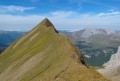
(9) Continue the ascent via the “Passage du Père” and then along a very pleasant ridge to reach the very busy Trou de la Mouche.
(10) Continue downhill along the very busy Combe de Grand Crêt path to the wide track you took earlier.
(1) Turn left and follow the path back the way you came to the Arpattaz car park (S/E).
 Visorando Member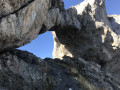
 Difficult
 Easy
Easy 
 Extremely difficult