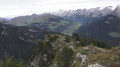
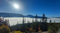
Crossing Les Auges, the Puvat and Queblette peaks

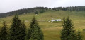
Above the village of Entremont and its hamlet of Malvoisin, this is a long walk through forests and mountain pastures, but one that also takes you up to some magnificent vantage points. You’ll pass through the village of Les Auges, where the chalets – destroyed during the Resistance – were rebuilt by the Ministry of Reconstruction around 1947. You’ll follow theGR® de Pays Massif de Tournette-Aravis for a long stretch.

Details

n°16048813
Creation:
Last update:
Last review:
  • Walking
    Activity: Walking
  • ↔
    Distance: 11.14 mi
  • ◔
    Average duration: 8h 35 
  • ▲
    Difficulty: Difficult

  • ⚐
    Back to start: Yes
  • ↗
    Ascent: + 4,012 ft
  • ↘
    Descent: - 4,022 ft

  • ▲
    Highest point: 6,270 ft
  • ▼
    Lowest point: 3,064 ft

Photos

Description of the walk

You can reach the Malvoisin car park from the village of Entremont by taking the small road at the traffic lights that climbs westwards via Le Regard and Lortier. Leave your car at the Malvoisin car park just before the bridge over the Ovéran.

(S/E) Cross the bridge and join theGRP® Massif de Tournette-Aravis, also known as the Route des Auges, which follows the Ovéran torrent upstream. Pass through the hamlet of Norcière and you will then come to a ford across the torrent.

(1) Continue along theGRP® and navigate eleven hairpin bends. You will then reach a crossroads with several routes at a place called Lachat.

(2) Leave the path leading up to the Col de la Buffaz on your left and continue to the right along theGRP® to the Chalets des Auges.

(3) Turn almost 180° and cross the Plateau des Auges heading south-west to descend to the Plat du Loup. Several signposts indicate various directions; take the one for the Col de l’Ovine and, at the lowest point, you’ll reach a crossroads near several spring catchments. Continue to the left.

(4) At this point, we leave theGRP® and climb left along a narrow path to reach the Col de l’Ovine, which we reach after negotiating two hairpin bends and passing through a very short, unchallenging rocky gap.

(5) You climb up to the Pointe de Puvat, keeping to the left, via a few exposed sections, some of which require you to use your hands.

(6) You then descend back down to the Col de l’Ovine.

(5) Take the path to the left, where you’ll soon have two options.
- Either take the well-marked path on the left, which leads directly to the Chalet de l’Ovine (recommended route if there are sheep present).
- Or you continue to the right (the route shown on the map), and climb towards the ridges to reach the Pointe de la Québlette.

(7) You begin the fairly steep south-easterly descent towards the Chalet de l’Ovine, which is off-trail. You then come across an old path. Avoid this section if there are sheep present. You arrive at the Chalet de l’Ovine.

(8) Turn right onto the path that came directly from the pass and continue the descent to the Col de la Buffaz, just past the summer chalet.

(9) Turn left towards Entremont. The path can be tricky and slippery after rain.
You’ll rejoin the wide track, the Route des Auges, at the crossroads you passed earlier.

(2) You head back along the route you took on the way out, thus returning to the car park in the hamlet of Malvoisin (S/E).

Waypoints

  1. S/E : mi 0 - alt. 3,097 ft - Car park at the hamlet of Malvoisin
  2. 1 : mi 0.86 - alt. 3,576 ft - Ford on the Ovéran
  3. 2 : mi 2.38 - alt. 4,800 ft - Crossroads of the circular loop
  4. 3 : mi 4.69 - alt. 5,774 ft - Chalets des Auges
  5. 4 : mi 5.77 - alt. 5,518 ft - GRP junction – footpath
  6. 5 : mi 6.24 - alt. 5,840 ft - Col de l'Ovine (1786m)
  7. 6 : mi 6.51 - alt. 6,243 ft - Pointe de Puvat
  8. 7 : mi 7.53 - alt. 6,270 ft - Pointe de Queblette
  9. 8 : mi 7.79 - alt. 5,807 ft - Chalet de l’Ovine
  10. 9 : mi 8.31 - alt. 4,931 ft - Col de la Buffaz (1501m)
  11. S/E : mi 11.14 - alt. 3,091 ft - Car park at the hamlet of Malvoisin

Notes

Please note: in spring, the flow of the Ovéran can be quite strong and tricky to fords.

From the car park to the village of Les Auges, the signposts have been removed – perhaps temporarily?

Between (1) and (3), you cross a mountain pasture with sheep. Watch out for stones dropped by the animals and the three mountain dogs guarding them. Stay on the wide path right next to the fence. The same applies between (8) and (2).

I recommend this walk in autumn when the sheep have been brought down from the mountains. In spring, you may be hampered by snow on the northern slopes, particularly between (4) and (5).

Worth a visit

Places to visit in Entremont: the church and its altarpiece, the Heritage Museum and the ‘Au cœur des monts’ inn.

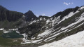
(8) Pointe de la Québlette: here you can enjoy a 360° panorama:
- to the south: the Aravis and the Mont Blanc range,
- to the north: the Lake Geneva plain and the northern Jura,
- to the west: La Tournette and Le Parmelan,
- to the east: the Bargy range and, in the distance, Valais.

Always be cautious and plan ahead when you're outdoors. Visorando and the author of this route cannot be held responsible for any accidents occurring on this route.

The GR® and PR® markings are the intellectual property of the Fédération Française de Randonnée Pédestre.

Reviews and comments

5 / 5
Based on 1 review

Reliability of the description
5 / 5
Ease of following the route
5 / 5
Route interest
5 / 5
corelli07
corelli07

Overall rating : 5 / 5

Date of your route : Aug 09, 2022
Reliability of the description : ★★★★★ Very good
Ease of following the route : ★★★★★ Very good
Route interest : ★★★★★ Very good
Very busy route : No

A magnificent, varied and very accessible hike for the average walker (no technical difficulties apart from the short climb at the top of Pointe de Puvat, which you can easily skip without missing out on anything).
The view of the Aravis and Mont Blanc in the background is breathtaking.
The total distance, as recorded by two GPS watches, was closer to 20 km than 18, and the elevation gain is accurate.

Machine-translated

Other walks in the area

For more walks, use our search engine .

The GPS track and description are the property of this route's author. Please do not copy them without permission.