Nicole Guil

 Visorando Member
 Premium user
- Location: Mably (42300)
- Gender: woman
Sign up:
Published route(s)
 Pointe du Haut Fleury – Lac de Roy from Praz de Lys
 4.82 mi
 +1,765 ft
 -1,749 ft
 3h 45
 Moderate
 Departure from Taninges (Haute-Savoie)
An easy family walk in the heart of the Praz de Lys Sommand mountain pastures. The viewpoint at the summit offers a remarkable vista stretching from Lake Geneva to the Alps.
Col du Rati from Mont Caly
 9.04 mi
+2,667 ft
-2,648 ft
6h 30
Moderate
Departure from Les Gets (Haute-Savoie)
A circular walk offering panoramic views of the peaks of the Chablais, Mont Blanc and the Aravis.At the foot of the Roc d’Enfer, the Col Ratti provides a vantage point from which to view this mountain with its fearsome name.
Lacs Vert and Chésery, Tête de Lindaret, Col de Bassachaux as seen from Lindarets
 9.39 mi
+2,474 ft
-2,451 ft
6h 30
 Difficult
Departure from Montriond (Haute-Savoie)
A long circular walk in the stunning setting of the Portes du Soleil, with no technical difficulty. Ascent to the Swiss high-altitude lakes: Lac Vert and Lac de Chesery. A scenic route along the Rochassons ridge and the Tête des Lindarets to the Col de Bassachaux, returning via theGR®5.
Le Chazelet par l'Oratoire et le Perchoir
 5.51 mi
+1,575 ft
-1,578 ft
3h 45
Moderate
Departure from La Grave (Hautes-Alpes)
Splendide point de vue sur le massif de la Meije depuis l'Oratoire dotée de la table d'orientation des Portes composée de 2 parties: le versant Nord de la Meije et le versant sud en direction du Chazelet et de la Savoie.
The Combeynot Circuit in 4 stages
 24.21 mi
+5,413 ft
-5,344 ft
4 days
Moderate
Departure from Villar-d'Arêne (Hautes-Alpes)
Set against a backdrop of rocks and glaciers, beneath the peaks of the Agneaux, Pic Gaspard and La Meije (3,983 m), the route winds its way through mountain pastures, larch forests and mountain hamlets. Whether along the Romanche or the banks of the Guisane, biodiversity unfolds with every step. With breathtaking views, the trail takes you on a journey through tradition and the high mountains.
From Alpe de Villard-d'Arène to Monêtier-les-Bains
9.74 mi
+1,289 ft
-3,261 ft
5h 35
Moderate
Departure from Villar-d'Arêne (Hautes-Alpes)
Stage2 of the Tour du Combeynot: From the Romanche to the Guisane Valley via the Col d'Arsine, this stage takes place at the foot of the Agneaux
From Le Lauzet to the Col du Lautaret
4.19 mi
+1,325 ft
-26 ft
3h 05
Moderate
Departure from Le Monêtier-les-Bains (Hautes-Alpes)
Stage4 of the Tour du Combeynot: from the Guisane Valley to the Col du Lautaret
Du Monêtier-les-Bains au Lauzet
 6.28 mi
+2,336 ft
-1,742 ft
4h 55
Moderate
Departure from Le Monêtier-les-Bains (Hautes-Alpes)
3ème étape du Tour du combeynot : découverte de la vallée de la Guisane en passant par le chemin du Roy pour arriver à l'Alpe du Lauzet
From the Col du Lautaret to the Alpe de Villard d'Arène
 3.99 mi
+463 ft
-315 ft
2h 15
Moderate
Departure from Villar-d'Arêne (Hautes-Alpes)
Stage1 of the Tour du Combeynot: From the Col du Lautaret to the Alpe de Villar-d'Arêne refuge via the schistose crevasse trail overlooking the Romanche valley. Unique view of the Écrins and Meije peaks.
Tour des Aiguilles Rouges: Bellachat Refuge - Servoz
 7.13 mi
+738 ft
-5,105 ft
3h 55
Moderate
Departure from Chamonix-Mont-Blanc (Haute-Savoie)
Fifth and final stage of the Tour des Aiguilles Rouges.
This stage offers panoramic views of the Mont Blanc massif and its glaciers, the Contamines valley and Les Fiz. The descent is through forest.
Tour des Aiguilles Rouges
36.71 mi
+13,881 ft
-14,416 ft
5 days
Difficult
Departure from Servoz (Haute-Savoie)
The five-day Tour des Aiguilles Rouges is one of the most beautiful hikes in the Mont Blanc region: breathtaking panoramic views, extremely varied landscapes, and a wild and unspoilt environment.
This tour is located in the heart of three nature reserves: the Aiguilles Rouges, Passy and Vallon de Bérard nature reserves. A panoramic route of great beauty between glaciers, lakes, moraines, forests, flora and wildlife.
Refuges Moëde Anterne - Pierre à Bérard via le Buet
 9.08 mi
+4,334 ft
-4,573 ft
7h 55
Difficult
Departure from Passy (Haute-Savoie) (Haute-Savoie)
Second stage of the Tour des Aiguilles Rouges.
This second stage follows the itinerary of the Mont Blanc GRP®. Hike through the Passy Reserve to the Col de Salenton. It's optional to climb the Mont Blanc des Dames: le Buet. Descent through the Vallon de Bérard nature reserve to the mountain hut.
Tour des Aiguilles Rouges: Servoz - Refuge Moede Anterne
 5.16 mi
+3,704 ft
-387 ft
5h 35
Difficult
Departure from Servoz (Haute-Savoie)
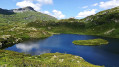
First stage of the Aiguilles Rouges tour.
This stage begins with a forest climb with views of Mont Blanc and the Bossons glacier. Continuing with a panoramic hike over the Passy reserve, we pass Lac de Pormenaz and arrive at Refuge de Moëde Anterne which overlooks the Mont Blanc mountain range.
Tour des Aiguilles Rouges: Refuge La Flégère - Refuge Bellachat
 6.28 mi
+2,425 ft
-1,503 ft
5h 00
Difficult
Departure from Chamonix-Mont-Blanc (Haute-Savoie)
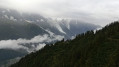
Fourth stage of the Tour des Aiguilles Rouges.
This stage is on the Mont Blanc GRP® route, with the Mont Blanc massif and its glaciers as a panorama. Balcony hike to Planpraz. The panorama on arrival at Brévent is exceptional.
Tour des Aiguilles Rouges : Refuge Pierre à Bérard - Refuge Flégère
 9.06 mi
+2,680 ft
-2,848 ft
6h 30
Moderate
Departure from Vallorcine (Haute-Savoie)
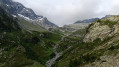
Third stage of the Tour des Aiguilles Rouges.
This stage is on the GRP® Tour du Pays du Mont Blanc itinerary. Descend through the Vallon de Bérard nature reserve with its waterfall to the Col des Montets, then climb back up to the Refuge de la Flègère to take in the panoramic view of the Mont Blanc mountain range and its glaciers.
Belle-ÎIe en Mer : Donnant - Pointe du Talut
8.00 mi
+502 ft
-522 ft
4h 05
Moderate
Departure from Morbihan
Belle-Île-en-Mer est la plus grande des îles de Bretagne et la plus majestueuse.
Le sentier côtier permet d'en faire le tour et d'apprécier la beauté et la variété des paysages. Cette randonnée se trouve sur la côte Sud, (côte sauvage) face aux vents de l'Atlantique ; les falaises déchiquetées couvertes d'une lande rase et colorée dessinent un incroyable tableau.
Belle-Île en Mer: Grand Cosquet - Locmaria
 6.35 mi
+807 ft
-856 ft
3h 35
Moderate
Departure from Locmaria (Morbihan)
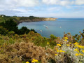
Belle-Île-en-Mer is the largest and most majestic of Brittany’s islands.
The coastal path allows you to walk all the way round the island and appreciate the beauty and variety of the landscapes. This walk is on the south coast (the wild coast), facing the Atlantic winds; the jagged cliffs, covered in short, colourful heathland, paint an incredible picture.
Belle-Île en Mer: Locmaria - Le Palais
 11.17 mi
+1,191 ft
-1,230 ft
6h 10
Moderate
Departure from Locmaria (Morbihan)
Belle-Île-en-Mer is the largest and most majestic of Brittany's islands.
The coastal path allows you to walk around the island and appreciate the beauty and variety of the landscapes. This hike is located on the north coast, sheltered from the wind, where beautiful beaches, flower-filled meadows and charming little harbours follow one another.
Belle-Île-en-Mer: Les Poulains – Donnant
 8.35 mi
+607 ft
-577 ft
4h 20
Moderate
Departure from Sauzon (Morbihan)
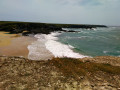
Belle-Île-en-Mer is the largest and most majestic of Brittany’s islands.
The coastal path allows us to walk all the way round the island and appreciate the beauty and variety of the landscapes. This walk is on the south coast (the ‘wild coast’), facing the Atlantic winds; the jagged cliffs, covered in sparse, colourful heathland, paint an incredible picture.
Belle Ile en Mer : Port Fouquet - Les Poulains
9.56 mi
+948 ft
-1,007 ft
5h 15
Moderate
Departure from Le Palais (Morbihan)
Belle-île-en-Mer est la plus grande des îles de Bretagne et la plus majestueuse.
Le sentier côtier nous permet d'en faire le tour et d'apprécier la beauté et la variété des paysages. Cette randonnée se trouve sur la côte Nord à l'abri du vent où se succèdent de belles plages, des prairies fleuries et de charmants petits ports de mouillage. Elle se termine avec un superbe panorama : la pointe des Poulains.
The Grand Tour of Mont-Chéry via Col Lachat
 8.28 mi
+1,768 ft
-2,992 ft
5h 20
Moderate
Departure from Les Gets (Haute-Savoie)
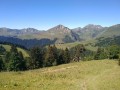
This route allows you to explore the entire Mont-Chéry area. This hike is signposted "Le Grand Tour du Mont Chéry" (Pink hike). I suggest a variation by climbing Mont-Chéry and passing through the Col de Lachat. Much of this hike offers magnificent views of the Mont Blanc range and the Pre-Alps.
The Pointe d'Angolon via the Arête de Chamossière
 9.30 mi
+2,664 ft
-3,973 ft
6h 35
Difficult
Departure from Les Gets (Haute-Savoie)
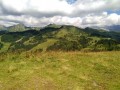
A circular loop around the resort of Les Gets with an ascent to the Pointe d’Angolon, where the panorama is superb, offering views of: the Fiz and Aravis ranges, the Mont Blanc massif in the background and the Dents du Midi. You can also see Morzine clearly and a stretch of Lake Geneva.
The climb to Pointe d’Angolon is a good introduction to ridge trails as it is slightly exposed, with cables at one point. However, the route is never difficult.
Lac Blanc and Cheserys lakes from La Flégère
 5.50 mi
+1,850 ft
-1,837 ft
4h 10
Moderate
Departure from Chamonix-Mont-Blanc (Haute-Savoie)
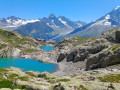
Hiking facing the Mont Blanc massif and the Chamonix peaks.
Avoriaz et Pointe de Chavanette
9.43 mi
+2,759 ft
-2,740 ft
6h 45
Moderate
Departure from Montriond (Haute-Savoie)
Boucle champêtre autour d'Avoriaz par la pointe de Chavanette avec en ligne de mire les Hauts-Forts, point culminant du Chablais.
Lake Roy Pointe du Haut Fleury and La Couenasse
 6.78 mi
+2,585 ft
-2,589 ft
5h 20
Difficult
Departure from Taninges (Haute-Savoie)
A mid-mountain route offering remarkable views. An easy family hike through the heart of the mountain pastures. Passes by the glacial Lake Roy. An exceptional viewpoint overlooking Lake Geneva and the Alps,
two information boards with 360° panoramic views at Pointe du Haut Fleury.
Balcon des Mémises via Sur les Prés
 6.91 mi
+2,461 ft
-2,438 ft
5h 20
Moderate
Departure from Bernex (Haute-Savoie)
The Balcon des Mémises is a magnificent hike alternating between forest trails and walks along the ridges, with spectacular views of Lake Geneva, the Chablais and the Jura mountains throughout the return journey. This hike does not take the Passage de l'Échelle.
The Tour des Chavannes via the Col de Joux Plane
 7.52 mi
+1,476 ft
-1,480 ft
4h 45
Moderate
Departure from Les Gets (Haute-Savoie)
This hike allows you to discover the Les Gets ski resort. It offers beautiful panoramic views of the Les Gets, Morzine and Samoens valleys. Route through the forest or mid-mountain, passing by the Col and Lac de Joux Plane.
Trek around Monte Viso in 4 days
 36.36 mi
+13,330 ft
-13,327 ft
4 days
Difficult
Departure from Bobbio Pellice (Torino)
A 4 day trek on a high mountain route. The trek around Monte Viso (one of the highest summits in the Italian alps) is a sight for sore eyes. Crossing through some of the most authentic and wild high valleys of the Alps is delightful. This trek is almost identical to another trek by another hikiideas hiker which is done over 5 days. A big thank you to him and his description which inspired me.
Trek around Monte Viso day 4: Refuge Vallanta - L'Echalp
9.83 mi
+1,552 ft
-3,970 ft
5h 50
Difficult
Departure from Pontechianale (Cuneo)
This stage involves a pass with neves and crossing Refuge du Viso high berm then Guil valley.
Trek around Monte Viso day 3: Refuge Sella Quintino - Refuge Vallanta
 8.54 mi
+2,277 ft
-2,917 ft
5h 55
Difficult
Departure from Oncino (Cuneo)
Italian stage through wild upper valleys and rocky wasteland, scattered by beautiful mountain lakes, consistantlyaround Monte Viso.
Trek around Monte Viso day 2: Refuge Granero - Refuge Quintino Sella
 10.73 mi
+5,381 ft
-4,511 ft
9h 35
Difficult
Departure from Bobbio Pellice (Torino)
Quite a long high mountain stage today, set in a mineral landscape passing through "les sources du Pô" and near beautiful mountain lakes. Exploring the north-east side of Monte Viso (3841m) will be the highlight.
Trak around Monte Viso day 1: L'Echalp - Refuge Granero
 7.26 mi
+4,121 ft
-1,929 ft
6h 55
Difficult
Departure from Ristolas (Hautes-Alpes)
First stage starting at Queyras National Park (Parc National du Queyras) passing through Col Lacroix, then a beautiful Italian valley and ending up at a shelter near a lake where the real trek around Monte Viso will start the next day.
Refuge de La Balme - Bourg Saint Maurice
7.05 mi
+2,615 ft
-3,117 ft
5h 30
Moderate
Departure from Les Contamines-Montjoie (Haute-Savoie)
Itinéraire de la traversée des Alpes. Départ du Refuge de la Balme jusqu’aux Chapieux. Cette étape nous fait entrer dans un monde minéral (Col de la Croix du Bonhomme) et nous permet d'avoir un magnifique panorama sur la belle région du Beaufortain.
Les Houches - Refuge de La Balme
16.71 mi
+4,154 ft
-4,469 ft
11h 20
Difficult
Departure from Saint-Gervais-les-Bains (Haute-Savoie)
Itinéraire de la traversée des Alpes. Départ des Houches pour rejoindre le Beaufortain. Itinéraire classique et tranquille passant par Bionassay et les Contamines Montjoie pour aller jusqu’au refuge de la Balme. Cet itinéraire est commun à celui du tour du Mont Blanc.
Refuge Moëde Anterne - Les Houches
12.22 mi
+3,527 ft
-6,516 ft
8h 40
Difficult
Departure from Passy (Haute-Savoie) (Haute-Savoie)
Itinéraire de la traversée des Alpes. Départ du refuge Moëde Anterne en passant par le sommet du Brévent pour arriver par une longue descente sur Les Houches. Cette étape en haute montagne offre un panorama somptueux sur le massif du Mont Blanc et les glaciers.
Tour des Aiguilles Rouges : Samoëns - Refuge Moëde Anterne
13.72 mi
+5,958 ft
-1,831 ft
11h 30
Difficult
Departure from Samoëns (Haute-Savoie)
Itinéraire de la traversée des Alpes. Départ du beau village de Samoens par les anciennes gorges du Giffre pour rejoindre le Massif des Fiz en faisant la longue ascension du Col d'Anterne (royaume des marmottes). Très belle étape variée (cascades, lac, alpages et vue exceptionnelle sur le Massif du Mont Blanc et des Aiguilles Rouges).
Refuge de Chesery - Samoens
13.81 mi
+2,080 ft
-6,129 ft
8h 10
Difficult
Departure from Abondance (Haute-Savoie)
Itinéraire de la traversée des Alpes. Départ du Chablais Suisse (Lac de Chesery) par une belle balade en balcon offrant un panorama sur le Massif des Dents Blanches et la Vallée du Giffre jusqu'au Col de Coux (frontière) pour rejoindre ensuite par une longue descente Samoens.
La Chapelle d'Abondance - Refuge de Chesery
13.80 mi
+3,907 ft
-745 ft
9h 45
Difficult
Departure from La Chapelle-d'Abondance (Haute-Savoie)
Itinéraire de la traversée des Alpes. De La Chapelle d’Abondance passer par le Haut Giffre pour un intermède suisse. Cette étape domine la Haute Vallée de la Dranse d'Abondance, passe par le domaine skiable des Portes du Soleil.
Vous êtes sur une zone protégée. Voir la réglementation dans les informations pratiques.
Saint Gingolph - La Chapelle d'Abondance
10.74 mi
+6,010 ft
-3,934 ft
10h 10
Difficult
Departure from Saint-Gingolph (Haute-Savoie)
Itinéraire de la traversée des Alpes. Etape des rives du lac Léman au Val d'Abondance. Franchir les montagnes du Chablais par une longue grimpette de 1850m en traversant les alpages pour passer le Col de Bise puis redescendre à la station de ski de la Chapelle d'Abondance. Cet itinéraire offre de très beaux panoramas sur le plus grand lac d'Europe et sur le sommet des Cornettes de Bise.
Mont Veyrier
 6.58 mi
+2,795 ft
-2,795 ft
5h 30
Difficult
Departure from Annecy-le-Vieux (Haute-Savoie)
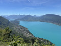
The ridge trail from Mont Veyrier to Mont Baron overlooks Lake Annecy from a height of over 800 metres and offers panoramic views of the Bauges peaks.
⚠️ A decree issued by the municipalities of Annecy and Veyrier-du-Lac prohibits motorised vehicles from accessing the Col des Contrebandiers and Pré Vernet.
Roya - Roure
17.57 mi
+4,469 ft
-5,830 ft
12h 00
Difficult
Departure from Saint-Étienne-de-Tinée (Alpes-Maritimes)
Étape de la traversée des Alpes de Roya jusqu'à Roure. Randonnée allant de la Haute Tinée en passant par le Mercantour où l'on peut apercevoir des vautours. À l'approche du Col de Croussette un univers minéral nous attend puis un plateau quasi désertique pour finir par la douceur des pâturages de Roure.
Levens - Nice
13.55 mi
+2,077 ft
-3,734 ft
8h 00
Difficult
Departure from Alpes-Maritimes
Étape de la traversée des Alpes de Levens jusqu'à Nice. Randonnée permettant de traverser la bande littorale typiquement méditerranéenne et arriver à la Mer Méditerranée à Nice.
Utelle - Levens
7.41 mi
+1,870 ft
-2,680 ft
5h 00
Moderate
Departure from Utelle (Alpes-Maritimes)
Etape de la traversée des Alpes d'Utelle jusqu'à Levens. Randonnée entre la vallée de la Vésubie et les derniers reliefs alpins.
Saint-Dalmas de Valdeblore - Utelle
15.74 mi
+4,354 ft
-5,919 ft
11h 00
Difficult
Departure from Valdeblore (Alpes-Maritimes)
Étape de la traversée des Alpes de Saint-Dalmas de Valdeblore jusqu'à Utelle. Randonnée sur une ligne de crête offrant des panoramas extraordinaires sur l'arrière pays niçois.
Roure - Saint Dalmas Valdeblore
9.54 mi
+3,261 ft
-2,657 ft
7h 15
Difficult
Departure from Alpes-Maritimes
Étape de la traversée des Alpes avec un départ de Roure jusqu'à Saint Dalmas de Valdeblore.
Randonnée allant de la vallée de la Tinée à l'arrière pays niçois.
Meyrueis – L’Espérou
10.15 mi
+2,789 ft
-1,066 ft
7h 05
Moderate
Departure from Meyrueis (Lozère)
Walk from the village of Meyrueis (Causse Noir) in the Cévennes to get closer to Mont Aigoual.
Saint-Dalmas-le-Selvage - Roya
13.32 mi
+4,255 ft
-4,203 ft
9h 50
Difficult
Departure from Saint-Dalmas-le-Selvage (Alpes-Maritimes)
Étape de la traversée des Alpes de Saint-Dalmas-le-Selvage jusqu'à Roya. Randonnée offrant un très beau panorama sur la Haute Tinée avec passage de la station de ski d'Auron puis après le Col du Blainon entrée dans le vallon de Roya où le mouton est roi.
Larche - Saint-Dalmas-le-Selvage
17.35 mi
+5,102 ft
-5,633 ft
12h 25
Difficult
Departure from Larche (Alpes-de-Haute-Provence)
Étape de la traversée des Alpes par le GR®5 de Larche à Saint Dalmas le Selvage. Passage dans le Parc National du Mercantour sauvage et authentique puis transition entre la Haute Tinée et le Vallon de Jalorgues avec un passage sur la plus haute route d'Europe vers le Col de la Bonnette.
Maljasset - Larche
15.60 mi
+4,199 ft
-4,898 ft
10h 50
Difficult
Departure from Saint-Paul-sur-Ubaye (Alpes-de-Haute-Provence)
Etape de la traversée des Alpes à partir du hameau de Maljasset qui suit la route de la Haute Ubaye avec une vue époustouflante sur les sommets qui bordent le flanc sud du Queyras. Traversée de la Haute Ubaye dans un univers minéral parmi les sommets de plus de 3000m.