Refuge de La Balme - Bourg Saint Maurice

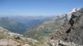
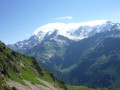
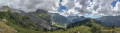
Itinéraire de la traversée des Alpes. Départ du Refuge de la Balme jusqu’aux Chapieux. Cette étape nous fait entrer dans un monde minéral (Col de la Croix du Bonhomme) et nous permet d'avoir un magnifique panorama sur la belle région du Beaufortain.

Details

48900
Creation:
Last update:
Last review:
  • Walking
    Activity: Walking
  • ↔
    Distance: 7.05 mi
  • ◔
    Average duration: 5h 30 
  • ▲
    Difficulty: Moderate

  • ⚐
    Back to start: No
  • ↗
    Ascent: + 2,615 ft
  • ↘
    Descent: - 3,117 ft

  • ▲
    Highest point: 8,156 ft
  • ▼
    Lowest point: 5,079 ft

Description of the walk

(S/E) Above the Refuge de la Balme, you’ll reach a crossroads.

(1) Turn left and climb the cliff face from which the Torrent du Bon Nant cascades down, forming the Cascade de la Balme.
Shortly afterwards, cross the Plan Jovet plateau heading south-east.

(2) As the slope becomes steeper, the path turns south-west and climbs another cliff face leading to the Plan des Dames (2,043 m). Via a short but steep scree slope, where large snowfields linger late in the season, reach the Col du Bonhomme (2,329 m).

(3) At the Michelin marker, turn left onto the track, cross a stream and reach a small rocky outcrop.

(4) Continue to the right towards the south and carry on to the Refuge du Col de la Croix Bonhomme.

(5) Turn left, heading east, then straight south across the mountain pastures to reach thefirst group of sheepfolds.

(6) Continue to the Chalets de la Raja.

(7) Cross the stone bridge. Continue along a track suitable for vehicles to the Carrefour des Murs.

(8) Turn left and continue along the path leading to the village of Les Chapieux (E).
From Les Chapieux, take the shuttle bus to Bourg-Saint-Maurice (or walk down the road).

Waypoints

  1. S : mi 0 - alt. 5,581 ft - Refuge de la Balme
  2. 1 : mi 0.3 - alt. 5,873 ft - To the left - Cascade de la Balme
  3. 2 : mi 1.22 - alt. 6,490 ft - Towards the south-west
  4. 3 : mi 2.37 - alt. 7,654 ft - Col du Bonhomme
  5. 4 : mi 3.35 - alt. 8,110 ft - A short climb before the refuge
  6. 5 : mi 3.66 - alt. 8,012 ft - Refuge du Col de la Croix du Bonhomme
  7. 6 : mi 5.21 - alt. 6,601 ft - Plan Varrago chalets
  8. 7 : mi 5.81 - alt. 5,892 ft - Chalets de la Raja
  9. 8 : mi 6.06 - alt. 5,755 ft - Les Murs
  10. E : mi 7.05 - alt. 5,079 ft - Les Chapieux - Refuge Auberge de la Nova

Notes

Accommodation and meals are available at the Refuge du Col de la Croix Bonhomme, in Les Chapieux and in Bourg-Saint-Maurice.

This route passes through a protected area, which may be subject to special regulations:

Other walks in the area

For more walks, use our search engine .

The GPS track and description are the property of this route's author. Please do not copy them without permission.