Meyrueis – L’Espérou

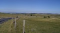
Walk from the village of Meyrueis (Causse Noir) in the Cévennes to get closer to Mont Aigoual.

This walk is part of a multi-day hike: Les Cévennes

Details

26451
Creation:
Last update:
Last review:
  • Walking
    Activity: Walking
  • ↔
    Distance: 10.15 mi
  • ◔
    Average duration: 7h 05 
  • ▲
    Difficulty: Moderate

  • ⚐
    Back to start: No
  • ↗
    Ascent: + 2,789 ft
  • ↘
    Descent: - 1,066 ft

  • ▲
    Highest point: 4,852 ft
  • ▼
    Lowest point: 2,310 ft

Description of the walk

Starting from Meyrueis: parking available at the Champ de Mars car park.

(S) Set off from the car park towards Rue du 19 Mars 1962 (following the river) until you reach the sports hall.

(1) Find the start of theGR®6A, which is on the hillside.
Head up a path via the Col de Tribe.

(2) Then enter the Forêt de Pourcares.

(3) Continue along theGR® to reach the Campis Forest.

(4) Carry on through the forest, staying on theGR® and following its red-and-white markings, until you reach Plo de Valbelle and its shelter.

(5) Keep to theGR® as it climbs. Here, it is known as the Drovers' Road of the Calcadis. Near the Col de la Caumette, you’ll reach a major junction of trails.

(6) Keep left on the GR®. You will then pass beneath the ski lifts at the Prat Peyrot resort.

(7) Turn right towards L’Esperou, which is signposted with theGR®60. Follow this track and reach the source of the Hérault.

(8) Continue the descent to reach the Col de la Serreyrède, where the Maison de l’Aigoual is located.

(9) Begin a short climb leading to the Col de l’Espérou.

(10) Follow theGR® markings carefully through the forest, then descend to l’Espérou and head for the l’Espérou stopover lodge (E).

Waypoints

  1. S : mi 0 - alt. 2,310 ft - Champ de Mars car park. Near the - Jonte (rivière)
  2. 1 : mi 0.13 - alt. 2,313 ft - Meyrueis GR6A. Near the - Béthuzon (rivière) - Affluent de la Jonte
  3. 2 : mi 0.68 - alt. 2,569 ft - Col de Tribe (781m)
  4. 3 : mi 1.67 - alt. 3,189 ft - Pourcares Forest
  5. 4 : mi 4.31 - alt. 3,980 ft - Campis Forest
  6. 5 : mi 5.42 - alt. 4,324 ft - Plo de Valbelle shelter
  7. 6 : mi 7.06 - alt. 4,813 ft - Crossroads of trails
  8. 7 : mi 8.11 - alt. 4,639 ft - Prat Peyrot station - Col de Prat Peyrot (1411)
  9. 8 : mi 8.47 - alt. 4,626 ft - Source - Hérault (fleuve)
  10. 9 : mi 9.26 - alt. 4,265 ft - Col de la Serreyrède (1299m)
  11. 10 : mi 9.66 - alt. 4,354 ft - Col de l'Espérou(1329m)
  12. E : mi 10.15 - alt. 4,032 ft - L’Espérou stopover lodge.

Notes

No water sources along the entire route.
La Grande Draille stopover lodge in L’Espérou, with half-board available.
Grocery shop in the village

Worth a visit

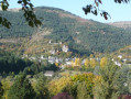
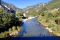
Visit to Meyrueis: an authentic village through which the River Jonte flows. Its gorges are very famous.

Always be cautious and plan ahead when you're outdoors. Visorando and the author of this route cannot be held responsible for any accidents occurring on this route.

The GR® and PR® markings are the intellectual property of the Fédération Française de Randonnée Pédestre.

Reviews and comments

4.8 / 5
Based on 2 reviews

Reliability of the description
5 / 5
Ease of following the route
5 / 5
Route interest
4.5 / 5
Biquette30
Biquette30

Overall rating : 4.7 / 5

Date of your route : Jun 01, 2026
Reliability of the description : ★★★★★ Very good
Ease of following the route : ★★★★★ Very good
Route interest : ★★★★☆ Good
Very busy route : No

A challenging hike with a decent climb… offering beautiful panoramic views and some lovely sections through the forest.

Machine-translated

ermanno nerini
ermanno nerini
• Edited:

Overall rating : 5 / 5

Date of your route : Aug 20, 2018
Reliability of the description : ★★★★★ Very good
Ease of following the route : ★★★★★ Very good
Route interest : ★★★★★ Very good
Very busy route : No

I walked the St Guilhem route from Aumont-Aubrac to St Guilhem at the end of August 1918, passing through the Tarn and Jonte gorges… absolutely beautiful. I’ll be doing the route again in June 2022, passing through the Causses de Sauveterre and other alternative routes.

Machine-translated

Other walks in the area

For more walks, use our search engine .

The GPS track and description are the property of this route's author. Please do not copy them without permission.