The Combeynot Circuit in 4 stages

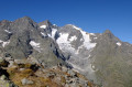
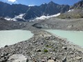
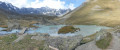
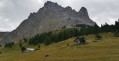
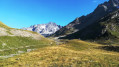
Set against a backdrop of rocks and glaciers, beneath the peaks of the Agneaux, Pic Gaspard and La Meije (3,983 m), the route winds its way through mountain pastures, larch forests and mountain hamlets. Whether along the Romanche or the banks of the Guisane, biodiversity unfolds with every step. With breathtaking views, the trail takes you on a journey through tradition and the high mountains. 

Details

n°2247113
Creation:
Last update:
Last review:
  • Walking
    Activity: Walking
  • ↔
    Distance: 24.21 mi
  • ◔
    Average duration: 4 days 
  • ▲
    Difficulty: Moderate

  • ⚐
    Back to start: No
  • ↗
    Ascent: + 5,413 ft
  • ↘
    Descent: - 5,344 ft

  • ▲
    Highest point: 8,068 ft
  • ▼
    Lowest point: 4,797 ft

Photos

Stages of the route

This route needs several days, find the details below:

  1. S
  2. 2
  3. 3
  4. E

Notes

The Combeynot Circuit in 4 stages with 3 nights in a lodge or mountain refuge:

Alpe de Villar-d’Arêne Mountain Hut
Address: 05480 Villar-d’Arène – Telephone: 04 76 79 94 66

Le Flourou Lodge
Address: 31 Rue Bonbourget, 05220 Le Monêtier-les-Bains
Telephone: 04 92 24 41 13

Lodge L'Aiguillette du Lauzet
Address: Le Lauzet, 05220 Le Monêtier-les-Bains
Telephone: 04 92 24 55 55

You’ll be hiking in the heart of the Écrins National Park.

The Écrins massif is an exceptional area, open to all, boasting a rare natural, cultural and scenic heritage. To protect these treasures, the heart of the park is marked by blue, white and red flags, and certain regulations must be observed. Please familiarise yourself with these regulations when planning your hike to help preserve this shared heritage, on the website https://www.ecrins-parcnational.fr.

This route passes through a protected area, which may be subject to special regulations:

Worth a visit

Lautaret Pass Botanical Garden
Grands Bains in Le Monêtier

Always be cautious and plan ahead when you're outdoors. Visorando and the author of this route cannot be held responsible for any accidents occurring on this route.

Reviews and comments

5 / 5
Based on 1 review

Reliability of the description
5 / 5
Ease of following the route
5 / 5
Route interest
5 / 5
valy38
valy38

Overall rating : 5 / 5

Date of your route : Aug 01, 2023
Reliability of the description : ★★★★★ Very good
Ease of following the route : ★★★★★ Very good
Route interest : ★★★★★ Very good
Very busy route : Yes

Hello, a three-day hike starting from Le Lauzet. We found a parking space at 10 am in early August at the entrance to the village, but there weren’t many left. The hike was brilliant and absolutely stunning. There’s a slightly vertiginous section between Lautaret and Villard d’Arène (you can avoid it by adding a few kilometres), but the view is absolutely stunning. As for the lodges, we received a warm welcome at the CAF lodge in Villard d’Arène, though the food was a bit ‘stingy’ (you might want to check out the private lodge right next door); we absolutely loved the Gîte du Flourou in Monetier, both for the hospitality and the meals. I’d foolishly injured myself on the descent from Villard d’Arène, so I was hesitant to take the GR54 to reach Le Lauzet, but the climb between Monetier and Le Lauzet is very manageable and the views are brilliant. I’d mentioned that the walk was busy, but that’s mainly on the section between Lac de la Douche and Casset.

Machine-translated

Other walks in the area

For more walks, use our search engine .

The GPS track and description are the property of this route's author. Please do not copy them without permission.