


frike

 Visorando Member
 Premium user
 - Location: Saleilles (66280)
- Gender: woman
Sign up:
Published route(s)
 Col des Gascons from Banyuls-sur-Mer
 5.14 mi
 +1,240 ft
 -1,240 ft
 3h 25
3h 25
 Moderate
 Departure from Banyuls-sur-Mer (Pyrénées-Orientales)
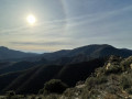
This is an easy short hike with beautiful sea views.
The Col de Bise in the Vallespir
11.34 mi
+3,698 ft
-3,684 ft
7 hrs
 Very difficult
Departure from Prats-de-Mollo-la-Preste (Pyrénées-Orientales)
Very difficult
Departure from Prats-de-Mollo-la-Preste (Pyrénées-Orientales)
A lovely circular route in Vallespir, partly on a very good path and partly off-trail, offering varied scenery.
Puig del Pam loop via La Balmette
 9.27 mi
+2,612 ft
-2,631 ft
6h 30
9.27 mi
+2,612 ft
-2,631 ft
6h 30
 Difficult
Departure from Les Angles (Pyrénées-Orientales) (Pyrénées-Orientales)
Difficult
Departure from Les Angles (Pyrénées-Orientales) (Pyrénées-Orientales)
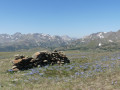
A lovely loop offering 360° views and glimpses of the Capcir, Madres and Canigou peaks. Added to this are the two magnificent lakes you pass by.
Part of the hike is off-trail, so you need to know how to find your way.
The Camporells Lakes
 9.66 mi
+2,612 ft
-2,598 ft
6h 45
Difficult
Departure from Formiguères (Pyrénées-Orientales)
9.66 mi
+2,612 ft
-2,598 ft
6h 45
Difficult
Departure from Formiguères (Pyrénées-Orientales)
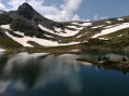
The Camporells Lakes are magnificent. This loop is varied and avoids having to make a return trip. The outward journey is little known and you don't come across many people.
Pic Sec and Mir Tower from the Can Got forest hut (prats de mollo)
7.27 mi
+2,608 ft
-2,589 ft
5h 35
Moderate
Departure from Prats-de-Mollo-la-Preste (Pyrénées-Orientales)
A very beautiful circular on excellent, scenic trails, mostly through forest. Superb 360° view from the ridge, overlooking the Canigou massif, the peaks of Spain and the Costabonne.
Col de l'Estagnol via the Cabane de la Devèze from the hamlet of Leca
 7.26 mi
+2,559 ft
-2,539 ft
5h 35
Moderate
Departure from Corsavy (Pyrénées-Orientales)
7.26 mi
+2,559 ft
-2,539 ft
5h 35
Moderate
Departure from Corsavy (Pyrénées-Orientales)
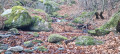
A lovely walk through the woods, best enjoyed in autumn due to the varied, colourful vegetation and beautiful views of the foothills of Canigou.
Col de Teixo and Coume iron mines from Baillestavy
 5.79 mi
+2,674 ft
-2,684 ft
5h 00
Moderate
Departure from Baillestavy (Pyrénées-Orientales)
5.79 mi
+2,674 ft
-2,684 ft
5h 00
Moderate
Departure from Baillestavy (Pyrénées-Orientales)
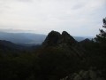
A lovely walk through the woods, very pleasant in autumn with its many colours. At the pass, there is a view of Canigou.
Fontguéré Refuge and Tambour de Sahorre from the hamlet of Thorrent
7.55 mi
+2,822 ft
-2,822 ft
5h 55
Moderate
Departure from Sahorre (Pyrénées-Orientales)
A lovely hike in the foothills of Pic des Trois Estelles, where the remains of iron mines can still be seen. The well-marked trail winds through the forest.
Col de Paracolls via the Santa Engràcia Chapel from Arles-sur-Tech
 6.15 mi
+2,185 ft
-2,185 ft
4h 45
Moderate
Departure from Arles-sur-Tech (Pyrénées-Orientales)
6.15 mi
+2,185 ft
-2,185 ft
4h 45
Moderate
Departure from Arles-sur-Tech (Pyrénées-Orientales)
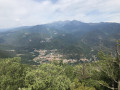
Magnificent restored chapel and hike through the woods.
Montalba d'Amélie and the Engracia Chapel from Amélie-les-Bains
 8.27 mi
+2,641 ft
-2,615 ft
6h 05
Difficult
Departure from Amélie-les-Bains-Palalda (Pyrénées-Orientales)
8.27 mi
+2,641 ft
-2,615 ft
6h 05
Difficult
Departure from Amélie-les-Bains-Palalda (Pyrénées-Orientales)
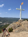
This hike takes place in the woods, but offers beautiful views of the Vallespir (Roc Saint-Sauveur) and Canigou. Avoid when it is too hot.
Pic d'Aureille from Laroque-des-Albères
7.86 mi
+2,986 ft
-2,992 ft
6h 15
Difficult
Departure from Laroque-des-Albères (Pyrénées-Orientales)
This peak is less well known than its neighbour, Pic Néoulous (Pic Neulos). Marked trail (PRLAR11) on beautiful paths through the woods in the Albères.
Notre-Dame du Coral circular from Prats-de-Mollo-la-Preste
 8.59 mi
+3,104 ft
-3,110 ft
6h 40
Moderate
Departure from Prats-de-Mollo-la-Preste (Pyrénées-Orientales)
8.59 mi
+3,104 ft
-3,110 ft
6h 40
Moderate
Departure from Prats-de-Mollo-la-Preste (Pyrénées-Orientales)
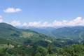
A very beautiful hike, mostly through woodland, but with plenty of variety. The trails are fully marked and very beautiful.
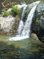
Cascade des Anglais via Coll de Lloseta
 5.84 mi
+2,730 ft
-2,723 ft
5h 05
Difficult
Departure from Vernet-les-Bains (Pyrénées-Orientales)
5.84 mi
+2,730 ft
-2,723 ft
5h 05
Difficult
Departure from Vernet-les-Bains (Pyrénées-Orientales)
A very beautiful hike, partly on marked trails. The route includes a circular path on the map that is not marked, where the descent to the Cascade des Anglais is very steep for 100 metres and should not be attempted if it is raining or still wet. In case of bad weather, plan to descend via the usual trail.
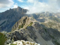
Crête de la Plane
 7.38 mi
+2,657 ft
-2,654 ft
5h 40
Difficult
Departure from Saint-Étienne-en-Dévoluy (Hautes-Alpes)
7.38 mi
+2,657 ft
-2,654 ft
5h 40
Difficult
Departure from Saint-Étienne-en-Dévoluy (Hautes-Alpes)
The ascent of the Crête de la Plane offers superb views of the Pic de Bure and the whole of Dévoluy.
The first part of the hike, up to the Col de Rabou, follows theGRP® du Tour du Dévoluy, which is very well marked.
After Col de Rabou, the route is no longer marked and is off-trail. There are no particular difficulties as you follow the ridge. However, good visibility and the ability to navigate with a map and compass are required.
Col des Aiguilles - Return circular via Le Chauvet
 7.94 mi
+2,743 ft
-2,723 ft
6h 00
Difficult
Departure from Agnières-en-Dévoluy (Hautes-Alpes)
7.94 mi
+2,743 ft
-2,723 ft
6h 00
Difficult
Departure from Agnières-en-Dévoluy (Hautes-Alpes)
Most of the route follows theGRP® Tour du Dévoluy trail markedGR®94.
For the return journey, rather than going back the same way, you can vary the route by returning via Small Pass and Le Charvet. This is an off-trail route.
This alternative route must be taken in good visibility and requires the ability to use a map and compass, which is essential for off-trail hiking.
The view from Le Chauvet over Le Dévoluy is magnificent.
Loop in the Jujols Nature Reserve
 10.46 mi
+3,117 ft
-3,127 ft
7h 30
Difficult
Departure from Jujols (Pyrénées-Orientales)
10.46 mi
+3,117 ft
-3,127 ft
7h 30
Difficult
Departure from Jujols (Pyrénées-Orientales)
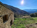
This is a lovely loop that allows you to explore the Jujols nature reserve, with superb views of the Conflent peaks. The hike faces south-east, is very sunny and sheltered from the tramontane wind, and crosses pastoral areas.
Shortcuts are possible on this loop (see description in the practical information section).
The Roque Coucoulère loop via the Sant-Guillem refuge
 9.85 mi
+2,992 ft
-3,018 ft
7h 10
Difficult
Departure from Le Tech (Pyrénées-Orientales)
9.85 mi
+2,992 ft
-3,018 ft
7h 10
Difficult
Departure from Le Tech (Pyrénées-Orientales)
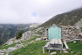
Loop around the Sant-Guillem Chapel offering beautiful views of the Vallespir.Caution: the Torrent de la Coumelade cannot be crossed during snowmelt or after heavy storms.
Roc Planer from Laroque-des-Albères
 8.22 mi
+2,766 ft
-2,756 ft
6h 10
Moderate
Departure from Laroque-des-Albères (Pyrénées-Orientales)
8.22 mi
+2,766 ft
-2,756 ft
6h 10
Moderate
Departure from Laroque-des-Albères (Pyrénées-Orientales)
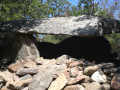
A lovely hike on a yellow-marked trail, mostly through the woods, with some beautiful views of the radiant coastline.
Les Esquerdes de Rotjà from Les Conques via the source of the Tech
 10.23 mi
+3,051 ft
-3,038 ft
7h 20
Difficult
Departure from Prats-de-Mollo-la-Preste (Pyrénées-Orientales)
10.23 mi
+3,051 ft
-3,038 ft
7h 20
Difficult
Departure from Prats-de-Mollo-la-Preste (Pyrénées-Orientales)
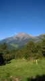
A very lovely walk in Vallespir, on a signposted path, but one that is rarely used, allowing you to spot chamois and marmots.
See the ‘Practical Information’ section regarding the crossing of the Tech at the Ouillat huts ¹.
Pilon de Belmaig from Pujol del Mig
 9.54 mi
+2,720 ft
-2,707 ft
6h 45
Moderate
Departure from Amélie-les-Bains-Palalda (Pyrénées-Orientales)
9.54 mi
+2,720 ft
-2,707 ft
6h 45
Moderate
Departure from Amélie-les-Bains-Palalda (Pyrénées-Orientales)
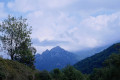
An easier way to climb this pleasant summit in Vallespir is from Arles-sur-Tech.
(!) Access to the start of the hike is impossible by car: the road has been closed since 9 November 2024. Situation unchanged on 9 November 2025.
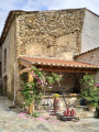
Roc de la Collada via the Chapel of Saint-Étienne de Pomers
 7.34 mi
+2,418 ft
-2,418 ft
5h 30
Moderate
Departure from Clara (Pyrénées-Orientales)
7.34 mi
+2,418 ft
-2,418 ft
5h 30
Moderate
Departure from Clara (Pyrénées-Orientales)
A little-visited but very pleasant area, in winter or early spring when the Canigou is covered in snow.
The trail is mostly signposted and very well marked.
Historical route above Villefranche-de-Conflent
 9.92 mi
+2,592 ft
-2,585 ft
6h 50
Moderate
Departure from Corneilla-de-Conflent (Pyrénées-Orientales)
9.92 mi
+2,592 ft
-2,585 ft
6h 50
Moderate
Departure from Corneilla-de-Conflent (Pyrénées-Orientales)
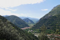
This route allows you to discover military remains (Vauban's cistern and redoubt) as well as former ore quarries (marble, manganese and talc) and, above all, superb panoramic views of the Têt and Cady valleys. You can also see Villefranche-de-Conflent and Fort Libéria from above.
This is a fairly easy hike, but don't underestimate the length.
Water and iron trail in Fuilla
 8.65 mi
+1,047 ft
-1,063 ft
4h 55
Moderate
Departure from Fuilla (Pyrénées-Orientales)
8.65 mi
+1,047 ft
-1,063 ft
4h 55
Moderate
Departure from Fuilla (Pyrénées-Orientales)
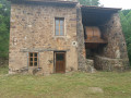
A pleasant outing along the Sahorre Canal and a historical walk among the remains of the iron route.
Caution for those prone to vertigo: although the path along the canal is generally good, from (5) there are places where you have to walk straddling the canal, on narrow footbridges and areas where the edge of the canal is very narrow. Alternative route possible.
Tour of the Corsavy forest
 6.86 mi
+1,388 ft
-1,358 ft
4h 20
Moderate
Departure from Corsavy (Pyrénées-Orientales)
6.86 mi
+1,388 ft
-1,358 ft
4h 20
Moderate
Departure from Corsavy (Pyrénées-Orientales)
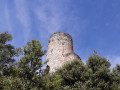
This is a pleasant circular route that allows you to discover the beautiful village of Corsavy and walk through a magnificent boxwood forest, where the sun hardly penetrates. The moss growing on the trunks and branches of the trees gives the forest a strange and mysterious character.
The elevation gain is relatively low, but be careful, as at times the path is quite difficult to see and you need to pay close attention, especially if you don't have a GPS signal to follow the trail.
The Source of the Agly and the Salt Spring
 8.76 mi
+1,978 ft
-1,939 ft
5h 45
Difficult
Departure from Camps-sur-l'Agly (Aude)
8.76 mi
+1,978 ft
-1,939 ft
5h 45
Difficult
Departure from Camps-sur-l'Agly (Aude)
A very pleasant hike, but best avoided in summer.
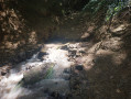
Beautiful views of Bugarach and the Corbières. Along the route, you can see the site of the old glass furnaces and taste the saltwater spring.
The hike is classified as difficult because you need to know how to find your way, read a map and/or follow the GPS track.
The GPS track and map are almost essential as there are many paths and the trails are not always well marked.
Tour of the chapels from Ria-Syrach
7.58 mi
+2,303 ft
-2,283 ft
5h 30
Moderate
Departure from Ria-Sirach (Pyrénées-Orientales)
Hike on good trails that allow you to discover mountain chapels. Beautiful views of the Madres Massif. A visit to Conat is also interesting.
The only difficulty is above Saint-Christophe Chapel: the trail is unmarked and sometimes difficult to see. It is necessary to know how to use a map and compass and/or how to follow a GPS track.
However, it is possible to avoid this section and shorten the hike by connecting the points (3) to (9).
Roc de les Creus from Conat
6.29 mi
+2,011 ft
-2,011 ft
4h 40
Difficult
Departure from Conat (Pyrénées-Orientales)
A walk offering beautiful views on the ascent of the Madres and Coronat massifs and on the descent towards the
Canigou. It gives you a real sense of the importance of pastoral activity in the past, with
numerous ruins along the way. The vegetation is varied; at the start there is a forest of
holm oak; higher up, there are rockroses and broom.
Please note: this walk is not really signposted and, although it generally follows good paths, it
requires experience of off-trail walking. A trail map is useful, if not essential.