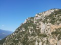
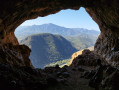
Roc de les Creus from Conat

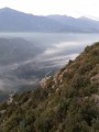
A walk offering beautiful views on the ascent of the Madres and Coronat massifs and on the descent towards the
Canigou. It gives you a real sense of the importance of pastoral activity in the past, with
numerous ruins along the way. The vegetation is varied; at the start there is a forest of
holm oak; higher up, there are rockroses and broom.
Please note: this walk is not really signposted and, although it generally follows good paths, it
requires experience of off-trail walking. A trail map is useful, if not essential.

Details

48044494
Creation:
Last update:
Last review:
  • Walking
    Activity: Walking
  • ↔
    Distance: 6.29 mi
  • ◔
    Average duration: 4h 40 
  • ▲
    Difficulty: Difficult

  • ⚐
    Back to start: Yes
  • ↗
    Ascent: + 2,011 ft
  • ↘
    Descent: - 2,011 ft

  • ▲
    Highest point: 3,573 ft
  • ▼
    Lowest point: 1,637 ft

Description of the walk

From Ria-Sirach, via the D26, park in the car park on Place du 8 Mai 1945, next to the town hall at the entrance to the village of Conat.

(S/E) Head towards the village and take thefirst right down the hill, Rue du Moulin.
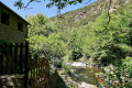
Just before the entrance to the property, turn left down the path alongside the house; on your left, look out for the ‘Llugols’ sign. Cross the footbridge over the El Callau and follow the steep path steadily uphill.

(1) At an altitude of 680 m, at the Teixoneres crossroads, turn left onto the path that climbs, following the ridge. The path is marked with cairns and has a few green markings. You will reach the Santa Marguerita de Nabille Chapel.

(2) Continue behind the chapel (heading north) along the ascending path that runs alongside the track.

(3) At an altitude of 900 m, go round the retention basin on the left and, immediately afterwards, follow a track
lower down which descends slightly, becomes a path, heads towards the ravine and then climbs again.
From there, there are no further markings or cairns, but the path is fairly well marked on the ground. It follows the
fence and the edge of the forest, about fifteen metres away.

(4) At an altitude of around 1,000 m, when the climb becomes less steep, look out for the few cairns and follow the path, which is less obvious and winds its way through the terrain. Follow the path that is clearest and least obstructed by vegetation,
moving a little further away from the forest edge.
At an altitude of around 1,090 metres, you’ll reach a flat area where the vegetation is less dense. You’ll come to a
fence; follow it to the left, where there is a passage marked with yellow barrier tape. Pass through it at this point
and follow the slightly ascending path, which leads to the track descending from the Roc de les Creus.

(5) Head down this wide, grassy track to the left. You’ll reach a ‘private property’ gate. The path
goes round it at the top, running alongside the fence. Then rejoin the path and follow it. Stay on the hillside for quite a while.

(6) At the large ruin (Arletes), below the path, just before the Riberot stream, the path ends. Descend to the left just after the ruin, following the cairns. Cross the stream and rejoin the path at this point. Climb slightly, then continue along the hillside.

(7) At an altitude of around 900 m, the path is then more clearly marked with cairns and features a few yellow markings.
You’ll reach Conat without any difficulty (S/E).

Waypoints

  1. S/E : mi 0 - alt. 1,706 ft - Conat. Car park. Place du 8 Mai 1945 - Église Saint-Jean-Baptiste (Conat)
  2. 1 : mi 0.88 - alt. 2,238 ft - Sign saying “this way”
  3. 2 : mi 1.63 - alt. 2,815 ft - Chapel of St Marguerite de Nabilles
  4. 3 : mi 2.01 - alt. 2,989 ft - Retention basin
  5. 4 : mi 2.55 - alt. 3,287 ft - Follow the cairns
  6. 5 : mi 2.95 - alt. 3,573 ft - Track
  7. 6 : mi 4.03 - alt. 3,127 ft - Ruins. Arletes
  8. 7 : mi 4.51 - alt. 2,989 ft - La Falguerosa
  9. S/E : mi 6.29 - alt. 1,706 ft - Conat. Car park. Place du 8 Mai 1945 - Église Saint-Jean-Baptiste (Conat)

Notes

No water in the area.

Worth a visit

The village of Conat is well worth a visit at the end of the walk, with its pretty cobbled streets.

Reviews and comments

4.1 / 5
Based on 4 reviews

Reliability of the description
4.3 / 5
Ease of following the route
4 / 5
Route interest
4 / 5
Caminerem
Caminerem

Overall rating : 4 / 5

Date of your route : Feb 03, 2025
Reliability of the description : ★★★★☆ Good
Ease of following the route : ★★★★☆ Good
Route interest : ★★★★☆ Good
Very busy route : No

A lovely winter walk, in the sunshine.

Machine-translated

Caminerem
Caminerem

Overall rating : 4 / 5

Date of your route : Feb 03, 2025
Reliability of the description : ★★★★☆ Good
Ease of following the route : ★★★★☆ Good
Route interest : ★★★★☆ Good
Very busy route : No

A lovely winter walk, in the sunshine.

Machine-translated

Sabine Peyrou
Sabine Peyrou

Overall rating : 4 / 5

Date of your route : Dec 04, 2024
Reliability of the description : ★★★★☆ Good
Ease of following the route : ★★★★☆ Good
Route interest : ★★★★☆ Good
Very busy route : No

I can confirm that you should avoid wearing shorts on this route unless you fancy scratching your thighs and calves. The unmarked paths are a bit overgrown and the vegetation is thorny. It’s also best avoided in hot weather. It’s also exposed to the tramontane wind.
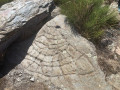
At the cattle pen, point 3, on the right near the junction of the tracks, there is a rock slab engraved with crosses and cup marks dating back to prehistoric times

Machine-translated

gigi66
gigi66

Overall rating : 4.3 / 5

Date of your route : Sep 15, 2024
Reliability of the description : ★★★★★ Very good
Ease of following the route : ★★★★☆ Good
Route interest : ★★★★☆ Good
Very busy route : No

A little-used route; the vegetation encroaches slightly on the paths; wear trousers rather than shorts; a peaceful walk – best avoided in very hot weather as there is little shade.

Machine-translated

Other walks in the area

For more walks, use our search engine .

The GPS track and description are the property of this route's author. Please do not copy them without permission.