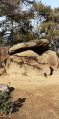
Circular walk around Roc Jocavell

A challenging hike with steep climbs, passing through varied landscapes depending on the section.
Most of the route is through woodland.

Warning: do not undertake this hike under the following conditions:
- After heavy rain or snowmelt, as the route crosses three streams where water levels may be high.
- In wet weather, as the rocks are slippery.

Details

n°4790589
Creation:
Last update:
Last review:
  • Walking
    Activity: Walking
  • ↔
    Distance: 7.79 mi
  • ◔
    Average duration: 6h 50 
  • ▲
    Difficulty: Difficult

  • ⚐
    Back to start: Yes
  • ↗
    Ascent: + 3,707 ft
  • ↘
    Descent: - 3,694 ft

  • ▲
    Highest point: 4,222 ft
  • ▼
    Lowest point: 2,290 ft

Description of the walk

Park at the Mas Malet refuge, the end point of the track starting either at Clara or at Villerach.

(S/E) Set off from beside the refuge and begin with a steep descent. Join another path, keep to the right and continue downwards to reach the Llech.

(1) Cross the stream by fording; as there is no bridge, avoid periods of rain and snowmelt, and take care as the stones are very slippery in wet weather.
From there, tackle a very steep climb through the forest. Follow the valley floor to the left. You’ll reach a shelter in very good condition, set against a rock. Continue the climb via a hairpin bend and then a few switchbacks to reach the Coll de la Gallina or Col de la Galine.

(2) Head left towards the north-east, continue the climb to reach a ridge and then begin thesecond descent. Turn right to reach the Mas de la Coume. At the farmhouse, follow the sign for Baillestavy. Cross the Còrrec de la Martina then join a track.

(3) Turn left onto it. Cross the Còrrec de la Font Nova, veer left and reach a crossroads with a sign for La Mouline via Col de Teixo.

(4) Begin thesecond steep ascent here by taking the path on the right. Climb along the ridge.
Pass the ruins of Cortal d’en Carbonell, indicated by a sign, and continue climbing, but leave the ridge and head off to the right, heading north-west. After a sharp bend to the left, you’ll reach a fork in the path. There are wooden signs here.

(5) Leave the path on the left (GR®36) and head up to the right to reach the highest point, the Collada del Teixó or Col de Teixó.

(6) Descend via a series of tight bends to the Còrrec de Prat Cabrera. Cross the stream here by wading across; take care here too – please refer to the previous notes. Climb slightly to reach another ford on the Còrrec del Salze; the slope then becomes steeper until you reach the track leading to La Mouline.

(7) Turn right onto the track and, after a right-angle bend, you’ll reach the old Lous Grounells car park.

(8) Here you have two options:
- stay on the track to the right and follow it to the car park at the Mas Malet refuge (S/E),
- leave the track and, before the barriers, take the path leading uphill to the left; this is the route shown on the map.
Walk along the gently ascending slope, above the track which is visible from time to time. Cross the Còrrec de les Beçoses. Continue on to reach another Y-junction.

(9) Ignore the path branching off to the left towards Roc Mosquit and continue northwards. You’ll reach the hamlet of Jaça de l’Espaülla after passing the 1208-metre mark.

(10) Here, begin the descent via tight hairpin bends. This is the final descent, in wide zigzags, leading you right up to the barrier at the Mas Malet car park (S/E).

Waypoints

  1. S/E : mi 0 - alt. 2,799 ft - Car park - Refuge Mas Malet
  2. 1 : mi 1.1 - alt. 2,395 ft - Llech ford
  3. 2 : mi 2 - alt. 3,776 ft - Coll de la Gallina (Col de la Galine)
  4. 3 : mi 2.92 - alt. 2,612 ft - Junction at the Mas Coume exit
  5. 4 : mi 3.29 - alt. 2,684 ft - End of track
  6. 5 : mi 4.39 - alt. 4,068 ft - Junction
  7. 6 : mi 4.58 - alt. 4,203 ft - Collada del Teixo (Col de Teixo)
  8. 7 : mi 5.31 - alt. 3,730 ft - Llech track
  9. 8 : mi 5.59 - alt. 3,642 ft - Lous Grounells car park
  10. 9 : mi 6.58 - alt. 3,802 ft - Roc Mosquit junction
  11. 10 : mi 6.99 - alt. 3,707 ft - Jaça de l’Espaülla
  12. S/E : mi 7.79 - alt. 2,799 ft - Car park - Refuge Mas Malet

Notes

Take care not to take this route after heavy rain or snowmelt, as it involves crossing three streams where water levels may be high. Also take care in wet weather as the rocks are slippery.

The track leading to the Mas Malet Refuge is generally in good condition (from Estoher). However, due to the water drainage ruts, I would not recommend it for low-clearance vehicles.
Alternative route: Mas Malet (the Llech track, via the villages of Prades and Villerach)

Worth a visit

(3) Mas de la Courme: Please note that this is a residential property, so keep your dogs on a lead due to the presence of livestock.
At this point, you can visit the remains of the old Coume Iron Mine, situated below on the left.

(5) Before the junction leading to the Col de Teixó (Collada del Teixó), there is a sign pointing to an old iron ‘carbonera’ (La Perola) to the left of the path. This is a cauldron used for making charcoal.

(7) Before reaching the track after the last crossing of the ford, there is an information board explaining how the Mouline forge worked; its ruins can still be seen there.

Always be cautious and plan ahead when you're outdoors. Visorando and the author of this route cannot be held responsible for any accidents occurring on this route.

The GR® and PR® markings are the intellectual property of the Fédération Française de Randonnée Pédestre.

Reviews and comments

5 / 5
Based on 1 review

Reliability of the description
5 / 5
Ease of following the route
5 / 5
Route interest
5 / 5
ThibaultT
ThibaultT

Overall rating : 5 / 5

Date of your route : Jul 15, 2023
Reliability of the description : ★★★★★ Very good
Ease of following the route : ★★★★★ Very good
Route interest : ★★★★★ Very good
Very busy route : No

A walk I went on with my dog on 15 July 2023, starting from Mas Maler. Access by car is easy. I have a low-slung car and didn’t scrape the underside.

A very pleasant walk through the woodland, especially given the heat of July 2023.
There are quite a few water sources, which is great for dogs.

At one point, you cross private property, so if you have a dog you’ll need to keep it on a lead. It’s really nice of the owners of Le Mas to allow the walking route to pass through their land.

For the last 4 km, I didn’t follow the path but took the track to get there faster.

According to my watch, I covered 14.45 km with 1,070 m of elevation gain. In trail running mode, it took me 2 hours 30 minutes, including breaks.

Thanks for sharing this.

Machine-translated

Other walks in the area

For more walks, use our search engine .

The GPS track and description are the property of this route's author. Please do not copy them without permission.