


boninmi

 Visorando Member
 Premium user
 Sign up:
Published route(s)
 Circuit from Vogüé to Balazuc via the old railway line
 8.91 mi
 +384 ft
 -413 ft
 4h 25
4h 25
 Moderate
 Departure from Vogüé (Ardèche)
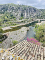
Circuit from Vogüé towards Balazuc, taking the old railway line (Vogüé-Grospierre greenway, which is flat, a rarity in the Ardèche), and returning along the right bank of the Ardèche, which is wilder. Please note: there is a lot of tarmac and cycle paths on this route, which should be avoided if you have allergies.
Short loop starting from Vogüé
 4.31 mi
+151 ft
-154 ft
2h 05
4.31 mi
+151 ft
-154 ft
2h 05
 Easy
Departure from Vogüé (Ardèche)
Easy
Departure from Vogüé (Ardèche)
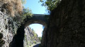
An easy walk, allowing you to explore the route of an old railway line through the landscapes of the Southern Ardèche on the way out, and the banks of the Ardèche in a very rural setting on the way back. Along the way, you can linger in the narrow streets of the old village of Lanas, with its almost medieval atmosphere.
Those who dislike tarmac may wish to avoid this very family-friendly walk, which is well suited to people who find uneven and hilly terrain more challenging. Take care when walking along roads and crossing them.
A short tour of Les Gras de Perret
 5.66 mi
+331 ft
-331 ft
2h 55
Moderate
Departure from Joyeuse (Ardèche)
5.66 mi
+331 ft
-331 ft
2h 55
Moderate
Departure from Joyeuse (Ardèche)
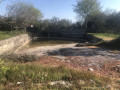
The gras are limestone plateaus characteristic of southern Ardèche. Here you can see low vegetation or trees: picards, junipers, Mediterranean shrubs, old mulberry trees left over from silkworm farming, various oaks and Montpellier maples. You will cross a karst landscape that is sometimes spectacular. This hike also offers a view from the top of the Beaume cliffs. You can stray from the path in search of karstic caves ( be careful at Réméjadou) and dolmens, sometimes lost in the woods.
The Lignon Valley between Jaujac and La Souche
 10.48 mi
+1,470 ft
-1,486 ft
6h 05
Moderate
Departure from Jaujac (Ardèche)
10.48 mi
+1,470 ft
-1,486 ft
6h 05
Moderate
Departure from Jaujac (Ardèche)
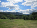
Between Jaujac and La Souche, the Lignon valley is an open valley, dominated to the north by the Rocher du Midi and to the south by the Tanargue massif. The hike takes you along the left bank, where you can admire old buildings and walk along beautiful, pleasant paths dotted with old bridges crossing streams, then back along the right bank and a succession of old hamlets.
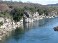
Circuit Lanas, Saint-Maurice-d'Ardèche, Balazuc
 5.83 mi
+354 ft
-354 ft
3h 00
Easy
Departure from Lanas (Ardèche)
5.83 mi
+354 ft
-354 ft
3h 00
Easy
Departure from Lanas (Ardèche)
Starting from Lanas, after crossing the Ardèche, the route of the old railway line to Saint-Maurice-d'Ardèche leads to the old Balazuc station. After climbing up to the village and crossing the bridge, the return journey follows the much wilder path along the river banks.
A loop around the Gorges de la Beaume
 3.30 mi
+558 ft
-564 ft
2h 00
Moderate
Departure from Saint-Alban-Auriolles (Ardèche)
3.30 mi
+558 ft
-564 ft
2h 00
Moderate
Departure from Saint-Alban-Auriolles (Ardèche)
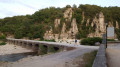
Shortly before flowing into the Ardèche, the Beaume (or Baume) has carved out meandering gorges in the limestone plateau west of Ruoms. Two routes along paths, paved slanting streets and tracks, but also tarmac, run along one bank of the river and then the other between Labeaume and Ruoms.
Here you will find the typical landscapes and vegetation of karst areas, between abandoned farmland and new developments, and the unspoilt charm of the old village of Labeaume.
Circular Saint-Andéol-de-Vals via the Moulin de Raoul
 8.63 mi
+1,444 ft
-1,427 ft
5h 15
Moderate
Departure from Saint-Andéol-de-Vals (Ardèche)
8.63 mi
+1,444 ft
-1,427 ft
5h 15
Moderate
Departure from Saint-Andéol-de-Vals (Ardèche)
This walk consists of two short circular loops connected by a short return trip. It takes you through a relatively unknown area of central Ardèche where the agricultural footprint is still clearly visible. You will pass from slopes to ridges and valleys following the north-south orientation of the mountain ranges. You will enjoy the wide views and landscapes.
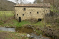
At the northernmost point, you will stop at an ancient mill dating back several centuries, known as "Le Moulin de Raoul" (see below).
Viewpoint over the Pont de Veyrières dam
 2.50 mi
+509 ft
-512 ft
1h 35
Easy
Departure from Saint-Pierre-de-Colombier (Ardèche)
2.50 mi
+509 ft
-512 ft
1h 35
Easy
Departure from Saint-Pierre-de-Colombier (Ardèche)
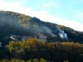
This short walk takes you from the village of Saint-Pierre-de-Colombier to the hamlet of Le Ranc, perched on a steep southern slope of the mountain, before continuing on to a superb viewpoint overlooking the valley and the dam. Return via the same route.
Between Lavilledieu and Vogüé
 7.76 mi
+659 ft
-663 ft
4h 10
Moderate
Departure from Lavilledieu (Ardèche)
7.76 mi
+659 ft
-663 ft
4h 10
Moderate
Departure from Lavilledieu (Ardèche)
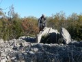
Between Lavilledieu and Vogüé, the limestone plateau (Le Gras) is easily accessible, with relatively little elevation gain. It offers a varied landscape and points of geological, prehistoric and historical interest. Hikers usually come away enchanted by this route.
Between basalt and limestone in southern Ardèche
 10.70 mi
+1,168 ft
-1,175 ft
5h 55
Moderate
Departure from Lussas (Ardèche)
10.70 mi
+1,168 ft
-1,175 ft
5h 55
Moderate
Departure from Lussas (Ardèche)
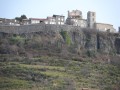
Between limestone plateau and volcanic relief, this hike reflects the diversity of the southern Ardèche, including crossing areas that are still agricultural, from the impressive fortified village of Saint-Laurent-sous-Coiron, which dominates the route, to the inevitable dolmens, passing by magnificent views of the Louyre gorges.
Circular around Balbiac in Rosières
 8.42 mi
+971 ft
-968 ft
4h 45
Moderate
Departure from Rosières (Ardèche)
8.42 mi
+971 ft
-968 ft
4h 45
Moderate
Departure from Rosières (Ardèche)
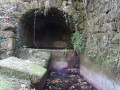
This vast south-facing valley surrounded by wooded areas (mainly pine trees) has retained its agricultural activities (vineyards, orchards, olive groves) and is dotted with several hamlets that are characteristic of southern Ardèche, even if there is some sprawl from recent residential developments. Streams and springs were equipped long ago with fountains and wash houses, sometimes in unexpected places.
La Tour de Brison
 8.43 mi
+1,444 ft
-1,447 ft
5h 10
Moderate
Departure from Sanilhac (Ardèche)
8.43 mi
+1,444 ft
-1,447 ft
5h 10
Moderate
Departure from Sanilhac (Ardèche)
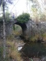
According to an old legend, "every year the devil takes a stone" from La Tour de Brison. This restored medieval tower is now a very effective fire lookout post. For hikers, it offers a remarkable view of the mountain to the west and the wide landscape it overlooks to the east, stretching as far as Mont Ventoux on a clear day.
Circular loop through the Bois de Païolive and Ruisseau du Granzon
 10.20 mi
+709 ft
-696 ft
5h 20
Moderate
Departure from Les Vans (Ardèche)
10.20 mi
+709 ft
-696 ft
5h 20
Moderate
Departure from Les Vans (Ardèche)
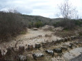
After crossing the Bois de Païolive, the route follows the Ruisseau du Granzon. After climbing out of the canyon, the return journey is via the plateau. An enchanting route and landscape. The use of GPS and the Visorando app may be necessary.
The walk from Robert to Meyras
 10.59 mi
+1,841 ft
-1,847 ft
6h 30
10.59 mi
+1,841 ft
-1,847 ft
6h 30
 Difficult
Departure from Meyras (Ardèche)
Difficult
Departure from Meyras (Ardèche)
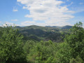
Robert, aged 86, led this hike around Meyras (December 2017), passing by the châteaux of Ventadour and Hautségur, then through the heights of Neyrac and the Souilhol volcanic flow. The route is a bit winding and involves some road walking, but it reveals a diverse and very distinctive area of the upper Ardèche.
Lalevade - Montgrand - Niègles
 9.27 mi
+1,614 ft
-1,614 ft
5h 40
Moderate
Departure from Lalevade-d'Ardèche (Ardèche)
9.27 mi
+1,614 ft
-1,614 ft
5h 40
Moderate
Departure from Lalevade-d'Ardèche (Ardèche)
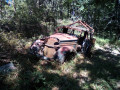
North of Lalevade-d'Ardèche, a hilly area is heavily affected by agricultural desertification. It is little known, except to its inhabitants and local hikers, but is nevertheless worth a detour. In Ardèche, the landscapes are beautiful everywhere. And this hike allows you to discover a gem, the Romanesque church of Niègles, rescued from ruin around 1980 by the Association des Amis de Niègles.
A circular loop along the towpath in Grenoble
 3.21 mi
+16 ft
-16 ft
1h 30
Easy
Departure from Grenoble (Isère)
3.21 mi
+16 ft
-16 ft
1h 30
Easy
Departure from Grenoble (Isère)
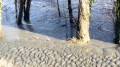
From the city centre (where you can take your time exploring as you please), head out to the banks of the Isère for a short, entirely flat circular walk along the towpath – either on the embankment if the riverbanks are wet, or on the dirt track closer to the river if it is dry enough. Wide views of Belledonne, which may be snow-capped, depending on the season.
Th Ajude woods, Ibie cliffs and Gour de la Sompe at Lagorce
 8.00 mi
+823 ft
-850 ft
4h 25
Moderate
Departure from Lagorce (Ardèche)
8.00 mi
+823 ft
-850 ft
4h 25
Moderate
Departure from Lagorce (Ardèche)
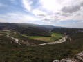
From Lagorce, the route climbs to the Notre-Dame d'Ajude chapel, through holm oak woods to the Ibie cliffs, past the Gour de la Sompe (waterfall and plunge pool), and returns to the village through more open farmland. This hike requires a good awareness of the environment, reading IGN maps and/or GPS indications.
Vals-les-Bains - Thieure circular
 6.61 mi
+1,936 ft
-1,909 ft
4h 45
Moderate
Departure from Vals-les-Bains (Ardèche)
6.61 mi
+1,936 ft
-1,909 ft
4h 45
Moderate
Departure from Vals-les-Bains (Ardèche)
The spa town of Vals-les-Bains is nestled within a fairly steep, partly volcanic landscape that largely overlooks it from the north-west and north-east. Up in the hills, the old farming settlements are still clearly visible in the valleys and on the slopes. Thieure is a hamlet perched on a promontory overlooking Vals. A steep climb leads up to it. The landscape is the reward.
Route between Lalevade and Fabras
 7.60 mi
+1,152 ft
-1,152 ft
4h 30
Moderate
Departure from Lalevade-d'Ardèche (Ardèche)
7.60 mi
+1,152 ft
-1,152 ft
4h 30
Moderate
Departure from Lalevade-d'Ardèche (Ardèche)
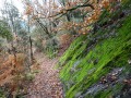
This route allows you to discover very wild areas, evidence of the long-ago abandonment of agricultural activities (chestnut groves), beautiful paths, the remains of a dense network of non-motorised rural communications, and views of the many hamlets, valleys, hills and neighbouring mountains that will make you forget a few less poetic passages.
Long circular: Vogüé, Balazuc and Lanas
 10.43 mi
+738 ft
-735 ft
5h 25
Moderate
Departure from Vogüé (Ardèche)
10.43 mi
+738 ft
-735 ft
5h 25
Moderate
Departure from Vogüé (Ardèche)
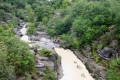
From Vogüé, the old railway line, converted into a greenway, leads to the hamlet of Les Louanes, south of Balazuc. A flat route in the Ardèche: a rarity! The climb back up to Balazuc takes you along the Coste-Labaume corniche. See the description in the practical information section. The return journey is along the right bank of the Ardèche, passing through the medieval village of Lanas.
Labeaume - Chapias loop
 5.83 mi
+571 ft
-564 ft
3h 10
Easy
Departure from Saint-Alban-Auriolles (Ardèche)
5.83 mi
+571 ft
-564 ft
3h 10
Easy
Departure from Saint-Alban-Auriolles (Ardèche)
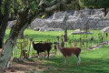
This pleasant circuit explores picturesque trails and places north of Labeaume.
Lalevade, Fabras and Bonneval circular loop
 9.63 mi
+1,506 ft
-1,486 ft
5h 45
Moderate
Departure from Lalevade-d'Ardèche (Ardèche)
9.63 mi
+1,506 ft
-1,486 ft
5h 45
Moderate
Departure from Lalevade-d'Ardèche (Ardèche)
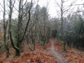
A former mining town, Lalevade-d’Ardèche is neither the best known nor the most popular of the Ardèche’s towns. Its surroundings are nonetheless charming: unspoilt countryside, picturesque hamlets, and beautiful views over valleys, hills and mountains. This extensive route offers a glimpse of them.
Around Le Sauvage between Le Ranc de Figère and L'Abeille
 5.38 mi
+430 ft
-423 ft
2h 50
Moderate
Departure from Labeaume (Ardèche)
5.38 mi
+430 ft
-423 ft
2h 50
Moderate
Departure from Labeaume (Ardèche)
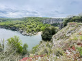
A surprising route, remarkable for its wild character and beauty, which circles the area known as ‘Le Sauvage’, starting from the megalithic necropolis at Ranc de Figère and running alongside that of L’Abeille. This is the karst landscape in all its splendour: large limestone slabs criss-crossed by impressive faults, rocks sculpted by erosion, and deep depressions. Paths lost in the wilderness alternate with wide tracks passing close to superb, isolated houses.
The Granges Necropolis
 3.64 mi
+167 ft
-167 ft
1h 50
Easy
Departure from Berrias-et-Casteljau (Ardèche)
3.64 mi
+167 ft
-167 ft
1h 50
Easy
Departure from Berrias-et-Casteljau (Ardèche)
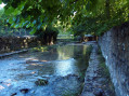
The Granges Necropolis is one of the most important dolmen sites in Ardèche. This short, easy circuit allows hikers to discover some of them while enjoying the landscape, vegetation and waterways of the limestone plateaus of lower Ardèche.
The paths of Prades
 6.44 mi
+1,188 ft
-1,184 ft
4h 00
Moderate
Departure from Ardèche
6.44 mi
+1,188 ft
-1,184 ft
4h 00
Moderate
Departure from Ardèche
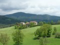
This hike takes you along country and forest paths south of Prades with beautiful views to the north-west over the Salindre valley and, further away, the Monts de Ladenne and Sainte-Marguerite, but also over the south of the Ardèche as you pass along the ridge overlooking Lentillères.
The use of an IGN map and the Visorando app's GPS is essential.
From one bank of the Bourges to the other between Burzet and Les Sausses
 3.82 mi
+705 ft
-692 ft
2h 20
Easy
Departure from Burzet (Ardèche)
3.82 mi
+705 ft
-692 ft
2h 20
Easy
Departure from Burzet (Ardèche)
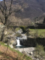
Superb trails and landscapes. Between Burzet and Les Sausses, on the left bank, the old Lachamp-Raphaël road is one of the most beautiful paved slanting streets in the Ardèche. On the right bank, on the way back, the old peatland road also has a wide, well-preserved paved slanting street under the chestnut trees and leads to the Roman road.
The hamlets of La Bourges
 10.00 mi
+2,703 ft
-2,710 ft
6h 55
Difficult
Departure from Saint-Pierre-de-Colombier (Ardèche)
10.00 mi
+2,703 ft
-2,710 ft
6h 55
Difficult
Departure from Saint-Pierre-de-Colombier (Ardèche)
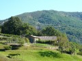
Clinging to the slopes of the Bourges valley, on the gentlest of hillsides, the hamlets bear witness to a way of life that has vanished, traces of which remain in a landscape that is gradually closing in: beautiful buildings, meadows, fields and vineyards still tended, chestnut groves and blueberries. This is the heart of the Ardèche Hautes Cévennes.
The Bourbouillet Trail
 9.22 mi
+413 ft
-404 ft
4h 35
Moderate
Departure from Lablachère (Ardèche)
9.22 mi
+413 ft
-404 ft
4h 35
Moderate
Departure from Lablachère (Ardèche)
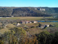
Les Gras, the limestone plateaus of southern Ardèche, may seem monotonous at first glance. This route allows you to discover varied vegetation and sometimes surprising terrain. Walking here in spring, with the green of the woods, or in autumn, with the beautiful colours, may be preferable to summer, with its high temperatures; however, part of the route is shaded. The hike passes near a karstic cave (caution!) where the underground river of the Bourbouillet resurgence flows.
In search of the lost paths of the Haute Ardèche
 5.34 mi
+1,191 ft
-1,191 ft
3h 30
Moderate
Departure from Saint-Pierre-de-Colombier (Ardèche)
5.34 mi
+1,191 ft
-1,191 ft
3h 30
Moderate
Departure from Saint-Pierre-de-Colombier (Ardèche)
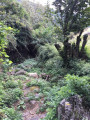
From Le Ranc to Aubignas, Aubignas to Le Libonès, and Le Libonès to Les Terrisses, there were once footpaths that were essential for life and trade between these hamlets. This hike offers the chance to rediscover these traces. You may have to search around a bit, either because the paths have been abandoned or because work has altered their course. The path between Cros du Libonès and Les Terrisses, long abandoned, is once again passable with a modified route.
The unfinished church of Saint-Genest-de-Beauzon
 7.05 mi
+1,047 ft
-1,043 ft
4h 10
Moderate
Departure from Saint-Genest-de-Beauzon (Ardèche)
7.05 mi
+1,047 ft
-1,043 ft
4h 10
Moderate
Departure from Saint-Genest-de-Beauzon (Ardèche)
Saint-Genest-de-Beauzon is a strange commune, made up of scattered hamlets in the southern foothills of the Cévennes Ardéchoises, with an isolated town hall near an unfinished church that has only its walls remaining. Landscapes, old houses, historical curiosities and geological sites punctuate this route.
Short tour of the drystone shelters at Maison Neuve
 6.57 mi
+558 ft
-558 ft
3h 30
Moderate
Departure from Chandolas (Ardèche)
6.57 mi
+558 ft
-558 ft
3h 30
Moderate
Departure from Chandolas (Ardèche)
This family hike begins with magnificent views of the Chassezac gorges, then crosses a karstic rocky chaos in a Tolkien-esque forest. Further on, you will find drystone shelters, ancient dry stone shelters. The return journey offers a classic route through the limestone landscapes of southern Ardèche along a small road that is little used out of season (those allergic to tarmac will find some alternative routes through heath).
Between chaos and heath north of Chassezac
 9.93 mi
+817 ft
-830 ft
5h 15
Moderate
Departure from Chandolas (Ardèche)
9.93 mi
+817 ft
-830 ft
5h 15
Moderate
Departure from Chandolas (Ardèche)
This route offers beautiful views of the cliffs and gorges of the Chassezac, rocky terrain, ancient dry stone constructions and a return route through a landscape of heath that is perhaps less poetic but nevertheless typical of the southern Ardèche.
The Col de Juvinas via the Chemin des Terrisses to the Cros du Libonès
 5.31 mi
+1,030 ft
-1,030 ft
3h 20
Moderate
Departure from Saint-Pierre-de-Colombier (Ardèche)
5.31 mi
+1,030 ft
-1,030 ft
3h 20
Moderate
Departure from Saint-Pierre-de-Colombier (Ardèche)
From Saint-Pierre-de-Colombier, the start of the path between the hamlet of Les Terrisses and Le Cros du Libonès had long been neglected. Following the creation of a new access route to the top of the hamlet, a new route for the start of the path has been cleared.
This walk takes you along this very old path linking the hamlets once again to reach the Col de Juvinas, before descending via the small road – a route popular with cyclists.
The Chante-Perdrix loop
 2.37 mi
+377 ft
-377 ft
1h 25
Easy
Departure from Saint-Pierre-de-Colombier (Ardèche)
2.37 mi
+377 ft
-377 ft
1h 25
Easy
Departure from Saint-Pierre-de-Colombier (Ardèche)
This easy walk allows you, over a short distance, to discover beautiful landscapes and places that bear witness to the former rural way of life in the Ardèche: hamlets, farms, meadows, chestnut groves, terraced vineyards and a mill.
From the Rochers de Païolive to the resurgences of the Ruisseau de Granzon
 7.88 mi
+561 ft
-531 ft
4h 05
Difficult
Departure from Les Vans (Ardèche)
7.88 mi
+561 ft
-531 ft
4h 05
Difficult
Departure from Les Vans (Ardèche)
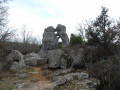
This unmarked route, which sometimes even leaves the trails, requires an IGN map and GPS, and leads to remote and wild areas of the Bois de Païolive and the upper part of the Ruisseau du Granzon.
The loop from Vinezac to Merzelet
 7.05 mi
+850 ft
-850 ft
4h 00
Moderate
Departure from Vinezac (Ardèche)
7.05 mi
+850 ft
-850 ft
4h 00
Moderate
Departure from Vinezac (Ardèche)
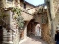
This pleasant hike takes you along beautiful paths from the old village of Vinezac to the hilltop hamlet of Merzelet through a varied environment (terraces returned to natural vegetation, pine forests, but also areas cultivated with vines, olive trees, and fruit trees). The distant landscape is magnificent, particularly at the top of the loop. The entire route is very well marked in yellow and white, with often recent markings.
Short loop around the Granzon stream
 5.68 mi
+591 ft
-564 ft
3h 10
Moderate
Departure from Banne (Ardèche)
5.68 mi
+591 ft
-564 ft
3h 10
Moderate
Departure from Banne (Ardèche)
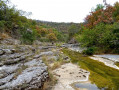
The Granzon stream canyon is a magical place that tour operators won't take you to. Go there, but don't tell anyone... The return route is via the plateau and a small road. Those allergic to tarmac may prefer to do a round trip.
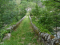
Circular route around Barnas - La Farre
 3.96 mi
+669 ft
-643 ft
2h 25
Easy
Departure from Barnas (Ardèche)
3.96 mi
+669 ft
-643 ft
2h 25
Easy
Departure from Barnas (Ardèche)
After a glimpse of the upper Ardèche valley, this hike enters one of the many small valleys of the complex terrain of the Ardèche Cévennes. Take care on the RN102 (be careful when walking alongside it and crossing it).
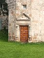
Coucouron circular
 8.91 mi
+1,050 ft
-1,053 ft
5h 00
Moderate
Departure from Coucouron (Ardèche)
8.91 mi
+1,050 ft
-1,053 ft
5h 00
Moderate
Departure from Coucouron (Ardèche)
When it gets too hot in southern Ardèche, hiking in fine weather on the Ardèche plateau can be a good idea. This circular loop starting from a local centre mostly follows farm tracks or small roads, with beautiful views of the volcanic knolls in places.
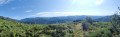
Circular loop from Aizac to Rouyon
 3.96 mi
+1,168 ft
-1,168 ft
2h 50
Moderate
Departure from Aizac (Ardèche)
3.96 mi
+1,168 ft
-1,168 ft
2h 50
Moderate
Departure from Aizac (Ardèche)
From chestnut trees to the moorland that precedes the Ardèche plateau, along beautiful paths with wide views, this is a relatively short but varied circular route with a slight elevation gain and a somewhat challenging start to the descent.
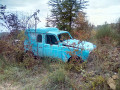
In the footsteps of Olivier de Serres
 9.08 mi
+1,053 ft
-1,047 ft
5h 05
Moderate
Departure from Ardèche
9.08 mi
+1,053 ft
-1,047 ft
5h 05
Moderate
Departure from Ardèche
Starting from the Domaine du Pradel – where, under Henry IV, in a valley surrounded by hills beneath the basalt cliffs of the Coiron, Olivier de Serres laid the foundations of modern agronomy – this unique walk leads to the hilltop village of Mirabel, then descends towards the farmland (mainly vineyards). A few road sections, generally with little traffic, cannot be avoided. Do not rely too heavily on the signposting.
La Grange aux Pères - Bourbouillet
 3.54 mi
+174 ft
-177 ft
1h 45
Easy
Departure from Lablachère (Ardèche)
3.54 mi
+174 ft
-177 ft
1h 45
Easy
Departure from Lablachère (Ardèche)
After crossing a forest that could have been used as a location for scenes from Tolkien's novels, the return to the ridge runs alongside a necropolis of dolmens.
Circular loop from Vinezac
 8.65 mi
+827 ft
-850 ft
4h 40
Moderate
Departure from Vinezac (Ardèche)
8.65 mi
+827 ft
-850 ft
4h 40
Moderate
Departure from Vinezac (Ardèche)
A hike that takes you along small roads and beautiful paths through a varied, little-known and still largely agricultural area of southern Ardèche. Best done on a clear day to admire the remarkable distant views in all directions.
Short circular loop around Puygiron and the Chapelle Saint-Bonnet
 2.34 mi
+200 ft
-187 ft
1h 15
Easy
Departure from Puygiron (Drôme)
2.34 mi
+200 ft
-187 ft
1h 15
Easy
Departure from Puygiron (Drôme)
A short country walk surrounded by beautiful scenery near Montélimar.
Châteauneuf de Mazenc - Souspierre circular
 4.07 mi
+272 ft
-262 ft
2h 05
Easy
Departure from La Bégude-de-Mazenc (Drôme)
4.07 mi
+272 ft
-262 ft
2h 05
Easy
Departure from La Bégude-de-Mazenc (Drôme)
Between the undergrowth and agricultural land, a short, easy hike allows you to enjoy the landscapes at the edge of the Valdaine plain.
Around Mastaize between La Bâtie-Rolland and La Touche
 4.52 mi
+469 ft
-492 ft
2h 30
Easy
Departure from La Touche (Drôme)
4.52 mi
+469 ft
-492 ft
2h 30
Easy
Departure from La Touche (Drôme)
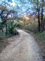
Through wooded and agricultural areas in the Drôme Provençale between Montélimar and Dieulefit.
The Marsanne plateau tour
 4.03 mi
+489 ft
-495 ft
2h 15
Easy
Departure from Marsanne (Drôme)
4.03 mi
+489 ft
-495 ft
2h 15
Easy
Departure from Marsanne (Drôme)
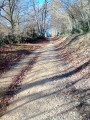
Route in the Marsanne forest with beautiful views of the valleys, along wide paths with gentle slopes.
The lapidary vats and the Val des Nymphes
 4.43 mi
+499 ft
-512 ft
2h 30
Easy
Departure from La Garde-Adhémar (Drôme)
4.43 mi
+499 ft
-512 ft
2h 30
Easy
Departure from La Garde-Adhémar (Drôme)
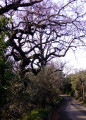
Above the Val des Nymphes, the IGN map refers to so-called "sacrificial stones". This magnificent hike allows you to see some of them, then revisit the magical site around the chapel.
Aleyrac - Citelles
 6.17 mi
+568 ft
-587 ft
3h 20
Easy
Departure from Aleyrac (Drôme)
6.17 mi
+568 ft
-587 ft
3h 20
Easy
Departure from Aleyrac (Drôme)
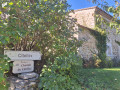
A peaceful hike along wide hillside paths, close to the picturesque, tiny, hidden village of Citelles.
A short walk above La Touche
3.21 mi
+476 ft
-479 ft
1h 55
Easy
Departure from La Touche (Drôme)
In Valdaine, amongst the wooded hills, there are plenty of paths. Armed with a good IGN map and a GPS, walkers can, so to speak, take their pick from all these possible routes. This short walk is a good example, taking in varied landscapes and attractive woodland.