In the footsteps of Olivier de Serres

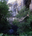
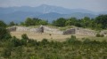
Starting from the Domaine du Pradel – where, under Henry IV, in a valley surrounded by hills beneath the basalt cliffs of the Coiron, Olivier de Serres laid the foundations of modern agronomy – this unique walk leads to the hilltop village of Mirabel, then descends towards the farmland (mainly vineyards). A few road sections, generally with little traffic, cannot be avoided. Do not rely too heavily on the signposting.

Details

2704570
Creation:
Last update:
Last review:
  • Walking
    Activity: Walking
  • ↔
    Distance: 9.08 mi
  • ◔
    Average duration: 5h 05 
  • ▲
    Difficulty: Moderate

  • ⚐
    Back to start: Yes
  • ↗
    Ascent: + 1,053 ft
  • ↘
    Descent: - 1,047 ft

  • ▲
    Highest point: 1,713 ft
  • ▼
    Lowest point: 732 ft

Photos

Description of the walk

From the RN 102 towards Villeneuve-de-Berg, head towards Mirabel then Le Pradel. It is also possible to reach the area via Saint-Privat and Lussas.

Park in the visitors’ car park at the Domaine du Pradel. The estate is open to visitors and welcomes walkers and hikers passing through (telephone confirmation dated 29 October 2019).

(S/E) Take the path heading south, which passes to the right of the group of buildings. Walk alongside the mulberry tree nursery on the right. Keep to the right, pass through the large oak trees, then go through the gate leading to the vineyards. Walk straight down to the bottom of the vineyards. The Gazel stream flows below the ravine. Turn left and follow the stream southwards.

(1) At the end of the field, turn right, pass under the viaduct of the old railway line, and head down the tarmac track (note an old stone millstone from the Pradel Mill on your left). Cross the Gazel stream, which flows into the Claduègne coming from the left. Follow the Claduègne on your right, join the road (D258), cross the bridge over the Largentelle stream and head uphill to the next junction.

(2) Pass under the railway line again, turning right onto the Chemin des Bombyx. Continue along this path, turning left at the first junction, then left again at the next junction whilst staying on the tarmac, and finally right before the railway line (still on the Chemin des Bombyx). You’ll reach the ‘Les Bombis’ signpost (likely a corruption of the same name).

(3) Take the farm track on the right, signposted Lavilledieu. At a three-way junction, keep to the right, following the power line and the yellow markers for a gas pipeline. At the next three-way junction, keep to the left, following the yellow markers but leaving the power line behind. After a gentle descent, cross a temporary watercourse, then climb up to the ridge (cedar trees).

(4) Turn right onto the wide, straight track (Chemin de la Crête). When you reach the tarmac, keep to the left and head downhill for about 200 metres, then leave the tarmac at a three-way junction to take the track leading uphill to the right. You will arrive at the ‘Le Chade’ mast.

(5) Head right towards Mirabel and immediately take the wide bend to the right, which leads downhill to the eastern slope of the ridge. Take the first hairpin bend to the left, then the second to the right; follow the protective fence of a water reservoir situated below on the right (sign: ‘No Swimming’), follow the road, and cross a bridge over the Blaches stream. About 100 m after the bridge, a path branches off steeply to the left.

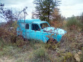
(6) Follow this track, keeping to the right as it climbs at the first three-way junction. Pass a ruin, then a blue 4L on the left. Ignore the turnings to the right and left to reach, with Mirabel in sight, the tarmac road and the newer houses (Chemin de Roussillon). Join the main road (D258) on the right.

(7) Follow the road briefly towards Mirabel, then take the path at the top left which climbs directly up to the village via the Chemin des Aires.

(8) Near the hiking information point, a vaulted passageway leads into the old village. Turn right onto Rue des Arceaux and follow it to the belfry and Place de la Fontaine. Head straight south after the washhouse along the small road (Chemin des Auches). Pass the town hall on your right, then the church, and carry on to the hairpin bend.

(9) At the hairpin bend (hiking signpost), keep to the right and continue down the road to a crossroads (on the right, Chemin de Chambre).

(10) Turn sharply left onto the downhill path (at the bottom, a small, faded wooden arrow-shaped sign on the large oak tree; old yellow and white markings, barely visible). Cross the Gazel stream and head back up towards the south. On the flat stretch, cross straight through the pig farm (a bit smelly…) via the wide path between the fences of the pens. Push open a gate (sign for walkers). Descend the slopes of the Argiolas ravine (Bourdaric stream), where you’ll see a few yellow and white markings.

(11) At the bottom of this descent, lift the gate to pass through it again, then turn left to walk alongside the vineyards on your left, leaving the hamlet of Le Clapier on the other side of the vineyards, and continue descending due south alongside the vineyards. Join the D458.

(12) Take the road on the right as far as the crossroads, then turn left, following the signs for Le Pradel – the same route you took to reach the starting point by road. Continue left along the D458A until you reach (S/E).


Waypoints

  1. S/E : mi 0 - alt. 899 ft - Domaine du Pradel - Domaine et ferme Olivier de Serres
  2. 1 : mi 0.55 - alt. 827 ft - Junction towards Ruisseau du Gazel, a tributary of the - Claduègue (rivière) - Affluent de l'Auzon, affluent de l'Ardèche
  3. 2 : mi 1.26 - alt. 758 ft - Chemin des Bombyx
  4. 3 : mi 1.74 - alt. 764 ft - Mât Les Bombis
  5. 4 : mi 2.41 - alt. 856 ft - Chemin de la Crête
  6. 5 : mi 3.59 - alt. 1,089 ft - Mât Le Chade
  7. 6 : mi 4.15 - alt. 978 ft - Ascent of the Blaches stream valley
  8. 7 : mi 5.43 - alt. 1,493 ft - Combe Chaude
  9. 8 : mi 5.7 - alt. 1,667 ft - Hiking Information Sign
  10. 9 : mi 6.18 - alt. 1,483 ft - Hiking pole in the hairpin bend
  11. 10 : mi 6.49 - alt. 1,322 ft - Chemin de Chambre
  12. 11 : mi 7.48 - alt. 1,093 ft - Barrier to lift
  13. 12 : mi 7.95 - alt. 961 ft - D 458
  14. S/E : mi 9.08 - alt. 899 ft - Domaine du Pradel - Domaine et ferme Olivier de Serres

Notes

There are no particular difficulties, but the usual hiking kit (shoes, water, food) is still recommended.

Worth a visit

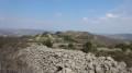
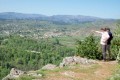
On the ridge, there are beautiful views over Lavilledieu, Lussas and the Tanargue massif.

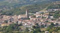
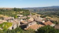
The medieval tower of Mirabel is often in view. On arrival in the village, if possible, walk up to it and take the time to stroll through the old streets; otherwise, return specifically to do so, or take the opportunity to do so during the shorter Mirabel walk , the sentinel of the Coiron.

A visit to the Domaine du Pradel can be a destination in its own right.

Reviews and comments

3.6 / 5
Based on 5 reviews

Reliability of the description
3.4 / 5
Ease of following the route
3.6 / 5
Route interest
3.8 / 5
Mich0726
Mich0726

Overall rating : 4 / 5

Date of your route : Aug 22, 2024
Reliability of the description : ★★★★★ Very good
Ease of following the route : ★★★☆☆ Average
Route interest : ★★★★☆ Good
Very busy route : No

A lovely walk, with a bit of tarmac but nothing too bad. If you haven’t visited Mirabel yet, now’s the time!
However, from point 10, after the pig farm, right up to point 12, you’ll need to get your map and compass (or GPS) out.
Head through the vineyard and past the stream (which is dry in summer) to rejoin the road further down; otherwise, it’s no problem.
I hope you enjoy the walk.

Machine-translated

PANPI64
PANPI64

Overall rating : 3.7 / 5

Date of your route : Dec 03, 2023
Reliability of the description : ★★★☆☆ Average
Ease of following the route : ★★★★☆ Good
Route interest : ★★★★☆ Good
Very busy route : No

The route was taken in reverse to better cope with the mistral.
No signposting, no landmarks. At the 2 km mark, the path had been used by a winegrower.
Fortunately, our GPS enabled us to get round these difficulties and get back on the original route. MIRABEL is a lovely village, well worth a visit. But be careful – don’t attempt this route relying solely on maps. We came across a pig farm, a sheep farm with its two friendly Patou dogs, a cattle farm, and a goat farm.
We won’t be doing this route again, even though we live in the area.
So, be patient and take care...

Machine-translated

boninmi
boninmi

Hello SebLau26,

Thank you for your comment.

I’ve recently updated the route (on 2 May); I’m not sure whether you followed the old or the new route.
At point 11, this is in principle a barrier that can be crossed (by lifting it or going round it, as I recall).
Between points 11 and 12, a section of the path (from the old route) before the road is no longer maintained (although it was previously signposted) and is blocked by large stones, brambles and dead shrubs. I’ve replaced it with a clearer route around the vineyards.
You can bypass the livestock farm by taking the wide path beneath the cliff at point 9, then heading off-track to the right of the Bourdaric stream to reach point 11. This route is only suitable for experienced walkers equipped with a GPS.

Machine-translated

SebLau26
SebLau26

Overall rating : 4 / 5

Date of your route : May 07, 2023
Reliability of the description : ★★★★★ Very good
Ease of following the route : ★★★☆☆ Average
Route interest : ★★★★☆ Good
Very busy route : No

We only managed to complete part of the route due to thunderstorms...
Nevertheless, regarding the section I did cover, I’d describe the route as little more than remnants of a former path; the signposting is in a state of disrepair and the section between points 11 and 12 is partly fenced off and obstructed by trees and vegetation. It’s therefore worth doing for the scenery, though you’ll need to make do with the route as it is – though this is through no fault of the author.
At point 10, despite the ‘private property’ sign, you can get through , near the pig farm.

Machine-translated

boninmi
boninmi

Good evening, Jean-Louis,

Which part of the walk are you referring to? This route doesn’t go beneath the basalt cliff, or at any rate it’s a long way from it, and at the points where it’s closest to it – before the location (9) – you’re on the road or on a very wide path.

I suspect you’ve made a mistake regarding the guided walk, or perhaps you took a wrong turn.

Kind regards.

Machine-translated

GAUDIN Jean-Louis
GAUDIN Jean-Louis

Overall rating : 3.3 / 5

Date of your route : Nov 21, 2021
Reliability of the description : ★★☆☆☆ Disappointing
Ease of following the route : ★★★★☆ Good
Route interest : ★★★★☆ Good
Very busy route : No

This section of the route must be omitted because, beneath the basalt cliff, the path disappears completely; it is blocked by walls of bramble 2 to 3 metres high. We managed to make our way 50 metres beneath the cliff with great difficulty.
G J-L

Machine-translated

boninmi
boninmi

"Hardly any signposts" is inaccurate, to say the least. Starting from (3), there are signposts practically all along the route, though it is true that they are not always clearly visible, and it is important to bear in mind that the yellow and white markings may correspond to several different routes. Instead, I have included numerous street and path names, descriptions of the landscape, and the presence of several signposts with directions. Furthermore, there is a hiking information board at the finish in Mirabel. What is missing to make this description reliable? Many guidebooks are far more limited. In this case, they are absent from this area. For criticism to be constructive, further details are desirable. Need I remind you once again that neither Visorando nor the author of the walk is responsible for the signposting?

Whether the route is of interest is, of course, a matter of personal taste. I described this route because the landscape – with its sweeping views, a distinctive agricultural area, the medieval village of Mirabel in the distance, and the Pradel site, with its history and current significance – seemed to me to merit it, whilst from a hiking perspective, this area was somewhat underrepresented. Everyone is entitled to their own opinion.

This walk was tested on 11 November 2019, without us feeling the earthquake, with a group of 13 people. Using the Visorando app, we encountered no problems.

Machine-translated

FLOCH
FLOCH ★

Thank you for this review
As for the wayfinding, the author had clearly stated in the introduction: ‘Don’t rely too much on the wayfinding’.

Does the rating ‘disappointing’ refer to the description itself or the lack of waypoints?

Machine-translated

vert
vert

Overall rating : 3 / 5

Date of your route : Dec 29, 2019
Reliability of the description : ★★☆☆☆ Disappointing
Ease of following the route : ★★★★☆ Good
Route interest : ★★★☆☆ Average

A very poorly signposted walk – there are hardly any signposts

Machine-translated

Other walks in the area

For more walks, use our search engine .

The GPS track and description are the property of this route's author. Please do not copy them without permission.