The Col de Juvinas via the Chemin des Terrisses to the Cros du Libonès

From Saint-Pierre-de-Colombier, the start of the path between the hamlet of Les Terrisses and Le Cros du Libonès had long been neglected. Following the creation of a new access route to the top of the hamlet, a new route for the start of the path has been cleared.
This walk takes you along this very old path linking the hamlets once again to reach the Col de Juvinas, before descending via the small road – a route popular with cyclists.

Details

1758685
Creation:
Last update:
Last review:
  • Walking
    Activity: Walking
  • ↔
    Distance: 5.31 mi
  • ◔
    Average duration: 3h 20 
  • ▲
    Difficulty: Moderate

  • ⚐
    Back to start: Yes
  • ↗
    Ascent: + 1,030 ft
  • ↘
    Descent: - 1,030 ft

  • ▲
    Highest point: 2,362 ft
  • ▼
    Lowest point: 1,332 ft

Photos

Description of the walk

In Saint-Pierre-de-Colombier, from the D26, cross the bridge over the Bourges towards Juvinas. 50 metres after the bridge, on the left, park in the Place du Marché.

(S/E) Continue along the D343 beneath the statue of the Virgin Mary until you reach the junction with the Chemin des Terrisses.

(1) Turn left onto the Chemin des Terrisses, pass beneath the hamlet along the newer road until you reach a wide hairpin bend, just past Les Terrisses.

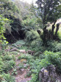
(2) At the hairpin bend, turn right onto the wide track that passes above a warehouse. After this building, leave this wide track (which descends and curves to the left). Take the path that climbs gently to the left. Cross a stream. Continue up a steep, sometimes slippery slope, marked by a few rough cairns.

Gradually rejoin the route of the old path (recently marked in yellow and white).
Cross several stream channels. Walk alongside low walls, some of which have collapsed, until you catch sight of the hamlet of Cros du Libonès. After crossing the stream below the hamlet of Cros, turn right to walk alongside the Gayots sheepfold and rejoin the D343.

(3) At the hairpin bend, take the D343 on the left, heading uphill. After the Gayots’ houses, a path on the left allows you to cut across another hairpin bend in the road. This path continues straight ahead and cuts across the junction between the D343 and the small road at the foot of Libonès.

Take this small road to the right. Before a stream, near a right-hand bend, a paved slanting street begins. Take this street, cross the stream and rejoin the D343 at the entrance to Libonès. Carry on along the road to the right. Drive through Libonès until you reach the next hairpin bend.

(4) At the three-way junction, follow the small road to the right. At the three-way junction by the house, Grangeou, on the right, take the wide path which continues to climb in the same general direction. As you approach the Col de Juvinas, cross the road again, climb up to the cross (view over the valley) and reach the pass.

(5) Head back down the road to Le Cros du Libonès.

(4) Return via Libonès. Continue to the hamlet of Le Cros to explore it, noting its character and beautiful buildings.

(6) Head back down between the houses and keep to the left to reach the sheepfold and the road at the hairpin bend.

(3) Continue down the road to the right. Pass in front of Le Pouget. At the bend, head right towards Les Terrons. Stay on the Route de Juvinas. Return to the starting point of the circular route. Follow the same route back as on the way out to the car park at the Place du Marché (S/E).

Waypoints

  1. S/E : mi 0 - alt. 1,332 ft - Place du Marché. Near the - Bourges (rivière)
  2. 1 : mi 0.12 - alt. 1,345 ft - Chemin des Terrisses
  3. 2 : mi 0.57 - alt. 1,539 ft - Les Terrisses (hairpin bend)
  4. 3 : mi 1.13 - alt. 1,778 ft - Le Cros du Libonès (D 343)
  5. 4 : mi 1.63 - alt. 2,044 ft - The hamlet of Libonès (hairpin bend)
  6. 5 : mi 2.2 - alt. 2,349 ft - Col de Juvinas (721m)
  7. 6 : mi 3.58 - alt. 1,870 ft - Le Cros du Libonès
  8. S/E : mi 5.31 - alt. 1,332 ft - Place du Marché

Notes

Make sure you wear sturdy footwear (the start of the path is steep).

Worth a visit

The return journey is via the road, which is quiet out of season (though you should still exercise caution). This is one of the routes of L’Ardéchoise, a well-known cycling event held in June. If you’re not keen on tarmac, you can head back down via the same paths you took on the way up, either in full or in part: in that case, do consider stopping off at the hamlet of Cros du Libonès.

For a shorter ride, you can also stop at Cros du Libonès and head back down either via the path you took on the way up or via the road.

On the way up, you can also pass through the hamlet of Les Terrisses (stairs, a passageway between the houses, and a vaulted entrance to an old barn).

The old route of the path starting from Les Terrisses is still shown on the IGN map. GPS enthusiasts may wish to try and find it: you’ll need to scramble a bit at the start, as the terrain has been significantly altered at the base by recent works, and you’ll need to find your way through the vegetation, as the path hasn’t been cleared for several years.

Reviews and comments

4.8 / 5
Based on 2 reviews

Reliability of the description
5 / 5
Ease of following the route
5 / 5
Route interest
4.5 / 5
Mich0726
Mich0726

Overall rating : 4.7 / 5

Date of your route : Aug 29, 2023
Reliability of the description : ★★★★★ Very good
Ease of following the route : ★★★★★ Very good
Route interest : ★★★★☆ Good
Very busy route : No

It was a lovely walk up to the pass, but as I didn’t want to turn back, I set off to tackle the next three passes.
But at the Col des Champs, instead of heading back down to Aubignas, I went straight on towards Le Ranc.
There was no proper path – the descent over the rocks was quite dangerous and I really struggled, lol.

Machine-translated

armelle42
armelle42

Overall rating : 5 / 5

Date of your route : Aug 07, 2023
Reliability of the description : ★★★★★ Very good
Ease of following the route : ★★★★★ Very good
Route interest : ★★★★★ Very good
Very busy route : No

On the way up to the pass, the shade was a welcome relief as I was doing it in the heat of the day
and on the way down, we were on a tiny, quiet road with a magnificent view and a gentle breeze – I didn’t want it to end too quickly (I was walking slowly to make it last longer, lol).

Machine-translated

Other walks in the area

For more walks, use our search engine .

The GPS track and description are the property of this route's author. Please do not copy them without permission.