From one side of the upper Ardèche valley to the other

Around Barnas, this walk takes in a little-known section of the slopes of the upper Ardèche valley, though it does involve a stretch along the RN 102 (take care when walking alongside and crossing it).

Details

n°2115955
Creation:
Last update:
Last review:
  • Walking
    Activity: Walking
  • ↔
    Distance: 6.45 mi
  • ◔
    Average duration: 4h 10 
  • ▲
    Difficulty: Moderate

  • ⚐
    Back to start: Yes
  • ↗
    Ascent: + 1,407 ft
  • ↘
    Descent: - 1,381 ft

  • ▲
    Highest point: 2,129 ft
  • ▼
    Lowest point: 1,427 ft

Photos

Description of the walk

See Practical Information for the starting point.

(S/E) Walk down to the small road below. Follow it to the right, then turn left at the junction to cross first a recent footbridge, then the old Bouix bridge.

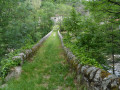
(1) Continue to the right after the bridge towards Champ Hagot. Keep to the right after the hamlet, follow the path which crosses a stream and then returns to run alongside the Ardèche further up the slope. Carry on to the Pont du Sigadou.

(2) As you approach the bridge, take the path that winds steeply uphill to the left. Follow this steep climb until you reach a forest track.

(3) Follow this wide track to the right as it descends gradually, passing a water intake and crossing the Abraham stream. Leave the start of the path to the Rocher d’Abraham on your left and head down to the right towards the hamlet of La Motte.

(4) On reaching the hamlet, take the small path on the right, then the steps to the left of the houses and continue down to the N102.

(5) Follow the N102 to the right (the side with some pavements) for 800 m. Take care: heavy traffic, including many lorries.

(6) Cross with care to reach the first car park on the left. Enter the village via the street set back from the main road. Go up the steps marked ‘Sentier botanique’. Follow this nature trail, which climbs gradually to the east of the village before turning north. You’ll reach the tarmac road at the hamlet of Le Pouget.

(7) Continue northwards along this small road. Pass the next hamlet (Les Granges) and leave the road 150 metres further on, before the descent to the stream, onto a path that climbs to the left. Keep heading north. At the tarmac road, head down to the right to the bridge over the La Farre stream.

(8) Walk down the road to Le Bouix.

(9) Take care. Turn left onto the N102. Cross the road to reach the car park (S/E).

Waypoints

  1. S/E : mi 0 - alt. 1,470 ft - Pont du Saut
  2. 1 : mi 0.18 - alt. 1,427 ft - Cross the bridge - Ardèche
  3. 2 : mi 1.17 - alt. 1,526 ft - Pont du Sigadou
  4. 3 : mi 1.72 - alt. 2,077 ft - Forest track
  5. 4 : mi 3.14 - alt. 1,732 ft - La Motte
  6. 5 : mi 3.3 - alt. 1,585 ft - La Motte, N102
  7. 6 : mi 3.81 - alt. 1,519 ft - Barnas car park
  8. 7 : mi 4.66 - alt. 1,886 ft - Le Pouget
  9. 8 : mi 5.25 - alt. 1,870 ft - Bridge over the La Farre stream
  10. 9 : mi 6.32 - alt. 1,486 ft - Le Bouix
  11. S/E : mi 6.45 - alt. 1,470 ft - Pont du Saut

Notes

Starting point:
- Coming from Thueyts via the N102 towards Barnas, after Chaudons, at the place known as Le Pont du Saut, look out for a widening on the left, just after the bridge. Due to the solid line, turn round at Barnas using the car park on the right-hand side of the road.
- Coming from Barnas, after the hamlet of Le Bouix, park on the right-hand side of this widening just after the sign for the place known as Le Pont du Saut.

Sturdy walking boots are essential.

Worth a visit

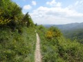
Paths, landscapes, woodland and typical Ardèche hamlets.

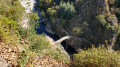
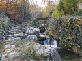
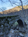
Streams and bridges in the Ardèche mountains.

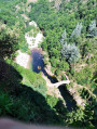
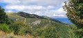
Beautiful views over this stretch of the Ardèche valley.

In the hamlet of Les Ayvidés, there is a beautiful carved gateway (it is possible to walk round the hamlet at the bottom).

Reviews and comments

4.3 / 5
Based on 2 reviews

Reliability of the description
4.5 / 5
Ease of following the route
4.5 / 5
Route interest
4 / 5
boninmi
boninmi

Unlike our friend Mich0726, it seems that Nini07 has found the path between (2) and (3), which might well have been lost over the past nine years since I posted this walk, which I’ve done several times with the independent walkers from La Fontaulière.

In the Ardèche, which I have since left, you sometimes have to put up with tarmac to discover the scenery. It’s still nice to see that a walk that’s rarely taken has remained useful.

Machine-translated

Nini07
Nini07

Overall rating : 4 / 5

Date of your route : Oct 12, 2026
Reliability of the description : ★★★★☆ Good
Ease of following the route : ★★★★☆ Good
Route interest : ★★★★☆ Good
Very busy route : No

Far too much tarmac for my liking, especially on the stretch between the two slopes; magnificent scenery all the same – I’m not sure I’d do this route again, though.

Machine-translated

Mich0726
Mich0726

Overall rating : 4.7 / 5

Date of your route : Feb 29, 2024
Reliability of the description : ★★★★★ Very good
Ease of following the route : ★★★★★ Very good
Route interest : ★★★★☆ Good
Very busy route : No

A superb walk with two tricky sections:
From the Sigadou bridge to the pylon (2 to 3), there’s no path, so you’ll need a compass (or GPS) and head straight into the woods uphill – about 45 mins!!! By the time I reached the pylon, my thighs were on fire, lol.
Then we had to swim across the Ardèche! lol. No, seriously, you’re mad – I took the bridge; it was far too cold (2–3°C).
Otherwise, plenty of water, streams and torrents. Beautiful scenery.
Well worth a go!

Machine-translated

Other walks in the area

For more walks, use our search engine .

The GPS track and description are the property of this route's author. Please do not copy them without permission.