Viewpoint over the Pont de Veyrières dam

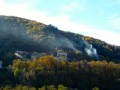
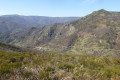
This short walk takes you from the village of Saint-Pierre-de-Colombier to the hamlet of Le Ranc, perched on a steep southern slope of the mountain, before continuing on to a superb viewpoint overlooking the valley and the dam. Return via the same route.

Details

837973
Creation:
Last update:
Last review:
  • Walking
    Activity: Walking
  • ↔
    Distance: 2.50 mi
  • ◔
    Average duration: 1h 35 
  • ▲
    Difficulty: Easy

  • ⚐
    Back to start: Yes
  • ↗
    Ascent: + 509 ft
  • ↘
    Descent: - 512 ft

  • ▲
    Highest point: 1,732 ft
  • ▼
    Lowest point: 1,296 ft

Photos

Description of the walk

Start from the old market square in Saint-Pierre-de-Colombier (car park), where you’ll find the hiking information point.

(S/E) Head south towards Juvinas. At the first junction, turn right (Courtiol Bas), continuing southwards, and pass between the houses to reach the Courtiol Béalière bridge over the Libonès stream (see the ‘Points of interest’ section).

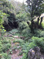
(1) Cross the bridge, follow the left bank of the stream as it runs above you for about twenty metres, then turn left to cross the Béalière over two large flat stones and walk along the meadows between the upper low wall on the left and the lower low wall on the right. Turn left onto a paved slanting street that climbs up to Les Terrons.

(2) Once you reach the tarmac road, turn right onto a path, also terraced, between an upper low wall and one below it. Pass a small barn and continue more or less straight on through the chestnut grove. When you reach the Chemin de Gardelle (tarmac), carry on straight ahead to climb up to the Route du Ranc.

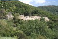
(3) Follow the Route du Ranc until you can see the first hairpin bend, which you cut across by turning left onto an uphill path. Cross the back of the hairpin bend and continue straight ahead along the path until you rejoin the Route du Ranc. Follow this road to the end of the hamlet.

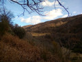
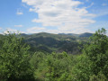
(4) Then take the path on the right, which descends slightly before continuing on roughly level ground. After five to six hundred metres, following an uphill section, you’ll reach a rocky viewpoint, the highest point on the path. There’s a sweeping view of the valley and the dam below, as well as the mountain ranges above Jaujac.

(5) Return via the same route and head back to the car park (S/E).

Waypoints

  1. S/E : mi 0 - alt. 1,332 ft - Place du Marché. Near the - Bourges (rivière)
  2. 1 : mi 0.16 - alt. 1,299 ft - Courtiol aqueduct
  3. 2 : mi 0.25 - alt. 1,342 ft - Terrons
  4. 3 : mi 0.52 - alt. 1,519 ft - Gardelle
  5. 4 : mi 0.91 - alt. 1,729 ft - Le Ranc
  6. 5 : mi 1.25 - alt. 1,732 ft - Viewpoint. Valley of the - Fontolière (rivière)
  7. S/E : mi 2.5 - alt. 1,332 ft - Place du Marché

Notes

In wet weather or after heavy rain, the paved slanting street at Les Terrons can turn into a stream, so it is best to take the Route de Juvinas and then follow the signposted turn-off towards Les Terrons.

An alternative route is to take the road, which is relatively quiet, as far as Le Ranc.

On the return journey, you can follow the ‘Chemin de Compostelle’ signposts (the Aubenas–Le Puy route, organised by Mrs Martine Morand).

Worth a visit

(S/E) The old market square was a bustling place for many years, particularly during the cherry season, when farmers would bring their produce to the traders. Until the mid-1980s, one could also witness the passage of the still there.

(1) The Courtiol water channel bridge is a curiosity. It remained in use until very recently. A little further on, two large stones allow you to cross the water channel. I accompanied some donkeys which, although they crossed the bridge, never wanted to cross the flowing water of the channel.

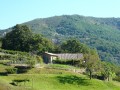
(3) After Gardelle, at the hairpin bend, there is a view of the terraces of Auluyères. All along the route, there are views of the Ardèche countryside, which is gradually being overtaken by the forest, apart from a few attempts to restore the chestnut grove.

(4) The curious rocky viewpoint almost evokes a prehistoric sacred site, but that is purely my own speculation…

Continuing along the path, you can join the circular loop that leads to Sainte-Marguerite.

Reviews and comments

3.7 / 5
Based on 4 reviews

Reliability of the description
3.8 / 5
Ease of following the route
3.5 / 5
Route interest
3.8 / 5
michem
michem

Overall rating : 3.3 / 5

Date of your route : May 05, 2025
Reliability of the description : ★★★☆☆ Average
Ease of following the route : ★★★☆☆ Average
Route interest : ★★★★☆ Good
Very busy route : No

A lovely walk with some beautiful views. The signposting is a bit unclear at the start of the route up to point 2 and before point 3.

Machine-translated

Gégé13430
Gégé13430

Overall rating : 3 / 5

Date of your route : Aug 04, 2021
Reliability of the description : ★★★☆☆ Average
Ease of following the route : ★★★☆☆ Average
Route interest : ★★★☆☆ Average
Very busy route : Yes

To find the sheepfold, there is a grassy path between the house on the left and an outbuilding (terrace).
Don’t be afraid to walk past the house.
The signposting is very clear on the way back but not on the way there (same path).

Machine-translated

chtiardechoise
chtiardechoise

Overall rating : 4 / 5

Date of your route : Oct 01, 2020
Reliability of the description : ★★★★☆ Good
Ease of following the route : ★★★★☆ Good
Route interest : ★★★★☆ Good
Very busy route : No

A superb route, with the added bonus of this magnificent view of the Pont de Verrières dam:.

Machine-translated

Other walks in the area

For more walks, use our search engine .

The GPS track and description are the property of this route's author. Please do not copy them without permission.