


bernard bb

 Visorando Member
 Premium user
- Gender: man
Sign up:
Published route(s)
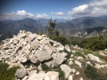
 The Crête de la Madone via Le Reveston
 7.34 mi
 +3,671 ft
 -3,665 ft
 6h 35
 Very difficult
 Departure from Utelle (Alpes-Maritimes)
A difficult, unspoilt and wild route which, after an hour’s walk, leaves the Reveston path (alt. 560 m) to reach the Crête de la Madone (alt. 1154 m). Please note : this hike is intended for those who enjoy challenging terrain and sustained physical exertion.
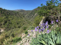
The Roman bridge at Thiéry
 2.48 mi
+886 ft
-883 ft
1h 55
 Easy
Departure from Thiéry (Alpes-Maritimes)
A very beautiful and short walk, following a centuries-old path, as evidenced by these two ancient bridges. The bridge and the unmarked wooded path are a lovely discovery. Beautiful views of the village of Thiéry before crossing it.
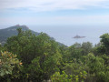
Dramont coastline and the Estérel forest
 5.72 mi
+922 ft
-909 ft
3h 25
Easy
Departure from Saint-Raphaël (Var) (Var)
The start of the hike involves regularly leaving the path to follow the shoreline and these reddish rocks as closely as possible. With so many views of the coastline, there are plenty of places to stop. The route around the village of Cap Estérel takes you up a little, offering a panoramic view of Dramont and Île d’Or.The fact that the Provence landings took place here in 1944 is down to the presence of these quarries; this fascinating information is provided on information boards.
The painted doors of Valloria on the way out of Dolcedo
 7.11 mi
+1,572 ft
-1,558 ft
4h 40
 Moderate
Departure from Dolcedo (Imperia)
The walk through this olive grove, the discovery of Valloria—a veritable timeless museum where visitors can escape, let their imaginations run wild and lose track of time for a moment—and the walk through Bellissini with its many mural hot-air balloons will leave all hikers deeply impressed by what they have seen along this route.
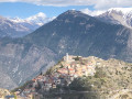
The Mont d'Ilonse circuit
 11.26 mi
+3,747 ft
-3,727 ft
8h 25
Very difficult
Departure from Ilonse (Alpes-Maritimes)
A very pleasant mule track, built by the people of Ilonzo, used for centuries to link the hamlets of Irougne and Le Pous, providing access to farmland and pastures. The path leading to the Col de Fourches is wide but very steep.
The Rocher de Chastellare, starting from Clans
 7.10 mi
+2,986 ft
-2,986 ft
5h 50
 Difficult
Departure from Clans (Alpes-Maritimes)
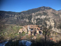
An excellent area to prepare for the alpine summer season. Areal pleasure to explore this wooded massif, home to a rich variety of species and one of the most beautiful forests in the Alpes-Maritimes department. This paved slanting street, these terraced walls and these ruins bear witness to an ancient agricultural tradition.
Gueydan Bridge – Entrevaux via the summit of La Lette
 10.68 mi
+3,665 ft
-3,845 ft
8h 05
Difficult
Departure from Saint-Benoît (Alpes-de-Haute-Provence) (Alpes-de-Haute-Provence)
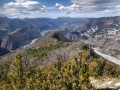
A beautiful, challenging route that keeps you on the ridgelines. The C-shaped configuration of the Var means that throughout this ascent you can admire the river’s banks on both the north and south sides. At the end of the hike, wander through the narrow streets lined with old walls in this magnificent village.
La Roche Trouée at the start of the Pont des Roberts
 3.78 mi
+1,558 ft
-1,558 ft
3h 05
Moderate
Departure from Guillaumes (Alpes-Maritimes)
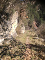
A short, moderately challenging hike offering beautiful views of the Var, the Gorges du Daluis and the Pont de la Mariée. The route, which is rarely used, passes through a pine forest before reaching the natural arch at La Roche Trouée, a true natural treasure. On your return to Pont des Roberts, visit the village of Guillaumes, a charming village nestled in the heart of the Upper Var Valley.
Mont Richarmet and La Roche Trouée from the Pont de la Mariée
 6.66 mi
+2,136 ft
-2,205 ft
4h 55
Moderate
Departure from Guillaumes (Alpes-Maritimes)
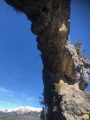
A beautiful forest trail that begins with an ascent up the Vallon de Cante and three river crossings. The views of the gorges and the Alpine massif are countless. The passage beneath the natural arch of La Roche Trouée, a stone monument some fifteen metres high and a testament to a distant geological past, leaves all hikers speechless.The Saint-Joseph Chapel in Sauze-Vieux and its picnic area make for a popular spot for a lunch break, facing Mont Saint-Honorat.
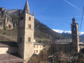
From Saint-Dalmas de Tende to La Brigue
 5.48 mi
+896 ft
-922 ft
3h 20
Easy
Departure from Tende (Alpes-Maritimes)
A beautiful walk through the Levensa Valley. Breathtaking views of these two towns. Prestigious sites steeped in history, including a magnificent House of Brigasque Heritage and Traditions to visit – everything you need for a pleasant day combining physical activity with fun and cultural visits.
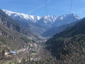
The Saint-Dalmas de Tende, La Brigue, Tende triangle
 9.79 mi
+2,972 ft
-2,966 ft
7h 05
Difficult
Departure from Tende (Alpes-Maritimes)
Three villages,names and prestigious locations steeped in history on the natural border of the Mercantour National Park and the Vallée des Merveilles. Numerous sweeping views over these two valleys and the Alpine massif. A magnificent hike that lives up to our expectations.
The listed Vegay Waterfall as seen from the village of Aiglun
 3.37 mi
+1,004 ft
-1,004 ft
2h 25
Moderate
Departure from Aiglun (Alpes-Maritimes) (Alpes-Maritimes)
A moderately strenuous but very pleasant walk. It is the largest recorded and listed natural waterfall in the Alpes-Maritimes, with its three successive drops. The waterfall is exceptional and, in terms of height, is matched only by its Icelandic twin sisters. The start and end of this route offer a chance to discover the beautiful architectural heritage of Aiglun. Thanks to its strategic location, the inn is a popular spot at the end of this round trip in the Estéron.
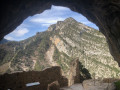
Aiglun, its cave fortress and its waterfall
 6.89 mi
+2,054 ft
-2,028 ft
4h 55
Difficult
Departure from Aiglun (Alpes-Maritimes) (Alpes-Maritimes)
An exceptional hike, combining history, nature and fitness. The troglodyte fortress is unique, the Vegay waterfall is rivalled only by its Icelandic twin sisters, and the rough section of the nature trail will test your sense of direction. The route concludes with a tour of Aiglun’s beautiful architectural heritage.
The three medieval bridges and the pools of the Barbaira tributary.
 2.55 mi
+699 ft
-705 ft
1h 45
Easy
Departure from Rocchetta Nervina (Imperia)
A change of scenery guaranteed. This lesser-known tributary of the Rio Barbaira features three medieval stone bridges and pools of green water. It promises a secluded spot and guaranteed swimming. Perhaps a fine reason to take this walk.
On the way back, the village of Roccheta Nervina reveals a completely unspoilt site with narrow alleyways. It’s like stepping back fifty years in time.
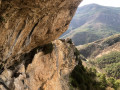
The troglodyte fortress of Aiglun
 1.43 mi
+958 ft
-961 ft
1h 30
Easy
Departure from Aiglun (Alpes-Maritimes) (Alpes-Maritimes)
Located a stone’s throw from the village, on the edge of an impressive canyon, the troglodyte fortress known as the “Château d’Aiglun”, with its stone-masonry walls, nestled in its natural surroundings, bears witness to a mysterious past . This rural built heritage, a veritable bastion situated beneath the Giet cliff, is believed to be the largest of its kind in France, spanning nearly 80 metres. The construction of stone steps, the installation of metal steps, the safety works on the access routes, the installation of signage and attractive information points allow visitors to fully enjoy these magical, timeless places.
Panoramas and Forts in the South-West of Sospel
 11.43 mi
+3,182 ft
-3,196 ft
8h 00
Difficult
Departure from Sospel (Alpes-Maritimes)
A route with many facets. The medieval history of Sospel, the magnificent panorama from the Tête de Nervina stretching across the Bévéra Valley, the paved slanting streets, and the forts dating from the last war will delight curious hikers.
From Isolabona to Roccheta Nervina via Monte Morgi
 11.57 mi
+4,377 ft
-4,380 ft
9h 10
Very difficult
Departure from Isolabona (Imperia)
This hike follows the old mule track that linked the two villages. Isolabona, a charming village known for its picturesque historic centre and olive groves, and Rocchetta Nervina, which offers hikers a unique experience, far from the hustle and bustle of modern life. A few ‘natural pools’ are real oases waiting to be discovered.
The hamlets of Cetta and Loreto at the start of Triora
 6.39 mi
+2,142 ft
-2,136 ft
4h 50
Moderate
Departure from Triora (Imperia)
This hike begins and ends with a walk through the village of Triora, ranked among the most beautiful villages in Italy. It is a perfect example of a medieval village, where every alleyway, every small square, every wall and every building bears witness to centuries of history and tradition. The wooded valley, the old bridge overlooking the Argentina valley, and the two other hamlets you pass through will capture your attention.
Coastline and mountains from Lower Mortola
 9.33 mi
+2,992 ft
-2,966 ft
6h 55
Moderate
Departure from Ventimiglia (Imperia)
A surprising and very beautiful hike where the sea and mountains, just a stone's throw from the French border, await you. Throughout the route, views of the coastline from Ventimiglia to Monaco, the Italian peaks and the terraced crops are omnipresent.
Mont de Théoule
 5.00 mi
+1,181 ft
-1,152 ft
3h 20
Moderate
Departure from Mandelieu-la-Napoule (Alpes-Maritimes)
A short, very pleasant hike in the Estérel.The red rocks, varied woodland, fragrant scents and scrubland will delight all hikers. The path starting from the point (7) is particularly popular as it passes through a tunnel of vegetation.
Circular walk from San Peyre Park to the crest of Mont Turney de la Napoule
 6.68 mi
+1,145 ft
-1,129 ft
4h 05
Moderate
Departure from Mandelieu-la-Napoule (Alpes-Maritimes)
This hike begins with the climb to the summit of San Peyre and its orientation table. From there, you will need to be observant to take a small section of unmarked trail. The colours, smells and wind of the Estérel accompany us throughout this varied itinerary. The coastal path is an added bonus, enjoyed all year round.
Around Gourdon via the Gorges du Loup
 8.01 mi
+2,277 ft
-2,303 ft
5h 40
Moderate
Departure from Gourdon (Alpes-Maritimes)
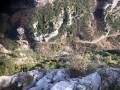
After visiting the hilltop village of Gourdon, the old mule track will take you to a natural site nestled at the bottom of a steep-sided valley. The Gorges du Loup reveal themselves to our eyes. Numerous waterfalls, the Courmes waterfall, the Saut du Loup and aerial views from the Pont de l'Abîme are all on the menu for this beautiful hike.
The must-sees of Bagnols-en-Forêt
 10.21 mi
+1,430 ft
-1,437 ft
5h 55
Moderate
Departure from Bagnols-en-Forêt (Var)
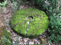
The village of Bagnols-en-Forêt, churches and chapels located at the four cardinal points, a waterfall and an oppidum are all on the agenda for this hike, which is rich in remarkable sites to discover. Beautiful forest of pine and cork oak trees. The latter provide a unique material, bark, which regenerates after each harvest.
From the old Tourrettes-sur-Loup railway line to Les Courmettes
 7.80 mi
+1,831 ft
-1,818 ft
5h 10
Moderate
Departure from Tourrettes-sur-Loup (Alpes-Maritimes)
Once you have finished visiting the medieval village of Tourrettes-sur-Loup, this hike takes you back along the old railway line, which has been converted into a road and footpath. The second part, which is physically demanding, involves climbing up to the wooded area of Courmettes, along a little-used path running alongside the cliffs, offering beautiful views of the coastline.
Monastère de l'Annonciade from Menton Bus Station
 1.80 mi
+643 ft
-640 ft
1h 25
Easy
Departure from Menton (Alpes-Maritimes)
This walk is open to all and takes place in a locationfamous for its panoramic views of Menton and the Monastery of the Annunciation. It also has heritage value.
Le Mounta cala de Menton
 5.84 mi
+1,526 ft
-1,532 ft
4h 00
Moderate
Departure from Menton (Alpes-Maritimes)
A challenging hike called Mounta cala, which means "up and down" in the Nice dialect. What better way to describe this succession of stairs, paths and roads that characterise the streets of this beautiful city with a rich past, lined with bright ochre façades.
Circular route between Menton and Sainte-Agnès
 8.60 mi
+2,569 ft
-2,566 ft
6h 10
Moderate
Departure from Menton (Alpes-Maritimes)
An unusual hike starting from the former Imperial Palace in Menton and ending in Sainte-Agnès via little-used paths, trails and roads. Magnificent views from Sainte-Agnès.
From Carros to Baou de la Gaude
 10.09 mi
+2,277 ft
-2,277 ft
6h 35
Moderate
Departure from Carros (Alpes-Maritimes)
This hike starts in the old hilltop village of Carros and takes you across the Monséguise plateau with its thousand clapiers (piles of stones) to the Baou de la Gaude, which offers exceptional views of Nice, the coastline and the Estérel.The return journey along the canal is just as interesting, overlooking the Var valley for over 2 km.
The Jas de Baylet
 7.09 mi
+1,467 ft
-1,444 ft
4h 30
Moderate
Departure from Vence (Alpes-Maritimes)
This route, in the shadow of Puy de Naouri, takes you across the Jas de Baylé plateau through an arid landscape composed of limestone rocks, which are responsible for the aridity of these places. Superb panoramic views of the coastline, the Estérel massif, the Baous and the Alps.
Le Puy de Naouri via the Croix de Malvan off-trail
 8.09 mi
+2,169 ft
-2,169 ft
5h 35
Moderate
Departure from Vence (Alpes-Maritimes)
From the Notre-Dame des Fleurs residence, the route begins by following the Malvan Route. Then, after the Medieval Chapel of Saint-Raphaël, an off-trail route takes you to the summit of the Croix de Malvan, a peak parallel to the Puy de Naouri. The latter marks the end of our route for the day.
The ridge and the edge of the Calern Plateau
 10.22 mi
+1,427 ft
-1,440 ft
5h 55
Moderate
Departure from Caussols (Alpes-Maritimes)
After learning about the work carried out by the Calern Astronomical Observatory, this hike takes you along one of the longest ridges in the region, offering magnificent panoramic views of the karst plateau, the Caussols plain, the middle country and the Mercantour.
The ridge of Mont Saint-Michel from Les Ferres
 3.11 mi
+889 ft
-902 ft
2h 10
Moderate
Departure from Les Ferres (Alpes-Maritimes)
A short hike that will take you off the beaten track through a relatively easy-to-navigate forest to the summit of Mont Saint-Michel. The summit offers a beautiful view of the village below. The return trail passes through an easy area wooded with chestnut trees.
This hike is reserved for off-trail enthusiasts.
From La Turbie to Monaco in the shadow of the Tête de Chien
 6.92 mi
+1,824 ft
-1,841 ft
4h 45
Moderate
Departure from La Turbie (Alpes-Maritimes)
An unusual hike: you wouldn't think it possible to connect La Turbie to Monaco via trails and stairways, yet this pleasant route awaits you. After the urban area of Monaco, Marquet Beach and its coastal path, we will begin the ascent to La Turbie, via steep climbs, steps and rocky paths in the shadow of the Tête de Chien.
Variation of the Siagne Gorges
 10.03 mi
+2,070 ft
-2,093 ft
6h 25
Moderate
Departure from Saint-Cézaire-sur-Siagne (Alpes-Maritimes)
After crossing the village centre, which has retained its feudal appearance, you will walk along magnificent paths, some of which are paved slanting streets. This hike is reserved for lovers of wooded areas and places steeped in history, as numerous remains bear witness to the intense activity that took place here until the early 20th century.
The Crête de Scaletta from L'Escarène
 6.97 mi
+2,454 ft
-2,438 ft
5h 20
Moderate
Departure from L'Escarène (Alpes-Maritimes)
This route crosses two villages in the hinterland, L'Escarène and Touët-de-l'Escarène, via rarely used paths. A fewancient ruins, the remains of forgotten terraces, a 360° view from the top of the Crête de la Scaletta and abundant wildlife.
This hike is for experienced hikers. The Crête de la Scaletta is off-trail and the terraces between (11) and (12) form low walls that must be crossed. Sometimes you have to use your hands on the rock.
The Bouyon and Estellier ridges
 8.64 mi
+2,379 ft
-2,379 ft
6h 05
Moderate
Departure from Bouyon (Alpes-Maritimes)
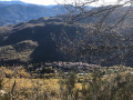
You can't start this hike without visiting this inland village. It's a journey into the past, leading to covered passageways, narrow streets, fountains, chapels and a wrought-iron bell tower in perfect condition. This magnificent hike then takes you off-trail with a view overlooking the village of Bouyon, then at Estellier, breathtaking views of the Estéron Valley with beautiful panoramas of the sea and the Alps.
A round trip from Var to Massoins
 3.02 mi
+781 ft
-810 ft
2h 05
Easy
Departure from Malaussène (Alpes-Maritimes)
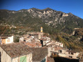
This is a very pleasant short walk with a south-facing route, which is very pleasant in winter. This century-old mule track linked the village of Massoins to Malaussène railway station, facilitating logistics and trade.
Circular South of Massoins, return via the Var
 3.05 mi
+935 ft
-955 ft
2h 15
Moderate
Departure from Malaussène (Alpes-Maritimes)
A very pleasant hike, the start of which is south-facing, which is very pleasant in winter. Once you have visited the village, the rarely used return trail ends in a rocky area, where it disappears. Take care when walking through the wooded area of thorn bushes and oak trees on the Dos de l'Éléphant ridge along the banks of the Var .
The western trails of Coursegoules
 6.82 mi
+1,870 ft
-1,873 ft
4h 45
Moderate
Departure from Coursegoules (Alpes-Maritimes)
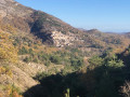
After exploring the old streets of Coursegoules and seeing its sights, this is a beautiful hike that surprises with the beauty of its trails and paths, passing through three different wooded areas of pine, oak and beech trees, sometimes winding through terraced fields offering lovely views of the Cime du Cheiron.
The summit of Castel Vieil from Roquebillière
 6.38 mi
+2,785 ft
-2,759 ft
5h 20
Difficult
Departure from Roquebillière (Alpes-Maritimes)
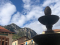
A very beautiful hike offering stunning views of the Vésubie Valley. The imposing Villette ridge overlooks the return trail. The route between points (8) and (9) bears witness to an ancestral agricultural past.
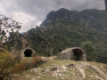
The Cruella tower circular via Les Crottés and the Breil-sur-Roya forest.
 4.92 mi
+2,280 ft
-2,297 ft
4h 15
Moderate
Departure from Breil-sur-Roya (Alpes-Maritimes)
A very beautiful hike, starting with a walk through Breil-sur-Roya, whose narrow streets with vaulted porches are steeped in history. Then, after discovering a dozen crottés (small vaulted shelters), a real local curiosity, as well as the old Cruella watchtower overlooking the village, our route crosses the main areas of biological diversity located on the left bank of the Roya, overlooking the town.
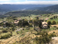
The summit of Andran via the village of Courbons
 6.24 mi
+2,480 ft
-2,457 ft
5h 00
Moderate
Departure from Digne-les-Bains (Alpes-de-Haute-Provence)
A very beautiful hike with a trail that gradually climbs, offering beautiful views of the Bléone River, which flows through Digne-les-Bains. The fortified village of Courbons proudly displays its medieval heritage. A break at the summit of Andran (altitude 1,218 m) is a must, as it offers an exceptional 360° view.
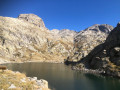
Lac Autier via the Nice refuge
 7.37 mi
+3,064 ft
-3,061 ft
6h 05
Difficult
Departure from Belvédère (Alpes-Maritimes)
A very beautiful circular in one of the wildest valleys in the Southern Alps. It offers landscapes of rare beauty in an exceptional setting. The refuge is a welcome place to take a break. Keep an eye out for wildlife: chamois, marmots (outside hibernation period) and ibex.
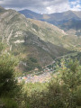
The Baisses de Géréon and Peluna from La Brigue
 10.52 mi
+2,680 ft
-2,667 ft
7h 10
Moderate
Departure from La Brigue (Alpes-Maritimes)
A pleasant, easy forest hike, ideal for getting back into walking in the spring. The descent offers beautiful views of La Brigue, the Chaberta massif and the terraces built over the centuries, evidence of an agricultural past.
Fort Charvet from the Courbaisse
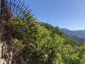 6.09 mi
+1,791 ft
-1,791 ft
4h 20
Moderate
Departure from Tournefort (Alpes-Maritimes)
Forgotten on its rocky ridge, the main attraction of this hike is a visit to Fort Charvet. But it is also an opportunity to imagine, for a few minutes, what it was like for the soldiers who were tasked with observing the Var and Tinée valleys at the end of the 18th century in order to protect against a possible Piedmontese invasion. Let us not forget that this area has been French since 1860.
Pin Pourri from Beuil
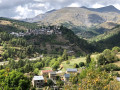 5.41 mi
+1,558 ft
-1,568 ft
3h 50
Moderate
Departure from Beuil (Alpes-Maritimes)
A very beautiful walk/hike that begins with a crossing of the beautiful Couillole valley. The Ibac de Frache is a magnificent coniferous forest. The descent through the mountain pasture areas from Pin Pourri is still used for transhumance.
The Baisse d'Ourne de Castérino
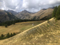 6.09 mi
+1,841 ft
-1,854 ft
4h 25
Moderate
Departure from Tende (Alpes-Maritimes)
A very pretty hike, offering beautiful views of the Alps, including Monts Bégo, Clapier and Grand Capelet, in the upper part. The return journey is along a very pleasant, unmarked, little-used wooded path. In total, there is a small elevation gain of 490 m, which will help you get back into shape.
The four fortified structures of Authion
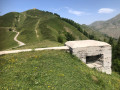 4.86 mi
+1,467 ft
-1,463 ft
3h 30
Moderate
Departure from La Bollène-Vésubie (Alpes-Maritimes)
This area with its four fortifications located at high altitude was the scene of fierce fighting, both in 1793 when the French invaded the County of Nice, and in April 1945, during one of the last battles between the German army and the Allies. These stone and cement structures, bearing multiple cannon and gunshot marks, bear witness to the violence of these final confrontations.
From Saint-Sauveur-sur-Tinée to Roure via the canal
 5.13 mi
+2,028 ft
-2,041 ft
4h 10
Moderate
Departure from Saint-Sauveur-sur-Tinée (Alpes-Maritimes)
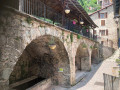
This route begins in woodland where wild strawberries grow, followed by an unusual, little-used canal, before joining the GR®5. The beautiful village of Roure is well worth a visit: original wash house, fountains, a wealth of renowned local heritage.
Garladan variant
 8.24 mi
+2,031 ft
-2,005 ft
5h 35
Moderate
Departure from Aubagne (Bouches-du-Rhône)
From the vallons de Préscator and des Piches to the Garladan summit, this hike allows you to immerse yourself in the natural world that Marcel Pagnol grew up in. This itinerary, with its many well-known sites, is above all a variation on the Garladan and is in no way intended to replace the guided tours offered by the tourist office.