


Refine your search for walks in Villecomte
Villecomte walks


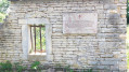
 The Creux Bleu walk in Villecomte
 Visorando Member
 5.69 mi
 +699 ft
 -699 ft
 3h 15
 Easy
 Departure from Villecomte (Côte-d'Or)
This route is closed to walkers at weekends from October to March.
Le Creux Bleu is the resurgence (karstic formation) of the Francheville stream, which disappears a few kilometres upstream and is situated 20 metres from the River Ignon in the centre of the village.
Bois de la Brosse, starting from Dienay
7.76 mi
+899 ft
-899 ft
4h 20
 Moderate
Departure from Diénay (Côte-d'Or)
A pleasant walk through the Bois de la Brosse, starting from the wash house in the centre of Dienay.
Around Saulx-le-Duc
 5.67 mi
+564 ft
-568 ft
3h 05
Easy
Departure from Saulx-le-Duc (Côte-d'Or)
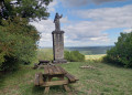
A short, easy and very pleasant hike leading to the Butte Saint-Siméon in Saulx-le-Duc, the highest point offering a beautiful view of the Ignon valley. No technical difficulty, but the climb to the Butte Saint-Siméon is steady.
The Creux Bleu Spring, starting from Chaignay
 9.70 mi
+925 ft
-896 ft
5h 15
Moderate
Departure from Chaignay (Côte-d'Or)
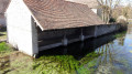
This circular walk allows you to discover or revisit this magnificent resurgence with its bluish hue. This spring flows into the Ignon at the site, which has been developed into a small park with picnic tables, a children’s playground and a wash house.
Villecomte is also steeped in history, notably with the Surcouf group’s maquis. A commemorative plaque on the town hall, next to the resurgence, marks these historical events.
The Chaugey Well in Chaignay
8.94 mi
+558 ft
-581 ft
4h 35
Moderate
Departure from Chaignay (Côte-d'Or)
A circular route around the village of Chaignay, taking in the magnificent ‘Puits de Chaugey’ washhouse (19th century). Also on this route is the Médepain Fountain with its copse, which serves as a bird sanctuary (Bird Protection League). The paths through the woods and the Laverottes forest are also very pleasant.
The Meuley Circuit in Is-sur-Tille
 Tourist office
 4.46 mi
+325 ft
-328 ft
2h 20
Easy
Departure from Is-sur-Tille (Côte-d'Or)
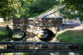
This route, partly through woodland, will allow you to discover the leat des Courtines, the market halls, the medieval defensive ditch and a viewpoint overlooking Mont de Marcilly
Hunting days: Sundays and public holidays. Côte-d’Or PDIPR route.
Les Mauritaines, departing from Is-sur-Tille
 6.71 mi
+574 ft
-571 ft
3h 35
Moderate
Departure from Is-sur-Tille (Côte-d'Or)
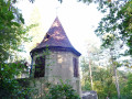
This forest route will allow you to discover the limestone plateau overlooking Is-sur-Tille, a wayside cross, a spring: the Marcevau fountain, and the small bell tower. The route, proposed by the Tille and Ignon Valleys Tourist Office, is listed in the Côte-d’Or PDIPR.
PDIPR: Departmental Plan for Walking and Hiking Routes.
Hunting days: Sundays and public holidays.
La Combe Marey, starting from Is-sur-Tille
 5.24 mi
+486 ft
-472 ft
2h 50
Easy
Departure from Is-sur-Tille (Côte-d'Or)
As you walk along the Combe Marey trail, some of Is-sur-Tille’s natural treasures are revealed to you. They lie hidden in the woods… This route will allow you to discover the limestone plateau overlooking Is-sur-Tille, the old Montchevreuil house and the small bell tower. Route recommended by the Tille and Ignon Valleys Tourist Office. Official route listed in the Côte-d’Or PDIPR.
Hunting days: Sundays and public holidays.
The Bredin towers at Saussy and Vernot
 13.56 mi
+1,818 ft
-1,837 ft
7h 50
 Difficult
Departure from Saussy (Côte-d'Or)
Circular route around Saussy, winding from valley to valley, which partly follows theGR® 7 and enters the regional nature reserve as well as the Is-sur-Tille State Forest.
It offers the chance to discover the curious history of the Bredin towers, designed to supply water to the village and the castle.
Also worth seeing is the magnificent umbrella-shaped roof structure of the riding school, built in the 19th century by the same architect (please book an appointment with the ASATS association on 0785742798 or 0786832079)
Saussy Tower and the Combe Quinquendolle viewpoint
4.07 mi
+177 ft
-174 ft
2h 00
Easy
Departure from Saussy (Côte-d'Or)
This family-friendly walk, with gentle gradients, allows you to admire the following along the way:- the Saussy wind tower, which was used to pump water from the spring situated below the village up to the village itself,- Saussy Castle and its riding arena, which is now used as a riding school, - the lovely Combe Quinquendolle viewpoint.
The best time to take this walk is in autumn or spring.
Between Saussy and Vernot
5.17 mi
+735 ft
-735 ft
3h 00
Easy
Departure from Saussy (Côte-d'Or)
A lovely, shaded walk starting from Saussy, with easy parking near the cemetery.
Beautiful views over the Is-sur-Tille State Forest.
The tower, the valleys and the forests at Saussy
6.17 mi
+479 ft
-472 ft
3h 15
Easy
Departure from Saussy (Côte-d'Or)
A short and easy hike to discover the valleys around Saussy, including the very wild Combe Quinquendolle, a nature reserve. This hike only uses public paths and forests!
In the footsteps of Gargantua around Marcilly-sur-Tille
4.73 mi
+174 ft
-180 ft
2h 20
Easy
Departure from Marcilly-sur-Tille (Côte-d'Or)
A short, easy walk around the village of Marcilly-sur-Tille, which is situated on the River Ignon and not on the River Tille as its name suggests, passing by the Étang de Venarde where you can see many birds (depending on the season). You’ll walk along the River Ignon, with its wash house and old mill, and reach Mont de Marcilly, where you’ll enjoy a magnificent view over the Tille Valley.
Springs and retting pits starting from Poiseul-lès-Saulx
 6.68 mi
+860 ft
-866 ft
3h 50
Moderate
Departure from Poiseul-lès-Saulx (Côte-d'Or)
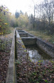
This forest route takes you to the Four à Pain refuge, the Puits du Bois, the Ormette spring, the Vignottes spring and retting pits, and the Champignolles wash house and retting pits. Route proposed by the Tille and Ignon Valleys Tourist Office. Official route registered with the Côte-d'Or PDIPR (public network of footpaths and trails). Hunting days: Saturday, Sunday, and public holidays. PDIPR route in the Côte-d'Or.
In pursuit of the mares of Moloy and Courtivron
9.02 mi
+715 ft
-735 ft
4h 45
Moderate
Departure from Moloy (Côte-d'Or)
Through the valleys and forests around Moloy, this is a long summer walk, often in the shade, offering the chance to explore the valleys and springs of the Ignon Valley. The route passes by the two ‘Juments’ – Moloy and Courtivron – which are the two farms on the limestone plateaus above Moloy.
In the woods of Savigny-le-Sec
 6.35 mi
+554 ft
-522 ft
3h 25
Moderate
Departure from Savigny-le-Sec (Côte-d'Or)
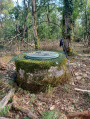
A pleasant walk through the woods of Savigny-le-Sec in search of the Puits de l’Ermitage.
The Puits de l’Ermitage is located at GPS coordinates 47.455 N 5.0064 E
In the forest of Crécey-sur-Tille via the Vornay valley
 4.41 mi
+417 ft
-410 ft
2h 25
Easy
Departure from Crécey-sur-Tille (Côte-d'Or)
This route will take you to Crécey-sur-Tille Castle and its dovecote, wash houses, wayside crosses and the Church of Notre-Dame de la Nativité. This walk will also take you through the forest via the Combe Vornay to the north-east of the village.
Les Grandes Charrières via the valleys at Savigny-le-Sec
6.12 mi
+509 ft
-495 ft
3h 15
Moderate
Departure from Savigny-le-Sec (Côte-d'Or)
A walk through the woods, known as the Grandes Charrières, taking in several valleys, including notably the Combe Froidevau and the Combe Pensa.
Route from Montaigu to Crécey-sur-Tille
 3.65 mi
+449 ft
-436 ft
2h 05
Easy
Departure from Crécey-sur-Tille (Côte-d'Or)
At the gateway to the Tille Valley, Le Montaigu is a hamlet situated deep within the forest at Crécey-sur-Tille. This route will take you past the castle and its dovecote (visible from the road), the wash houses, the church and the natural heritage found in the forest. This is the ideal spot to enjoy a peaceful walk.
Hunting days: Saturdays, Sundays and public holidays. Côte-d’Or PDIPR route.
La Combe Henri and Montchevreuil, starting from Villey-sur-Tille
12.43 mi
+663 ft
-656 ft
6h 20
Difficult
Departure from Villey-sur-Tille (Côte-d'Or)
A walk through plains and wooded areas in the north-western communes of Is-sur-Tille. Passing through little-known villages with a few points of interest (wash houses, fountains, churches).
A circular starting from Gemeaux, a picturesque village.
 5.58 mi
+141 ft
-131 ft
2h 40
Easy
Departure from Gemeaux (Côte-d'Or)
Circular route around and through Gemeaux to discover this picturesque little village in the Côte d'Or, rich in architectural heritage: its market halls, medieval house, church, castle, fountain and wash house.
Wind and stars as you set off from Crécey-sur-Tille
 7.99 mi
+499 ft
-512 ft
4h 05
Moderate
Departure from Crécey-sur-Tille (Côte-d'Or)
From Crécey-sur-Tille, a circular route that takes you through the Tille Valley, the deciduous forests with their criss-crossing paths, and past the wind turbines that dominate the plateau. A route that’s mostly in the shade, but with a sunnier return journey along the Tille Valley.
Circular route in the Moloy National Forest starting from L'Abergement.
 6.49 mi
+643 ft
-656 ft
3h 35
Moderate
Departure from Moloy (Côte-d'Or)
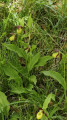
Walk in the Moloy National Forest. This walk will take you along the Bellefontaine Forest Road, past the summits and through numerous valleys. The Combe de Bellefontaine is home to a site famous for its wild orchids, the Lady’s Slipper orchids.
"Legend has it that, pursued by a satyr, Venus lost her clogs in the forest whilst running to escape him. Ever since that day, lady’s slippers have sprung up every spring."André Beuchot
Source du Bué in Pichanges
 5.07 mi
+148 ft
-161 ft
2h 25
Easy
Departure from Pichanges (Côte-d'Or)
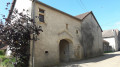
This circular route will take you to the Source du Bué with its curious legend. You can also explore the village, its chapel and its equally fascinating history, the Templars’ house, the manor house and the fortified church.In spring, you can see wild orchids in bloom.
Balcons du Suzon, part 3
 4.78 mi
+679 ft
-676 ft
2h 45
Easy
Departure from Val-Suzon (Côte-d'Or)
Part 3 of the “Les Balcons du Suzon” trail
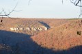
A lovely, gentle trail walk through light woodland and along the cliff face.
See notes in the practical information section.
Tour of the Fontaine des Essarts and the wash houses at Curtil-Saint-Seine
3.33 mi
+397 ft
-397 ft
1h 55
Easy
Departure from Curtil-Saint-Seine (Côte-d'Or)
This lovely walk through woods and the village will take you to the magnificent site of the Fontaine des Essarts, with its spring, its wash house, its tuff waterfalls, and its two basins which were used to retting the hemp – that is, to soften the fibres by soaking them. You’ll also pass by the village washhouse and the pretty church. And finally, you’ll be able to admire some beautiful beech woods.
Hydraulic structures and sinkholes around Curtil-Saint-Seine
11.82 mi
+1,355 ft
-1,355 ft
6h 35
Moderate
Departure from Curtil-Saint-Seine (Côte-d'Or)
A testament to man’s ingenuity in constructing hydraulic works and his propensity to explore the depths.
Les Balcons du Suzon, part 2
 4.89 mi
+745 ft
-738 ft
2h 55
Easy
Departure from Messigny-et-Vantoux (Côte-d'Or)
This is another section (2) of the marked trail "Les Balcons du Suzon". It follows on from the first route starting from Messigny-et-Vantoux towards Sainte-Foy.
Part of the route is through woods and hillsides with views of the Val Suzon.
The walking time depends on the hiker. The time indicated was calculated based on half walking and half trail running.
From the start in Sainte Foy: 1 hour 30 minutes.
From Sainte Foy back via theGR®7: 30 minutes (jogging pace).
Messigny Forest via Sainte-Anne
5.10 mi
+387 ft
-381 ft
2h 40
Easy
Departure from Messigny-et-Vantoux (Côte-d'Or)
Explore the Messigny Forest to Sainte-Anne. Return via the BMX site to the village. A route with very little elevation gain. This hike through the forest is very pleasant in the summer, with lily of the valley in May and orchids and foxgloves in June.
Around Val Suzon
7.21 mi
+748 ft
-755 ft
4h 00
Moderate
Departure from Étaules (Côte-d'Or) (Côte-d'Or)
Exploring the Val Suzon site above Sainte-Foy.
The Balcons du Suzon are easy to access from the Maison Forestière du Roy Jeannot.
 5.40 mi
+423 ft
-427 ft
2h 50
Easy
Departure from Étaules (Côte-d'Or) (Côte-d'Or)
For an almost complete tour of the Suzon balconies, on the right bank, starting from the Maison Forestière du Roy Jeannot. An easy, not very long route with little elevation gain, allowing you to admire the most beautiful panoramas of this part of the Val Suzon.
Circular route around Flacey
 5.81 mi
+236 ft
-230 ft
2h 55
Moderate
Departure from Flacey (Côte-d'Or)
A pretty little village, with a stream and a mix of forest paths and open stretches. You can cover fewer kilometres by, for example, avoiding the loop around the grassy area.
This route is described for Nordic walking but is also suitable for hiking.