Springs and retting pits starting from Poiseul-lès-Saulx

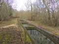
This forest route takes you to the Four à Pain refuge, the Puits du Bois, the Ormette spring, the Vignottes spring and retting pits, and the Champignolles wash house and retting pits. Route proposed by the Tille and Ignon Valleys Tourist Office. Official route registered with the Côte-d'Or PDIPR (public network of footpaths and trails). Hunting days: Saturday, Sunday, and public holidays. PDIPR route in the Côte-d'Or.

Details

4412877
Creation:
Last update:
Last review:
  • Walking
    Activity: Walking
  • ↔
    Distance: 6.68 mi
  • ◔
    Average duration: 3h 50 
  • ▲
    Difficulty: Moderate

  • ⚐
    Back to start: Yes
  • ↗
    Ascent: + 860 ft
  • ↘
    Descent: - 866 ft

  • ▲
    Highest point: 1,575 ft
  • ▼
    Lowest point: 1,201 ft

Photos

Description of the walk

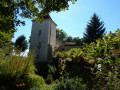
Park near the Church of the Nativity in Poiseul-lès-Saulx.

(S/E) Take theGR®7marked in white and red. Cross the D112 and continue opposite on theGR®. Shortly afterwards, enter the woods and follow a gentle descent to reach the Combe de Vaubois.

(1) Turn left and begin an easy climb, passing close to the Source des Vaubois. Continue to reach the junction of the D112 and 120f roads.

(2) Cross the departmental road and continue on theGR® to the Fontaine de Champignolles. Continue to re-enter the forest and reach a crossroads of trails.

(3) Leave theGR®7and take the yellow-marked path on the left, which is the Sources et Rouissoirs des Vignottes trail. Begin another gentle climb on a straight path to reach the top of the trail junction.

(4) Turn left, then quickly right after 200 metres to descend into the Combe des Vignottes. Pass in front of the Vignottes spring, continue on and reach the bottom of the combe.

(5) Continue left on a slight incline towards the Grande Combe. You will reach the Combe de l'Ormette crossroads.

(6) Turn left into this valley and pass in front of the Source de l'Ormette. Continue uphill, then begin a slight descent. Stay on this path, ignoring all the paths branching off to the right and left. Then join the Puits du Bois path.

(7) Turn right, descend and arrive at the Pothenière track junction. Turn left and head towards Puits du Bois.

(8) Climb back up to the village to the Four à Pain, theGR®7refuge, and continue on to quickly reach the car park of the Church of the Nativity (S/E).


Waypoints

  1. S/E : mi 0 - alt. 1,401 ft - Car park - Église de la Nativité de Notre-Dame (Poiseul-lès-Saulx)
  2. 1 : mi 0.98 - alt. 1,289 ft - Combe de Vaubois
  3. 2 : mi 2.08 - alt. 1,493 ft - Crossing the D112
  4. 3 : mi 2.64 - alt. 1,280 ft - GR-PR crossroads
  5. 4 : mi 3.16 - alt. 1,506 ft - Trail junction
  6. 5 : mi 4.19 - alt. 1,201 ft - Bottom of the Combe des Vignottes
  7. 6 : mi 4.73 - alt. 1,257 ft - Combe de l'Ormette
  8. 7 : mi 5.88 - alt. 1,506 ft - Crossroads of the Puits du Bois trail
  9. 8 : mi 6.41 - alt. 1,362 ft - Puits du Bois
  10. S/E : mi 6.68 - alt. 1,401 ft - Car park - Église de la Nativité de Notre-Dame (Poiseul-lès-Saulx)

Notes

Worth a visit

After (2) Fontaine de Champignolles: picnic area with a 400 m trail suitable for people with reduced mobility. Information panel on hemp processing.
(8) Le Puits du Bois: said to be the origin of the village's creation.

Always be cautious and plan ahead when you're outdoors. Visorando and the author of this route cannot be held responsible for any accidents occurring on this route.

The GR® and PR® markings are the intellectual property of the Fédération Française de Randonnée Pédestre.

Reviews and comments

4.6 / 5
Based on 6 reviews

Reliability of the description
5 / 5
Ease of following the route
4.2 / 5
Route interest
4.7 / 5
philjacque
philjacque

Overall rating : 4.7 / 5

Date of your route : Jul 18, 2024
Reliability of the description : ★★★★★ Very good
Ease of following the route : ★★★★☆ Good
Route interest : ★★★★★ Very good
Very busy route : No

A very interesting route from a historical and hydrological point of view, both in terms of water use and its importance for the environment and biodiversity. Therefore, it is best to do this route outside of periods of severe drought, as the springs suffer...

Machine-translated

Marc21
Marc21

Overall rating : 4.3 / 5

Date of your route : Jun 03, 2024
Reliability of the description : ★★★★★ Very good
Ease of following the route : ★★★★☆ Good
Route interest : ★★★★☆ Good
Very busy route : No

Nice walk

Machine-translated

bouboumi
bouboumi

Overall rating : 4.7 / 5

Date of your route : Jun 19, 2023
Reliability of the description : ★★★★★ Very good
Ease of following the route : ★★★★☆ Good
Route interest : ★★★★★ Very good
Very busy route : No

A lovely forest walk with beautiful discoveries, very well signposted.

Machine-translated

bouboumi
bouboumi

A beautiful, mostly woodland route, pleasant, with some lovely discoveries.
Very well signposted.

Machine-translated

jcehenne
jcehenne

Overall rating : 4.7 / 5

Date of your route : May 26, 2022
Reliability of the description : ★★★★★ Very good
Ease of following the route : ★★★★★ Very good
Route interest : ★★★★☆ Good
Very busy route : No

A beautiful route marked in yellow, passing several wind turbine installation sites.
We made a detour to discover the Trou d'Avelanges.

Machine-translated

montagne06
montagne06

Overall rating : 4.3 / 5

Date of your route : Aug 24, 2021
Reliability of the description : ★★★★★ Very good
Ease of following the route : ★★★☆☆ Average
Route interest : ★★★★★ Very good
Very busy route : Yes

A beautiful, shaded forest trail with extremely interesting cultural points of interest. We learnt a lot about how hemp is processed after harvesting. At the end of the hike, there is a gentle but long climb, but nothing too difficult. We also discovered a magnificent well and, at the end of the trail, a magnificent bread oven.
Perhaps best avoided during hunting season. But highly recommended.

Machine-translated

saint-apollinaire
saint-apollinaire
• Edited:

Overall rating : 5 / 5

Date of your route : Mar 24, 2021
Reliability of the description : ★★★★★ Very good
Ease of following the route : ★★★★★ Very good
Route interest : ★★★★★ Very good
Very busy route : No

Hello,

A beautiful hike, mostly through the forest in sunny weather.
Recommended for a cool walk in the forest during summer.
The climbs up the valleys are long and a little steep but not difficult.

A wonderful introduction to the technique of hemp cultivation, with the retting pits (the Champignole retting pit is very well presented).
The springs flow well and the paths are passable.

The village of Poiseuil-les-Saulx is typical of a Burgundy village, with beautiful stone buildings and a lovely (renovated) church.

Thank you for this hike.

Machine-translated

Other walks in the area

For more walks, use our search engine .

The GPS track and description are the property of this route's author. Please do not copy them without permission.