


Refine your search for walks in Verfeil (Tarn-et-Garonne)
Verfeil (Tarn-et-Garonne) walks


 Verfeil-sur-Seye - Former Abbey of Beaulieu-en-Rouergue
 Visorando Member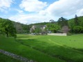
 12.25 mi
 +1,752 ft
 -1,739 ft
 7h 10
7h 10
 Difficult
 Departure from Verfeil (Tarn-et-Garonne) (Tarn-et-Garonne)
This countryside hike starts in the small village of Verfeil-sur-Seye and takes you through woods, shady valleys and plateaus to the former Cistercian abbey of Beaulieu-en-Rouergue, now a contemporary art centre, located in a truly green setting. This makes up for the short off-trail section, which requires attention, a good sense of direction and... strong legs.
Jouyre Valley
 4.07 mi
+617 ft
-636 ft
2h 25
4.07 mi
+617 ft
-636 ft
2h 25
 Easy
Departure from Najac (Aveyron)
Easy
Departure from Najac (Aveyron)
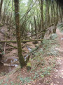
Hike in different environments with the damp valley floor and drier hillsides, discovering old mills, an old quarry and a cave.
From the Aveyron to Bonnan via the Causses
12.23 mi
+2,467 ft
-2,474 ft
7h 45
Difficult
Departure from Montrosier (Tarn)
This hike is a longer version of the hike. The start and finish are the same (points 1 to 7 and 9 to 14 of the short route).
A rugged and fairly challenging hike through magnificent landscapes and natural surroundings.
From the heights of Bonnan to the village of Roussayrolles
8.83 mi
+1,657 ft
-1,663 ft
5h 30
 Moderate
Departure from Montrosier (Tarn)
Moderate
Departure from Montrosier (Tarn)
This is a little-used route, reserved for lovers of unspoilt nature. They will walk only on footpaths, through varied landscapes.There are many different viewpoints to discover, including the Bonnan Valley, the Lexos rock, the petrified waterfall and the tumulus-dolmen. Climbs and descents along the cliff edge or through the undergrowth, and scrambling up the Bonnan Stream, will delight the more adventurous.
La Gresinhóla
 10.99 mi
+1,677 ft
-1,673 ft
6h 30
Moderate
Departure from Milhars (Tarn)
10.99 mi
+1,677 ft
-1,673 ft
6h 30
Moderate
Departure from Milhars (Tarn)
It is a long circular route connecting Milhars to Roussayrolles, passing behind the Château de la Prune.
Hikers will pass through valleys and hilltops amongst the peaceful little villages of the Cordais plateau.
Old stone buildings, a decorated church and local heritage sites punctuate a wooded, little-used path.
Bonnan, another side of the Bonne Vallée
 7.48 mi
+915 ft
-915 ft
4h 15
Moderate
Departure from Milhars (Tarn)
7.48 mi
+915 ft
-915 ft
4h 15
Moderate
Departure from Milhars (Tarn)
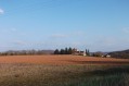
A little-used trail to discover a wild part of the Bonnan Valley. Wide tracks and pretty little paths running along both sides of the Bonnan stream offer a different view of the valley.
De la Vallée de Bonnan aux Moulins de la Laussière
 11.25 mi
+1,716 ft
-1,693 ft
6h 40
Difficult
Departure from Milhars (Tarn)
11.25 mi
+1,716 ft
-1,693 ft
6h 40
Difficult
Departure from Milhars (Tarn)
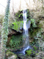
Voici une très belle randonnée alternant des moments d'immersion dans une nature sauvage et des moments culturels de haut intérêt.
Passé et présent se conjuguent avec les ruines, les fresques et la céramique moderne. Des découvertes qui raviront les randonneurs amateurs d'histoire et de l'art.
Bonnan Valley Trail
 7.26 mi
+1,122 ft
-1,096 ft
4h 20
Moderate
Departure from Milhars (Tarn)
7.26 mi
+1,122 ft
-1,096 ft
4h 20
Moderate
Departure from Milhars (Tarn)
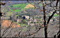
Landscapes of cliffs and valleys in the Bonnan valley and the Grézelles forest. This route only uses paths and tracks in the middle of unspoilt nature.
This is the classic version of the Vallée de Bonnan trail, as described in the Tarn à pied guidebook and on the FFRP information sheets.
Around Milhars
 4.56 mi
+686 ft
-676 ft
2h 40
Moderate
Departure from Milhars (Tarn)
4.56 mi
+686 ft
-676 ft
2h 40
Moderate
Departure from Milhars (Tarn)
A fairly short, unpretentious hike requiring a good sense of direction. The route is mostly along forest tracks or paths but has no signposts. A compass and map are essential; a GPS is recommended. The terrain is quite varied and you won’t get bored at any point.
Causse de Mordagne and Château de Cas
 2.56 mi
+404 ft
-410 ft
1h 30
Easy
Departure from Espinas (Tarn-et-Garonne)
2.56 mi
+404 ft
-410 ft
1h 30
Easy
Departure from Espinas (Tarn-et-Garonne)
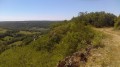
Walk on the limestone plateau of the hamlet of Mordagne with views of the Bonnette valley.
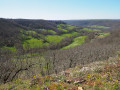
Château de Cas in Espinas
 9.84 mi
+1,168 ft
-1,168 ft
5h 35
Moderate
Departure from Espinas (Tarn-et-Garonne)
9.84 mi
+1,168 ft
-1,168 ft
5h 35
Moderate
Departure from Espinas (Tarn-et-Garonne)
In this beautiful region of Rouergue, near Saint-Antonin, Caylus and the Bonnette valley, we walk along paths and through valleys, passing mills, beautiful Rouergate buildings, chapels and wash houses.
The Ségala in the Tarn, the Candour and the Viaur
7.60 mi
+928 ft
-948 ft
4h 20
Moderate
Departure from Laguépie (Tarn-et-Garonne)
This walk starts at the Place du Foirail in Laguépie and continues through the village of Saint-Martin-Laguépie, crossing the bridge over the Viaur and following the Ruisseau de Bonnaval to reach the Saint-Pierre plateau, before descending to the Ruisseau de Candour and crossing it. This section follows theGRP® des Gorges du Viaur exactly. The path then heads towards the Viaur, first along the right bank and then the left bank of the Candour, before joining the D9. The walk then climbs to the summit of the Saint-Eugène peninsula to reach the Viaur and returns to Laguépie along the left bank of the river.
Going up the Aveyron river
 14.04 mi
+1,368 ft
-1,365 ft
7h 40
Difficult
Departure from Laguépie (Tarn-et-Garonne)
14.04 mi
+1,368 ft
-1,365 ft
7h 40
Difficult
Departure from Laguépie (Tarn-et-Garonne)
A long circular route that follows the course of the Aveyron river via theGR®36and gently returns to Laguépie from the plateau dotted with hamlets and livestock farms.
Going up the River Aveyron from Laguépie
9.19 mi
+1,033 ft
-1,007 ft
5h 10
Moderate
Departure from Laguépie (Tarn-et-Garonne)
Follow theGR® 36 trail up the Aveyron river, then take the small country roads back to the village of Laguépie.
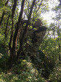
Le Rocher Tremblant
 5.29 mi
+659 ft
-676 ft
3h 00
Easy
Departure from Espinas (Tarn-et-Garonne)
5.29 mi
+659 ft
-676 ft
3h 00
Easy
Departure from Espinas (Tarn-et-Garonne)
Walk in the Bonnette valley between fields and forest with views of the Château de Cas and a strange rock formation known as Rocher Tremblant. You will pass two mills that have been converted into homes, a restored old church, a restored old bread oven and other small stone structures typical of our region (low walls, cazelles, etc.).
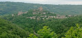
Aveyron Valley in Najac
 7.07 mi
+889 ft
-896 ft
4h 00
Moderate
Departure from Najac (Aveyron)
7.07 mi
+889 ft
-896 ft
4h 00
Moderate
Departure from Najac (Aveyron)
An excursion along the banks of the Aveyron river, dominated by the medieval village of Najac.
Below the village, the route is mostly shaded and runs peacefully along the river.
Najac from the VVF, walking along the Aveyron
4.06 mi
+958 ft
-965 ft
2h 40
Moderate
Departure from Najac (Aveyron)
A lovely walk of about 2 hours, with a shortcut to descend directly to the Aveyron from the VVF via a poorly maintained path – which is why I’d rate the difficulty as moderate – but we really enjoyed this section through the vegetation. The rest is easy and magnificent, whether along the banks of the Aveyron or through the village of Najac, of course.
Through the hamlets of Béteille and Belpech to Saint-André-de-Najac
 3.96 mi
+443 ft
-449 ft
2h 10
Easy
Departure from Saint-André-de-Najac (Aveyron)
3.96 mi
+443 ft
-449 ft
2h 10
Easy
Departure from Saint-André-de-Najac (Aveyron)
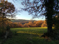
A lovely hike starting from the hamlet of Béteille in Saint-André-de-Najac and heading towards the hamlet of Belpech, passing through country lanes and forests, with the River Aveyron flowing gently in the distance. Beautiful panoramic views and, just after passing through the hamlet of Béteille, views of the Château de Najac.
Hiking trail no. 8
From Roussayrolles to the Laussière via Grézelles and the Fourcou dolmen
8.73 mi
+1,394 ft
-1,394 ft
5h 15
Moderate
Departure from Roussayrolles (Tarn)
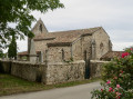
This circular route takes in the two streams near Roussayrolles and forms a varied route, both in terms of elevation and landscape. The Bonnan and the lower reaches of the Grézelles Forest run alongside the mills of the Laussière, much to the delight of walkers.
Roussayrolles
 8.23 mi
+1,634 ft
-1,604 ft
5h 10
Moderate
Departure from Roussayrolles (Tarn)
8.23 mi
+1,634 ft
-1,604 ft
5h 10
Moderate
Departure from Roussayrolles (Tarn)
Roussayrolles through the magical forest and the old mills...
The Mills of Laussière
 6.97 mi
+1,280 ft
-1,266 ft
4h 20
Moderate
Departure from Roussayrolles (Tarn)
6.97 mi
+1,280 ft
-1,266 ft
4h 20
Moderate
Departure from Roussayrolles (Tarn)
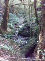
A route through the Cordais region with small villages and beautiful churches to discover, beautiful views all along the way and, to finish this circular route in style, a touch of magic with the Laussière valley and its ruined mills.
From Roussayrolles to the five mills of Laussière
4.63 mi
+919 ft
-912 ft
2h 55
Easy
Departure from Roussayrolles (Tarn)
Circular loop west of Roussayrolles, requiring some effort but allowing you to discover the remarkable ruins of La Laussière. In wet weather, the section of the mills is full of waterfalls.
La Côte Gelée and Pech d'Ablanc
 7.50 mi
+860 ft
-833 ft
4h 10
Moderate
Departure from Caylus (Tarn-et-Garonne)
7.50 mi
+860 ft
-833 ft
4h 10
Moderate
Departure from Caylus (Tarn-et-Garonne)
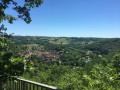
A circuit around Caylus rich in heritage. An ancient Roman road, stone crosses, dolmens... and continuing 2-3 km at the end, a detour to the petrifying waterfall (not included in the route described below)
Thanks to the website tourisme-tarnetgaronne.fr
Caylus, Notre-Dame de Livron and Notre-Dame des Grâces
 15.34 mi
+1,752 ft
-1,752 ft
8h 35
Moderate
Departure from Caylus (Tarn-et-Garonne)
15.34 mi
+1,752 ft
-1,752 ft
8h 35
Moderate
Departure from Caylus (Tarn-et-Garonne)
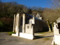
This hike allows you to discover a rich architectural heritage and beautiful landscapes near Caylus, in Tarn-et-Garonne. The return journey is on tarmac, as there is no alternative, but the road is pleasant and quiet, except for the last kilometre.
Between Causse and Ségala
11.43 mi
+1,266 ft
-1,243 ft
6h 20
Moderate
Departure from Castanet (Tarn-et-Garonne) (Tarn-et-Garonne)
Hike through agricultural land, alternating between the stony paths of the Causse plateau to the west and the chestnut forests typical of the Ségala region to the south-east.
Remarkable rural heritage punctuates the trail: cazelles and garriottes, stone bread ovens, wash houses and Quercy houses with conical roofs.
This route is marked along its entire length: aPR®: yellow markings (namedPR®2on the wooden signs) which sometimes follows theGRP® route: red and yellow markings.
Valleys, hills and groves of Mouzieys-Panens
 7.03 mi
+745 ft
-761 ft
3h 55
Moderate
Departure from Mouzieys-Panens (Tarn)
7.03 mi
+745 ft
-761 ft
3h 55
Moderate
Departure from Mouzieys-Panens (Tarn)
Variation on the "From Bournazel to Mouzieys-Panens" route
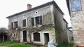
This circular route goes from roads to trails, with ups and downs, through the Cordes countryside with numerous viewpoints on the north side of Cordes-sur-Ciel. It includes different sections of trails and, although the route follows parts of otherPR® orGR®36trails, a GPS is recommended as the route includes unmarked sections.
From Bournazel to Mouzieys-Panens
 7.78 mi
+531 ft
-545 ft
4h 00
Moderate
Departure from Bournazel (Tarn) (Tarn)
7.78 mi
+531 ft
-545 ft
4h 00
Moderate
Departure from Bournazel (Tarn) (Tarn)
This route takes you off the beaten track and marked trails, offering numerous viewpoints over the north side of Cordes-sur-Ciel. The path alternates between small hills and valleys. Quiet footpaths make you forget the sections of road you encounter.
A GPS is recommended as the route is largely unmarked. The markings you may see are from otherPR® orGR®36trails.