Around the Grézelles Forest via Roussayrolles

Numerous routes start from, or pass through, Milhars and Roussayrolles.
This circular route combines part of the classic Bonnan Valley route with an extension to Roussayrolles, where you can stop for a break and visit its little church, decorated with frescoes by the famous fresco artist Nicolaï Greschny, who considered the Tarn his second home.

Details

9506610
Creation:
Last update:
Last review:
  • Walking
    Activity: Walking
  • ↔
    Distance: 8.27 mi
  • ◔
    Average duration: 4h 45 
  • ▲
    Difficulty: Moderate

  • ⚐
    Back to start: Yes
  • ↗
    Ascent: + 1,096 ft
  • ↘
    Descent: - 1,073 ft

  • ▲
    Highest point: 1,509 ft
  • ▼
    Lowest point: 453 ft

Description of the walk

Park in the large car park at the Milhars village hall.
Almost the entire route is signposted in yellow.
The markings alternate between those of the PR® de la Gresinhòla and those of the PR® de la Vallée de Bonnan; occasionally, some sections are shared.
Part of the GRP® Cordes-Penne-Coustous, marked in red and yellow, will be followed halfway along the route, around Roussayrolles.

(S/E) On the D600, with your back to the village hall, turn left towards the Place de la Mairie.
Opposite the community café, cross the road and head up to the right.

(1) This uphill street passes two wayside crosses. At the second white wrought-iron cross in Bournazel, continue straight ahead, following the sign for the Bonnan Discovery Trail. After the bend, the road descends and approaches the stream.

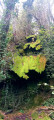
(2) Leave the road and head straight on along the wide dirt track. You’ll reach the edge of a second bridge. Turn right to cross the bridge. Just past the bend, note a huge, centuries-old elm tree on the left. Continue along the Bonnan Stream, which remains on your left. You’ll reach the foot of the petrified waterfall.

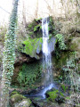
(3) Tuff waterfall. In summer, the waterfall is dry, but in winter the spring flows abundantly or becomes covered in stalactites when it freezes. It is possible to walk up to its source. After exploring, continue on to the third bridge.
Cross back over to the other side of the stream. At the signposts indicating the trails, follow the PR® Vallée de Bonnan by heading right. Continue walking, on almost level ground, to the ruins of the Madeleine Sarcophagus Chapel. Make your way to the final ford crossing the Ruisseau de Bonnan.

(4) Cross the stream one last time. Follow the yellow-marked path, which winds its way through the woods. Walk alongside a cattle enclosure, then through woodland and pasture. You’ll come out onto a wide track suitable for vehicles, at an elevation of 367.

(5) Turn left. Pass a tree on your right that has knocked down a small signpost. You’ll come to the entrance to a meadow with a large shed on your right. Continue straight ahead until you reach the Clauzels access road.

(6) Cross the road and take the dirt and stony track straight ahead, making sure to close the gate properly behind you. Walk alongside the Touron, keeping an eye out for the farm’s livestock. At the Y-junction, with a cross at the corner, continue to the right. On the tarmac, head left towards the church and cemetery at Roussayrolles.

(7) Walk past the town hall and continue along the road, ignoring a path branching off to the left. Pass another picnic table and a wayside cross. Walk past a house and, just after it, turn left onto the wide dirt track, the GRP® Cordes-Penne-Coustous.
You’ll come to a reservoir and the Fontaine Mère de Dieu.

(8) Cross a ford over a buried pipe. It is near this point that the Ruisseau de Bonnan has its source. Climb a short, grassy slope. The GRP® continues gently until it reaches the Route des Fontanelles. Further on, after a bend to the left, you’ll cross the D9.

(9) Leave theGRP® by following the road to the left. Pass Grézelles Hautes. Reach Grézelles Basses. Walk a few steps past the access lane to the farm of the same name.

(10) Turn onto the path branching off to the left. Walk downhill to the bend in the D9.

(11) Cross the road and continue descending, following the path opposite. Join the D9 near the Les Grailhettes campsite.

(12) Walk a few dozen metres to the right, then, at the Fork in the road, take the left-hand branch to follow the Ruelle de Carguemech. Continue downhill to the large stone cross at Alric.

(1) Turn right. At the corner by the community café, cross the D600. Head left and follow the path in the opposite direction to the way out to reach the car park at the village hall (S/E).

Waypoints

  1. S/E : mi 0 - alt. 453 ft - Car park at the village hall
  2. 1 : mi 0.1 - alt. 476 ft - Alric’s stone cross. Junction for the A/R route
  3. 2 : mi 0.74 - alt. 495 ft - Tarmac path near the first bridge
  4. 3 : mi 2.01 - alt. 643 ft - Cascade de Bonnan
  5. 4 : mi 2.52 - alt. 840 ft - Crossroads in front of the Ruisseau de Bonnan
  6. 5 : mi 3.46 - alt. 1,207 ft - Wide track suitable for vehicles
  7. 6 : mi 3.71 - alt. 1,237 ft - Crossing the road
  8. 7 : mi 4.14 - alt. 1,358 ft - Cemetery and picnic tables
  9. 8 : mi 4.63 - alt. 1,332 ft - Pond and ford
  10. 9 : mi 5.79 - alt. 1,473 ft - D9
  11. 10 : mi 6.65 - alt. 1,253 ft - Grézelles Basses
  12. 11 : mi 7.15 - alt. 922 ft - Pin D9
  13. 12 : mi 7.96 - alt. 561 ft - Les Grailhettes
  14. S/E : mi 8.27 - alt. 453 ft - Car park at the village hall

Notes

The classic version of the Bonnan Valley, previously published here on Visorando.
To visit the church in Roussayrolles, ask for the key at the last house (covered in flowers) on the left. It’s opposite the town hall, on the way out of the village.

(S/E) Drinking fountain and toilets in the car park of the Milhars village hall.
(7) Picnic tables, drinking fountain and toilets next to the Roussayrolles town hall.

Worth a visit

The small Church of Notre Dame de Roussayrolles (a 13th-century building) has, since 1952, housed frescoes by one of the great masters of icon painting, Nicolaï Greschny.
The Greschny family belong to a line of icon painters and fresco artists dating back to the 14th century, who have passed down their tradition from father to son.
Michaël Greschny continues Nicolaï’s work and lives in the hamlet of La Maurinié, which was restored and enhanced by his father.

Always be cautious and plan ahead when you're outdoors. Visorando and the author of this route cannot be held responsible for any accidents occurring on this route.

The GR® and PR® markings are the intellectual property of the Fédération Française de Randonnée Pédestre.

Reviews and comments

4.1 / 5
Based on 3 reviews

Reliability of the description
4 / 5
Ease of following the route
4.3 / 5
Route interest
4 / 5
madydou
madydou ★

Hello,
I don’t understand why it’s so difficult to find the starting point.
Milhars is a tiny village.
The village hall and its large car park are right by the D600, and the town hall is about fifty metres away.
You can’t miss the community café, and even less so the uphill street in front of it.

Machine-translated

jeanmarieeliane
jeanmarieeliane
• Edited:

Overall rating : 3.3 / 5

Date of your route : Sep 12, 2021
Reliability of the description : ★★★★☆ Good
Ease of following the route : ★★★☆☆ Average
Route interest : ★★★☆☆ Average
Very busy route : Yes

Like many Visorando routes, it’s difficult to find the start.

Machine-translated

loucsiber
loucsiber

Overall rating : 5 / 5

Date of your route : Sep 08, 2021
Reliability of the description : ★★★★★ Very good
Ease of following the route : ★★★★★ Very good
Route interest : ★★★★★ Very good
Very busy route : No

We went on a lovely walk on 6 September with three friends. It was a very hot day, so we were glad that most of the route was through the woods. The route is signposted throughout. I won’t comment on the route itself, as I download the GPX track and load it onto my GPS, so all I have to do is follow it.

Machine-translated

madydou
madydou ★

Hello,
PR = Short walk, with signposts always marked in yellow.
I don’t understand how you managed to get lost.
The route description mentions two types of markings, which you need to bear in mind at junctions.

As for the elevation gain, I wrote ‘almost flat’, which means there’s a slight incline, like a false flat.
Sorry for the misunderstanding...

Machine-translated

bricoleurconfirme
bricoleurconfirme

Overall rating : 4 / 5

Date of your route : Aug 29, 2021
Reliability of the description : ★★★☆☆ Average
Ease of following the route : ★★★★★ Very good
Route interest : ★★★★☆ Good
Very busy route : No

Hello, I’m not familiar with what the PR markings mean on the ground, but the walk is dotted with street names which, in some places, might be worth noting. At point No. 3, the sign says: “Follow the PR towards the Bonnan Valley by turning right, then continue along the path, which is almost flat.” This left us rather unsure, as the path actually starts to climb towards the ruins of the chapel. At point No. 7, we took a wrong turn, which cost us 45 minutes; we followed the yellow markings, which led us astray. All in all, it was a very pleasant walk as it was shaded on what was a very sunny day. The new bistro, restaurant, caterer and bread shop in Milhars is also very welcoming. Despite the 45-minute detour, we arrived well ahead of the estimated time.

Machine-translated

Other walks in the area

For more walks, use our search engine .

The GPS track and description are the property of this route's author. Please do not copy them without permission.