


Refine your search for walks in Todtnau
Todtnau walks


 Circular hike around the Letzbergweiher lake – Schönau in the Black Forest
 Tourist office
 3.33 mi
 +738 ft
 -738 ft
 2h 10
2h 10
 Easy
Easy
 Departure from Schönau im Schwarzwald (Regierungsbezirk Freiburg)
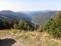
Short circular hike with great views in peaceful natural surroundings along the idyllic Letzbergweiher lake.
The Feldberg
 Visorando Member
 4.63 mi
+1,024 ft
-1,014 ft
3h 00
4.63 mi
+1,024 ft
-1,014 ft
3h 00
 Moderate
Departure from Feldberg (Regierungsbezirk Freiburg)
Moderate
Departure from Feldberg (Regierungsbezirk Freiburg)
Ascent of the Feldberg with a 360° view of the Black Forest and the Alps.
Albsteig (E4) from Feldberg Pass to Höchenschwand
 15.69 mi
+1,837 ft
-2,579 ft
8h 50
15.69 mi
+1,837 ft
-2,579 ft
8h 50
 Difficult
Departure from Feldberg (Regierungsbezirk Freiburg)
Difficult
Departure from Feldberg (Regierungsbezirk Freiburg)
This variant of the Albsteig (Black Forest) trail takes you on a 112-kilometre journey through the Alb Valley along the river from Albbruck to the Feldberg, the roof of the southern Black Forest. The fourth stage leads from the pass at Feldberg via Menzenschwand and St. Blasien to Höchenschwand. In terms of altitude, it is a little less strenuous than the previous stages. The eastern route of the Albsteig takes you back down towards the Hochrheintal valley.
Feldberg Passhöhe - Sankt Blasien
 13.09 mi
+1,627 ft
-3,123 ft
7h 25
Difficult
Departure from Feldberg (Regierungsbezirk Freiburg)
13.09 mi
+1,627 ft
-3,123 ft
7h 25
Difficult
Departure from Feldberg (Regierungsbezirk Freiburg)
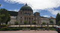
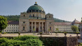
This sixth stage will take you from Feldberg Passhöhe to Sankt Blasien. The route follows the Albsteig Schwartzwald. The highest point of the day is the Herzogenhorn, the third highest peak in the Black Forest. You will enjoy a 360° panorama. In the evening, you will visit the town of Sankt Blasien with its imposing cathedral, whose dome is the third largest in Europe.
Wiedener Eck, Belchenseilbahn loop, Baden-Wurttemberg region
 Association / Club / Walk leader
 9.03 mi
+2,211 ft
-2,188 ft
6h 05
Difficult
Departure from Wieden (Regierungsbezirk Freiburg)
9.03 mi
+2,211 ft
-2,188 ft
6h 05
Difficult
Departure from Wieden (Regierungsbezirk Freiburg)
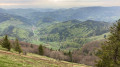
This is a great circular walk ground through the famous black forest where you will find great views of the German and French valleys.
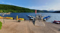
Notschreipass - Titisee
 15.98 mi
+2,008 ft
-2,900 ft
9h 05
15.98 mi
+2,008 ft
-2,900 ft
9h 05
 Very difficult
Departure from Todtnau (Regierungsbezirk Freiburg)
Very difficult
Departure from Todtnau (Regierungsbezirk Freiburg)
This fourth stage will take you from Notschreipass to Titisee. The route follows the Westweg Schwartzwald. The highest point of the day is Feldberq, the highest peak in the Black Forest. You will enjoy panoramic views as far as Mont Blanc. In the evening, you can enjoy a walk along the lake in the pleasant spa resort of Titisee.
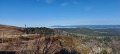
Tour of the Feldberg via the Feldsee
 7.03 mi
+1,339 ft
-1,325 ft
4h 25
Moderate
Departure from Feldberg (Regierungsbezirk Freiburg)
7.03 mi
+1,339 ft
-1,325 ft
4h 25
Moderate
Departure from Feldberg (Regierungsbezirk Freiburg)
Discover the Feldberg (1,493 m), the highest peak in the Black Forest, via the Feldsee, a small glacial lake at the foot of the mountain.
Most of the hike follows the "Feldbergsteig" route
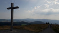
The Belchen
 4.02 mi
+1,125 ft
-1,135 ft
2h 50
Moderate
Departure from Aitern (Regierungsbezirk Freiburg)
4.02 mi
+1,125 ft
-1,135 ft
2h 50
Moderate
Departure from Aitern (Regierungsbezirk Freiburg)
A short hike to admire the view from the second highest peak in the Black Forest
The Goat Trail (Geissenpfad) in Menzenschwader
6.20 mi
+1,506 ft
-1,503 ft
4h 10
Moderate
Departure from St. Blasien (Regierungsbezirk Freiburg)
A superb, easy walk with the chance to stop for a bite to eat about 6 km from the start, near the lovely waterfalls. Ideal for families.
Feldberg, north face
9.93 mi
+1,673 ft
-1,650 ft
6h 00
Moderate
Departure from Hinterzarten (Regierungsbezirk Freiburg)
A very beautiful and varied walk, with no particular difficulties, taking you across the peaks of the Black ForestThe panoramic views of the surrounding area and the lakes in all their splendour, with the Alps visible in the distance (on a clear day), accompany you throughout this outing
Gorges Trail Stage 6 – from Todtmoos to Wehr (bad weather alternative)
 13.65 mi
+1,558 ft
-3,061 ft
7h 40
Moderate
Departure from Todtmoos (Regierungsbezirk Freiburg)
13.65 mi
+1,558 ft
-3,061 ft
7h 40
Moderate
Departure from Todtmoos (Regierungsbezirk Freiburg)
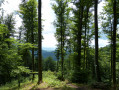
The Schluchtensteig trail leads in six stages over 119 km from Stühlingen to Wehr, right across the southern Black Forest.
The last stage is the longest at almost 22 km. In case of continuous or heavy rain or other incidents, this is an easy alternative if you want to get to Wehr somehow and cannot walk through the Wehraschlucht gorge.
While the first half of the stage to Gersbach offers some variety, the hike to Wehr is exclusively downhill on a gravel forest path.
Gorge Trail Stage 6 – From Todtmoos to Wehr
 14.81 mi
+2,441 ft
-3,973 ft
8h 55
Difficult
Departure from Todtmoos (Regierungsbezirk Freiburg)
14.81 mi
+2,441 ft
-3,973 ft
8h 55
Difficult
Departure from Todtmoos (Regierungsbezirk Freiburg)
The Schluchtensteig trail leads in six stages over 119 km from Stühlingen to Wehr, right across the southern Black Forest.
The last stage is the longest at almost 24 km and takes us through the wonderful Wehraschlucht gorge and later high above the Wehra river and then down to the Wehrastausee lake. Along the Wehra, we hike directly into the centre of Wehr.
Circular Schauinsland loop starting from the cable car
 7.97 mi
+1,362 ft
-1,388 ft
4h 50
Moderate
Departure from Freiburg im Breisgau (Regierungsbezirk Freiburg)
7.97 mi
+1,362 ft
-1,388 ft
4h 50
Moderate
Departure from Freiburg im Breisgau (Regierungsbezirk Freiburg)
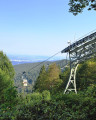
This walk allows you to explore this popular tourist spot near the city of Freiburg im Breisgau and to enjoy the panoramic views of the Black Forest, the Rhine plain stretching as far as the Vosges, and towards the Jura and the Alps on a clear day. The route alternates between wooded areas, stubble fields and pastures, villages, and isolated farms or inns, including a lovely forest path in the final section.
Schauinsland – With sweeping views – towards the sun
6.30 mi
+709 ft
-715 ft
3h 30
Moderate
Departure from Freiburg im Breisgau (Regierungsbezirk Freiburg)
Fancy a sunny panoramic circular walk along scenic high-altitude trails? And the best bit is that there are plenty of inns along the way where you can take a relaxing break.
Circular route P5 Pfaffenberg-Blauener Ebene-Gresgen-Adelsberg-Schänzle-Blauen
 9.23 mi
+1,404 ft
-1,391 ft
5h 30
Moderate
Departure from Zell im Wiesental (Regierungsbezirk Freiburg)
9.23 mi
+1,404 ft
-1,391 ft
5h 30
Moderate
Departure from Zell im Wiesental (Regierungsbezirk Freiburg)
A beautiful circular hike in the Zeller Bergland with fantastic views.
St. Ulrich circular walk from Berglusthaus
4.78 mi
+1,165 ft
-1,191 ft
3h 15
Moderate
Departure from Bollschweil (Regierungsbezirk Freiburg)
The 8 km circular trail was inaugurated in 2013 and leads to the most beautiful vantage points in St. Ulrich.It also offers an insight into the mountainous landscape, characterised by scattered farmsteads, with an impressive alternation of wide open grasslands and multi-layered forests. Furthermore, there are various places to stop for refreshments and rest areas along the trail.
The St. Ulrich Circular Trail actually begins in the village centre at the signpost “St. Ulrich Rössle” (571 m). However, we join the route at the Berglusthaus and return here as well.
Gschwendle–Heinehof–St. Ulrich–Winterberg–Talweg
4.14 mi
+1,020 ft
-1,050 ft
2h 45
Moderate
Departure from Bollschweil (Regierungsbezirk Freiburg)
The marked circular hiking trail (yellow diamond) runs alongside the St. Ulrich Circular Trail (yellow diamond and town coat of arms) from the Berglusthaus in a south-westerly direction through a charming meadow landscape, offering magnificent views of Geiersnest and the Upper Rhine Plain. Along the way, terraced steps and stone walls at the edge of the forest can be seen, indicating former agricultural use.It is also worth taking a look back at the beautifully situated Berglusthaus and the impressive landscape around the Hohbühl. Further downhill, the route alternates between woodland and grassland. From a crossroads at the edge of the forest, we enjoy another view of the meadows and scattered farmsteads of Geiersnest, before the stony path winds its way into the dense forest.
Circular Giesshübel starting from Sankt Ulrich
 8.72 mi
+1,896 ft
-1,896 ft
5h 40
Moderate
Departure from Bollschweil (Regierungsbezirk Freiburg)
8.72 mi
+1,896 ft
-1,896 ft
5h 40
Moderate
Departure from Bollschweil (Regierungsbezirk Freiburg)
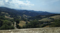
Cross beautiful pastures leading to the Gerstenhalm Pass and then on to Eduardshöhe for remarkable views of Horben before a short stop at the Giesshübel inn and its panoramic terrace. Return to St Ulrich, first along the ridges with views of the Belchen, then through the forest via the Kohlerhof inn.