Ascent to the Toter Mann

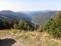
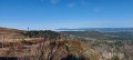
Much less busy than the nearby Feldberg, this gently sloping peak rises to 1,320 m. This short walk will take you there without any particular difficulty and offer a beautiful view.

Details

n°35245338
Creation:
Last update:
Last review:
  • Walking
    Activity: Walking
  • ↔
    Distance: 3.78 mi
  • ◔
    Average duration: 2h 25 
  • ▲
    Difficulty: Moderate

  • ⚐
    Back to start: Yes
  • ↗
    Ascent: + 807 ft
  • ↘
    Descent: - 827 ft

  • ▲
    Highest point: 4,341 ft
  • ▼
    Lowest point: 3,514 ft

Description of the walk

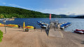
From the village of Oberried, follow the small road called Talstrasse. At the junction marked as a dead end, take the road that climbs to the right towards the Berggasthaus Stollenbacher Hütte. Follow it to the end and park in front of the inn.

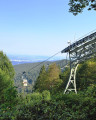
(S/E) With the inn’s terrace behind you, take the path that climbs to the right of the chairlift towards a dairy.

(1) Stay on the main path which heads off to the left. You’ll soon enter a forest and the path climbs steadily for 2 to 3 km until you reach a five-way junction with a signpost.

(2) Take the path on the right, which climbs the steepest. You’ll soon reach the summit after passing through a paddock. Enjoy the view: the cows grazing on this meadow won’t bother you!

(3) Carry on in the same direction for about 300 m.

(4) Turn left to head down through the meadow towards the west and join the main path (gate), which you follow to the right for about 1 km (passing another gate).

(5) At the junction, turn right and continue downhill.

(6) At the junction (bench and tarmac road), turn right, then after 100 m continue along the small path that descends alongside the forest. At the next junction, head downhill to the right to reach the inn, which is already clearly visible (S/E).

Waypoints

  1. S/E : mi 0 - alt. 3,533 ft - Berggasthaus Stollenbacher Hütte
  2. 1 : mi 0.12 - alt. 3,615 ft - Fruitière
  3. 2 : mi 1.7 - alt. 4,203 ft - Crossroads on a mountain pass
  4. 3 : mi 1.98 - alt. 4,341 ft - Toter Mann
  5. 4 : mi 2.16 - alt. 4,268 ft - Meadow, turn left
  6. 5 : mi 2.79 - alt. 3,993 ft - Crossroads
  7. 6 : mi 3.37 - alt. 3,757 ft - Crossroads with a bench
  8. S/E : mi 3.78 - alt. 3,514 ft - Berggasthaus Stollenbacher Hütte

Notes

The inn is not always open, but there are toilets next to it.

Reviews and comments

4.2 / 5
Based on 2 reviews

Reliability of the description
4.5 / 5
Ease of following the route
4 / 5
Route interest
4 / 5
Marieack
Marieack

Overall rating : 4.3 / 5

Date of your route : Oct 01, 2024
Reliability of the description : ★★★★★ Very good
Ease of following the route : ★★★★☆ Good
Route interest : ★★★★☆ Good
Very busy route : No

A fine walk, but with long stretches on wide tracks.

Machine-translated

PR35
PR35

Overall rating : 4 / 5

Date of your route : Oct 25, 2023
Reliability of the description : ★★★★☆ Good
Ease of following the route : ★★★★☆ Good
Route interest : ★★★★☆ Good
Very busy route : No

A nice walk, but using the gps track and map.me (for example) might be useful at certain crossroads.

Machine-translated

Other walks in the area

For more walks, use our search engine .

The GPS track and description are the property of this route's author. Please do not copy them without permission.