Country:

 City:


Start: Westwegtor at Wiedener Eck (79695 Wieden)
Parking:
You’ll find car parks right next to the hiking car park at Wiedener Eck. If these are full, you can park your car just above the hiking car park, on the main road towards Belchen. The wide hard shoulder offers plenty of parking space. There are also smaller hiking car parks at Lückle and at Krinne.
Public transport starting point: Wiedener Eck stop
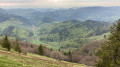
(S/E) We start our walk on the premium hiking trail at Wiedener Eck and head clockwise towards Lückle. The first few metres are a gentle climb along a wide meadow path, offering a magnificent view across the Wiedener Valley.
(1) After about 500 metres, we pass the Lilienfein estate, before entering a wooded area a short while later which takes us past the Wiedener Eck ski lift.
(2) The path then takes us to the clearing by the timber yard, leading directly to Lückle (km 2). Here we cross the road and, on the opposite side, take the middle of the three paths. This leads us down into the idyllic Hintergrundbach Valley.
(3) In the Hintergrundbach valley, we pass a magnificent plateau where cows graze and horses frolic, before veering slightly to the right at kilometre 3.1 and heading up a relatively steep slope towards the Eckle.
(4) Once at the top, we keep to the left, skirting the Eckle on the western side along a gently sloping, wide forest track, before, after a few hundred metres, a narrow path leads us left again towards Untermulten.
After about 200 metres, not far from the Dießlin Hut, this path widens into a broad hiking trail again, before turning right onto a meadow path shortly afterwards.
(5) This takes us directly to the Belchen-Multen inn. At the inn, we cross the main road, follow our path straight ahead and then turn right, heading towards the valley station of the Belchen cable car, which we reach after a total of 5.5 kilometres.
Anyone wishing to avoid a 300-metre climb over the next two kilometres can take the Belchen cable car from here.
(6) Those wishing to continue on foot should follow the Premium hiking trail from the Belchenhotel Jägerstüble along signposted paths through the so-called ‘Donauwellen’ and then, after crossing the old Belchen road (7), take the Belchenwegchen to the Belchenhaus.
(8) Once at the top, we are treated to a magnificent view of the Swiss Jura and the snow-capped Alpine range, which seems close enough to touch. We carry on, past the Belchenhaus, and – accompanied by stunning views – then take the upper circular trail, which leads us to the summit of the Belchen.
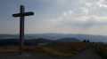
(9) The view sweeps across the Münster Valley, Staufen and Bad Krozingen to the Rhine Valley and the Vosges mountains beyond. We can see Freiburg as well as the surrounding Black Forest mountains, foremost among them the 1,493-metre-high Feldberg, the highest mountain in the Black Forest. Just as at the Belchenhaus, up here at an altitude of 1,414 metres the Swiss Alps seem very close by, making one want to linger for hours.
Right by the summit cross, we follow the meadow path to the left, which winds its way down to the lower circular trail via two hairpin bends, with a view of the Rhine Valley accompanying us all the way.
(10) We reach this at the tree line, where we keep to the right. The alpine path takes us round the steep and well-known northern flank of the Belchen. As well as offering a spectacular route, this section is a real treat.
(11) After a few hundred metres, we reach the Krinne descent. Here we join the Westweg. Once again, the path winds its way down in a series of hairpin bends for two kilometres to the Krinne, which we reach at kilometre 10.5. On the way down to the Krinne, we stop briefly every now and then to enjoy the fantastic views towards Münstertal-Staufen and the Rhine valley beyond.
(12) Once at the Krinne, the third path branches off to the left. We take this path and, after less than a quarter of an hour, reach the Heidstein (another viewpoint).
(13) At the Heidstein, we follow the route to the right into a dense little wood. Via narrow paths and, now and then, slightly wider forest tracks, we eventually cross the Heidstein (14) and Neuhof (15) ski lifts, before reaching our starting point at the Wiedener Eck (S/E) again after around 14.5 kilometres.

 Association / Club / Walk leader

 Tourist office

 Moderate
 Visorando Member

 Easy
 Very difficult