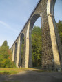
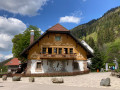
Feldberg, north face

A very beautiful and varied walk, with no particular difficulties, taking you across the peaks of the Black Forest
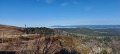
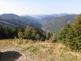
The panoramic views of the surrounding area and the lakes in all their splendour, with the Alps visible in the distance (on a clear day), accompany you throughout this outing

Details

1673114
Creation:
Last update:
Last review:
  • Walking
    Activity: Walking
  • ↔
    Distance: 9.93 mi
  • ◔
    Average duration: 6h 00 
  • ▲
    Difficulty: Moderate

  • ⚐
    Back to start: Yes
  • ↗
    Ascent: + 1,673 ft
  • ↘
    Descent: - 1,650 ft

  • ▲
    Highest point: 4,895 ft
  • ▼
    Lowest point: 3,665 ft

Description of the walk

Meet at the Wanderparking car park just before the Gashaus Jägersheim Rinken.

(S/E) Set off south-west along the path called Kirchzarten-Feldberg, pass the Gashaus Jägersheim and continue until you reach a multi-way junction.

(1) Turn left onto the Seewaldweg – Feldbergsteig path, heading towards Feldsee. Stay on this path, following the signposts. You’ll reach Feldsee lake.

(2) Head uphill to the left, skirting the lake, before turning left to reach the ski resort.

(3) Just before the resort, turn right. Climb up a fairly steep path with steps. You’ll reach the start of the Felsenpfad trail. Follow it to the junction with the Emil-Thoma-Weg.

(4) Turn left and follow this path uphill until you reach the junction with the Feldbergsteig path.

(5) Turn left onto the Feldbergsteig path. Follow it until you reach the Bismarckdenkmal monument.

(6) Walk round it, then take the path leading to the Feldbergturm.

(7) Walk round it, then take the path down to the junction with the Feldbergsteig path you passed earlier.

(5) Continue straight ahead, walking along the ridge to the summit of the Feldberg (1,493 m).

(8) Return to the Feldbergsteig path and turn right onto it. Follow this path to reach the Wilhelmer Hütte.

(9) Turn right, still on the Feldbergsteid path, and you’ll come to a three-way junction.

(10) Keep to the right on this path. Make a wide circular loop to the right, then veer left to reach the Zastler Hütte.

(11) Turn right and follow the road. You’ll soon leave the Feldbergsteid behind by keeping to the left. Continue northwards until you reach another Y-junction.

(12) Take the path on the right – this is the Naturlehrpfad. Walk due east to return to the original junction.

(1) Follow the route you took on the way there to return to the car park where you started (S/E).

Waypoints

  1. S/E : mi 0 - alt. 3,914 ft - Car park: Wanderparking
  2. 1 : mi 0.29 - alt. 3,947 ft - Junction
  3. 2 : mi 2.06 - alt. 3,691 ft - Lake Feldsee
  4. 3 : mi 2.98 - alt. 4,206 ft - Feldberg ski resort
  5. 4 : mi 4.17 - alt. 4,357 ft - Junction with the Emil-Thoma-Weg
  6. 5 : mi 5.12 - alt. 4,642 ft - Junction with the Feldbergsteig trail
  7. 6 : mi 5.5 - alt. 4,734 ft - Bismarck Monument
  8. 7 : mi 5.72 - alt. 4,757 ft - Belvedere Tower with a small museum
  9. 8 : mi 6.89 - alt. 4,895 ft - Feldberg summit with orientation table
  10. 9 : mi 7.41 - alt. 4,521 ft - Wilhelmer Hütte
  11. 10 : mi 7.66 - alt. 4,495 ft - Y-shaped path towards Zastler Hütte
  12. 11 : mi 8.52 - alt. 4,121 ft - Zastler Hütte
  13. 12 : mi 8.71 - alt. 4,039 ft - Y-junction (road – Naturlehrpfad trail)
  14. S/E : mi 9.93 - alt. 3,921 ft - Car park: Wanderparking

Notes

Drinks and meals are available at the various huts, if they are open (check in advance).
Don’t forget to bring a drink.
Energy bars and, if necessary, a packed lunch
Warm clothing – and rainwear (depending on the weather)
Safety: sturdy walking shoes
This hike should be undertaken after the snow has melted.
Important information: signs with the names of paths, lakes, huts, monuments and towers are located along the entire route; simply follow them.

Worth a visit

(2) Admire the beautiful glacial lake Feldsee (you may wish to walk around it).
The small waterfalls amidst unspoilt, lush countryside on the Felsenpfad.
(3) The ski resort.
(7) Climb the observation tower with its small museum (admission fee applies).
(8) Admire the panoramic views from the summit of the Feldberg, the highest point in the Black Forest at 1,493 metres, where there is a weather station and a survey table.
On a clear day, the Alps are visible.
Admire the authentic charm of the mountain huts.

Reviews and comments

4.5 / 5
Based on 2 reviews

Reliability of the description
4.5 / 5
Ease of following the route
4.5 / 5
Route interest
4.5 / 5
CoralieR68
CoralieR68

Overall rating : 5 / 5

Date of your route : Apr 04, 2026
Reliability of the description : ★★★★★ Very good
Ease of following the route : ★★★★★ Very good
Route interest : ★★★★★ Very good
Very busy route : No

We weren’t able to finish the walk because there was simply too much snow for a walk without snowshoes, but we’ve already rescheduled it

Machine-translated

champagne74
champagne74

Overall rating : 4 / 5

Date of your route : Aug 05, 2022
Reliability of the description : ★★★★☆ Good
Ease of following the route : ★★★★☆ Good
Route interest : ★★★★☆ Good
Very busy route : No

Hiking in bad weather, so no panoramic views. What a shame!
Otherwise, an easy hike for everyone.

Machine-translated

Other walks in the area

For more walks, use our search engine .

The GPS track and description are the property of this route's author. Please do not copy them without permission.