


The Goat Trail (Geissenpfad) in Menzenschwader


A superb, easy walk with the chance to stop for a bite to eat about 6 km from the start, near the lovely waterfalls. Ideal for families.
Details
Creation:
Last update:
Last review:
–
–
-
 Activity: Walking
 -
 Distance: 6.20 mi
 -
 Average duration: 4h 10
 -
 Difficulty: Average
 -
-
 Back to start: Yes
 -
 Ascent: + 1,506 ft
 -
 Descent: - 1,503 ft
 -
-
 Highest point: 3,973 ft
 -
 Lowest point: 2,795 ft
-
 Country:
Germany
Country:
Germany
-
 Area: Forêt Noire
 -
 City:
St. Blasien
City:
St. Blasien -
 Start/End: N 47.822321° / E 8.071061°
 -


 Hour-by-hour weather


Waypoints
- S/E : mi 0 - alt. 2,874 ft - Menzenschwader – Mitteldorf
- 1 : mi 0.47 - alt. 2,802 ft - Junction of the short circular loop
- 2 : mi 0.61 - alt. 2,854 ft - Junction on the Grand Circular Loop
- 3 : mi 3.61 - alt. 3,970 ft - Junction
- S/E : mi 6.2 - alt. 2,877 ft - Menzenschwader – Mitteldorf
Other walks in the area
Tour of the Feldberg via the Feldsee
 Visorando Member
 7.03 mi
+1,339 ft
-1,325 ft
4h 25
Average
7.03 mi
+1,339 ft
-1,325 ft
4h 25
Average
 Departure from Feldberg (Regierungsbezirk Freiburg)
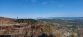
Discover the Feldberg (1,493 m), the highest peak in the Black Forest, via the Feldsee, a small glacial lake at the foot of the mountain.
Most of the hike follows the "Feldbergsteig" route
Feldberg Passhöhe - Sankt Blasien
 13.09 mi
+1,627 ft
-3,123 ft
7h 25
13.09 mi
+1,627 ft
-3,123 ft
7h 25
 Difficult
Departure from Feldberg (Regierungsbezirk Freiburg)
Difficult
Departure from Feldberg (Regierungsbezirk Freiburg)
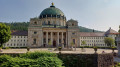
This sixth stage will take you from Feldberg Passhöhe to Sankt Blasien. The route follows the Albsteig Schwartzwald. The highest point of the day is the Herzogenhorn, the third highest peak in the Black Forest. You will enjoy a 360° panorama. In the evening, you will visit the town of Sankt Blasien with its imposing cathedral, whose dome is the third largest in Europe.
Albsteig (E4) from Feldberg Pass to Höchenschwand
 15.69 mi
+1,837 ft
-2,579 ft
8h 50
Difficult
Departure from Feldberg (Regierungsbezirk Freiburg)
15.69 mi
+1,837 ft
-2,579 ft
8h 50
Difficult
Departure from Feldberg (Regierungsbezirk Freiburg)
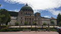
This variant of the Albsteig (Black Forest) trail takes you on a 112-kilometre journey through the Alb Valley along the river from Albbruck to the Feldberg, the roof of the southern Black Forest. The fourth stage leads from the pass at Feldberg via Menzenschwand and St. Blasien to Höchenschwand. In terms of altitude, it is a little less strenuous than the previous stages. The eastern route of the Albsteig takes you back down towards the Hochrheintal valley.
Gorge Trail Stage 4 – from Fischbach to St. Blasien
 12.41 mi
+1,457 ft
-2,356 ft
7h 00
Average
Departure from Schluchsee (Regierungsbezirk Freiburg)
12.41 mi
+1,457 ft
-2,356 ft
7h 00
Average
Departure from Schluchsee (Regierungsbezirk Freiburg)
The Schluchtensteig trail leads in six stages over 119 km from Stühlingen to Wehr across the southern Black Forest.
The fourth stage of the Schluchtensteig is almost completely free of gorges and therefore quite easy to walk. However, you should not underestimate the altitude difference, especially after Unterkrummenhof, where a long climb awaits hikers, and after St. Blasien, where the forest road descends for a long time and is quite steep in places.
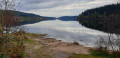
The southern Black Forest with its isolated farms shows its charming side on this stage, offering frequent views of the Alps. At the end, you can enjoy the Windeck waterfalls above St. Blasien.
Thanks to good bus connections, this stage can also be hiked very well as a single stage.
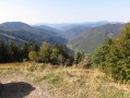
The Feldberg
 4.63 mi
+1,024 ft
-1,014 ft
3h 00
Average
Departure from Feldberg (Regierungsbezirk Freiburg)
4.63 mi
+1,024 ft
-1,014 ft
3h 00
Average
Departure from Feldberg (Regierungsbezirk Freiburg)
Ascent of the Feldberg with a 360° view of the Black Forest and the Alps.
The Genießerpfad – Schluchseer Jägersteig
 Tourist office
 7.42 mi
+876 ft
-879 ft
4h 10
Average
Departure from Schluchsee (Regierungsbezirk Freiburg)
7.42 mi
+876 ft
-879 ft
4h 10
Average
Departure from Schluchsee (Regierungsbezirk Freiburg)
A premium hiking trail offering magnificent views of the Schluchsee and idyllic, narrow paths amidst the stunning Upper Black Forest landscape.
Feldberg, north face
9.93 mi
+1,673 ft
-1,650 ft
6h 00
Average
Departure from Hinterzarten (Regierungsbezirk Freiburg)
A very beautiful and varied walk, with no particular difficulties, taking you across the peaks of the Black ForestThe panoramic views of the surrounding area and the lakes in all their splendour, with the Alps visible in the distance (on a clear day), accompany you throughout this outing
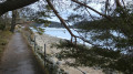
Walk around Schluch Lake (Schluchsee)
 11.10 mi
+659 ft
-676 ft
5h 40
Average
Departure from Schluchsee (Regierungsbezirk Freiburg)
11.10 mi
+659 ft
-676 ft
5h 40
Average
Departure from Schluchsee (Regierungsbezirk Freiburg)
Lake Schluch is the largest lake in the Black Forest, in Germany. It is a pleasant walk around the lake at any time of year. Most of this walk follows a fairly shaded path along the lakeshore.
For more walks, use our search engine .
The GPS track and description are the property of this route's author. Please do not copy them without permission.

