


Refine your search for walks in Suarce
Suarce walks


 Along the Suarcine in Suarce
 Visorando Member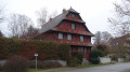
 1.81 mi
 +52 ft
 -52 ft
 0h 55
0h 55
 Easy
Easy
 Departure from Suarce (Territoire-de-Belfort)
A lovely walk in the Sundgau region at Suarce, 20 km south-east of Belfort. You’ll discover beautiful scenery along the Suarcine and magnificent half-timbered houses.
This 3 km walk is easily accessible to everyone.
It is signposted.
Walk of the little huts in Chavanatte
 4.67 mi
+98 ft
-69 ft
2h 15
Easy
Departure from Chavanatte (Territoire-de-Belfort)
4.67 mi
+98 ft
-69 ft
2h 15
Easy
Departure from Chavanatte (Territoire-de-Belfort)
A lovely walk in the Sundgau region at Chavanatte, 20 km south-east of Belfort. You’ll discover beautiful scenery along the Suarcine and magnificent half-timbered houses.
This walk is easily accessible to all and can be split into three circular routes.
It is signposted.
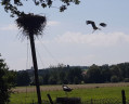
Hindlingen Stork Walk
 2.62 mi
+98 ft
-102 ft
1h 20
Easy
Departure from Hindlingen (Haut-Rhin)
2.62 mi
+98 ft
-102 ft
1h 20
Easy
Departure from Hindlingen (Haut-Rhin)
Enjoy a short walk starting from the stork park in the village of Hindlingen. Follow the Largue and discover the pretty half-timbered houses in the village of Friesen!
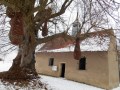
Sundgau circuit in Friesen-Ueberstrass
 4.81 mi
+236 ft
-226 ft
2h 25
Easy
Departure from Friesen (Haut-Rhin)
4.81 mi
+236 ft
-226 ft
2h 25
Easy
Departure from Friesen (Haut-Rhin)
Friesen boasts an exceptional array of half-timbered houses built between 1499 and 1876. Thanks to meticulous inventory work, the walk allows you to see many reminders of a rural world that disappeared forever after the Second World War. A country lane then leads to the Notre-Dame de Grünenwald chapel and Ueberstrass, following in the footsteps of the Knights of Malta.
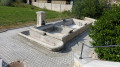
Walk from Normanvillars to Boron, Grosne and Vellescot
 6.91 mi
+197 ft
-197 ft
3h 20
6.91 mi
+197 ft
-197 ft
3h 20
 Moderate
Departure from Boron (Territoire-de-Belfort)
Moderate
Departure from Boron (Territoire-de-Belfort)
A family-friendly hike to discover the culture and nature of a region full of surprises.
The route is marked with red discs.
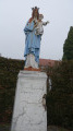
Route des Barons de Ferrette in Faverois
 5.37 mi
+118 ft
-118 ft
2h 35
Easy
Departure from Faverois (Territoire-de-Belfort)
5.37 mi
+118 ft
-118 ft
2h 35
Easy
Departure from Faverois (Territoire-de-Belfort)
A lovely hike in the Faverois area, 30 km south-east of Belfort.
You will discover a charming village, landscapes of fields and forests with beautiful ponds.
In spring and autumn, you can observe many migratory birds.
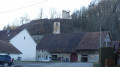
In the shadow of the Florimont towers
 3.66 mi
+161 ft
-148 ft
1h 50
Easy
Departure from Florimont (Territoire-de-Belfort)
3.66 mi
+161 ft
-148 ft
1h 50
Easy
Departure from Florimont (Territoire-de-Belfort)
A very pleasant walk to discover the village of Florimont and its surroundings in the lush countryside.
At the end, I suggest a short alternative route to reach the foot of the two towers.
Florimont is situated in the foothills of the Jura, 30 km from Belfort and a stone’s throw from Switzerland.
The route is marked with a Green Ring
Around the Vendeline in Réchésy
2.52 mi
+144 ft
-141 ft
1h 15
Easy
Departure from Réchésy (Territoire-de-Belfort)
A short walk that allows you to discover the charming village of Réchésy, situated 24 km south-east of Belfort, very close to the Swiss border.You’ll discover its church, the old tramway, the River Vendeline, an old mill, beautiful half-timbered houses and the ‘Académie de Réchésy’.This walk is signposted.
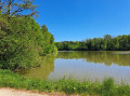
The Sentier des Bornes in Rechesy
 Local authority
 10.15 mi
+797 ft
-791 ft
5h 20
10.15 mi
+797 ft
-791 ft
5h 20
 Difficult
Departure from Réchésy (Territoire-de-Belfort)
Difficult
Departure from Réchésy (Territoire-de-Belfort)
This long hike through fields and forests allows you to discover the peaceful Sundgau region of Belfort, walk along ponds and flirt with the Swiss Jura.
The trail is marked with a yellow ring.
Circular Courlis and Rhône-Rhine Canal
 7.77 mi
+69 ft
-66 ft
3h 40
Moderate
Departure from Montreux-Château (Territoire-de-Belfort)
7.77 mi
+69 ft
-66 ft
3h 40
Moderate
Departure from Montreux-Château (Territoire-de-Belfort)
A pleasant hike in Montreux-Château, 15 km east of Belfort.
It will allow you to discover some very pretty villages:
- Autrage and Novillard with their pretty half-timbered houses.
- Petit-Croix with the Pégoud monument.
- Montreux-Château with its beautiful chapel and the motte castrale, the remains of a medieval castle.
The route is marked with a blue disc.
From Montreux-Vieux to Montreux-Châteaux via Reppe and Fontaine
19.29 mi
+236 ft
-246 ft
9h 05
 Very difficult
Departure from Montreux-Vieux (Haut-Rhin)
Very difficult
Departure from Montreux-Vieux (Haut-Rhin)
This is a long, completely flat walk that straddles the Franche-Comté and Alsace regions. It is a challenging walk due to its length, but it offers the chance to see many points of interest such as the Marnière and Belle Île ponds, the Notre-Dame de Bellefontaine Chapel, the Tilleul de Turenne, the Petit-Croix Church and, finally, the Sainte-Catherine Chapel and the feudal motte of Montreux-Château. The entire walk alternates between woodland, villages and countryside.
The Verchat trail in Joncherey
 5.39 mi
+174 ft
-171 ft
2h 40
Easy
Departure from Joncherey (Territoire-de-Belfort)
5.39 mi
+174 ft
-171 ft
2h 40
Easy
Departure from Joncherey (Territoire-de-Belfort)
A lovely hike in the Joncherey area near Delle, 25 km south-east of Belfort. Easy access via the N1019 expressway. You will discover a charming village, landscapes of fields and forests, and the Étang du Verchat lake with its tree houses.
This hike is marked with a red ring.
Circular walk around the castle mound at Montreux-Château
 6.59 mi
+102 ft
-98 ft
3h 05
Moderate
Departure from Montreux-Château (Territoire-de-Belfort)
6.59 mi
+102 ft
-98 ft
3h 05
Moderate
Departure from Montreux-Château (Territoire-de-Belfort)
A lovely walk starting in Montreux-Château, located 15 km east of Belfort.
A pretty village with a chapel built near the site of a motte-and-bailey castle. You’ll discover a rural landscape with views of the Swiss Jura.
The walk passes the spot where Adolphe Pégoud, a flying ace, was shot down in 1915.
This walk is signposted.
The Tour des Deux Seppois
 4.99 mi
+236 ft
-236 ft
2h 30
Easy
Departure from Seppois-le-Bas (Haut-Rhin)
4.99 mi
+236 ft
-236 ft
2h 30
Easy
Departure from Seppois-le-Bas (Haut-Rhin)
A route inviting you to explore the two neighbouring villages of Seppois-le-Bas and Seppois-le-Haut. You will also enjoy sections through the forest, including the Gobenwald.
Discovering the heritage around Dannemarie
9.64 mi
+315 ft
-318 ft
4h 40
Moderate
Departure from Dannemarie (Haut-Rhin) (Haut-Rhin)
You’ll discover Dannemarie’s monuments and the surrounding countryside, with a beautiful view of the Ballersdorf viaduct and, further afield, the Sundgau and the Vosges. At the end of the walk, you’ll admire the Relais Nautique along the Rhône–Rhine Canal, followed by the former Gilardoni tile works.
The Enchanted Forest in Boncourt
 2.16 mi
+377 ft
-377 ft
1h 20
Easy
Departure from Boncourt (Canton du Jura) (Canton of Jura)
2.16 mi
+377 ft
-377 ft
1h 20
Easy
Departure from Boncourt (Canton du Jura) (Canton of Jura)
The ‘Enchanted Forest’ walk and the ‘Sentier des Faînes’ in Boncourt, a border village in the Swiss Jura, is a short walk through the forest featuring wooden sculptures depicting famous cartoon characters. A fun little walk to enjoy with the family.
Delle and the Mazarin Fountain in Fêche-l'Église
 10.83 mi
+860 ft
-853 ft
5h 45
Difficult
Departure from Delle (Territoire-de-Belfort)
10.83 mi
+860 ft
-853 ft
5h 45
Difficult
Departure from Delle (Territoire-de-Belfort)
A very beautiful walk that allows us to discover the historical heritage of the town of Delle, the surrounding countryside and also the superb Mazarin Fountain in Fêche-l'Église.
The route is marked with Yellow Rings.
Grandvillars family walk, Montrobert walk
 4.11 mi
+118 ft
-118 ft
2h 00
Easy
Departure from Grandvillars (Territoire-de-Belfort)
4.11 mi
+118 ft
-118 ft
2h 00
Easy
Departure from Grandvillars (Territoire-de-Belfort)
A very pleasant walk that allows you to explore Grandvillars and its surroundings.
You’ll see countryside and woodland scenery with a lovely view of the Jura.
Grandvillars is easily accessible via the motorway, 15 km from Belfort.
This walk is signposted.
On the path of the Monks of Cluny
5.60 mi
+154 ft
-148 ft
2h 45
Easy
Departure from Brebotte (Territoire-de-Belfort)
Froidefontaine was founded around 1100, when monks from Cluny established a priory in a marshy area. All that remains of the Benedictine monastery church is the 12th-century Romanesque apse. Three human heads can be seen on the cornice. The gravestones on either side of the portal date from 1750. The presbytery next to the church is remarkable for its size.
Chavannes-sur-l'Étang pond trail
 6.27 mi
+66 ft
-66 ft
2h 55
Easy
Departure from Chavannes-sur-l'Étang (Haut-Rhin)
6.27 mi
+66 ft
-66 ft
2h 55
Easy
Departure from Chavannes-sur-l'Étang (Haut-Rhin)
A superb hike on the border between Belfort and Haut Rhin. You will discover a landscape of countryside and forests with magnificent ponds. As a bonus, there is a discovery trail with information panels about the trees of our region.
The Smugglers’ Trail in Delle
 3.46 mi
+213 ft
-207 ft
1h 45
Easy
Departure from Delle (Territoire-de-Belfort)
3.46 mi
+213 ft
-207 ft
1h 45
Easy
Departure from Delle (Territoire-de-Belfort)
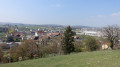
A lovely walk that takes you through the centres of Delle and Boncourt, with some very pretty old buildings.You’ll also walk through a forest with a stunning view.If you have a little time to spare, take a short detour to enjoy the tranquillity of the ‘Sentier des Faines’ and the ‘Enchanted Forest’.This walk is signposted.
The remarkable lime tree of Grandvillars
 1.93 mi
+46 ft
-46 ft
0h 55
Easy
Departure from Grandvillars (Territoire-de-Belfort)
1.93 mi
+46 ft
-46 ft
0h 55
Easy
Departure from Grandvillars (Territoire-de-Belfort)
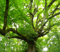
Short excursion from Grandvillars to the remarkable lime tree
Adolphe Pégoud circular in Petit-Croix
 6.50 mi
+102 ft
-102 ft
3h 05
Easy
Departure from Petit-Croix (Territoire-de-Belfort)
6.50 mi
+102 ft
-102 ft
3h 05
Easy
Departure from Petit-Croix (Territoire-de-Belfort)
A beautiful hike starting in Petit-Croix, located 10 km east of Belfort.
You will discover a pleasant landscape at the foot of the Vosges mountains as you pass through the villages of Cunelières and Foussemagne.
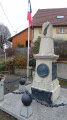
The hike passes by the spot where Adolphe Pégoud, an aviation ace, was shot down in 1915. You will also see the monument dedicated to him in the centre of the village.
The trail is signposted.
The Marnière circular in Foussemagne
 4.11 mi
+30 ft
-30 ft
1h 55
Easy
Departure from Foussemagne (Territoire-de-Belfort)
4.11 mi
+30 ft
-30 ft
1h 55
Easy
Departure from Foussemagne (Territoire-de-Belfort)
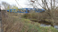
This is a very pretty hike that will allow you to discover a charming village and its suburbs, an old synagogue and an "Arromanches" type bridge. It passes near the Porte d'Alsace area with the Fosses discovery trail, where you will learn to recognise the trees of our region. Not to mention the Étang de la Marnière, a vast wetland with flora and fauna to discover.
The hike is signposted.
Circular Madeleine in Novillard, Fontenelle and Petit-Croix
 7.55 mi
+171 ft
-167 ft
3h 35
Moderate
Departure from Novillard (Territoire-de-Belfort)
7.55 mi
+171 ft
-167 ft
3h 35
Moderate
Departure from Novillard (Territoire-de-Belfort)
A beautiful hike starting in Novillard, located 10 km east of Belfort.
You will discover Novillard, Fontenelle, Petit-Croix and beautiful countryside landscapes with views of the Swiss Jura and the Vosges. You will walk along the banks of the Madeleine river through the undergrowth.
The hike passes by the spot where Adolphe Pégoud, a flying ace, was shot down in 1915.
This hike is signposted.
The Kilometre Zero Trail - World War I
 4.93 mi
+289 ft
-295 ft
2h 30
Easy
Departure from Pfetterhouse (Haut-Rhin)
4.93 mi
+289 ft
-295 ft
2h 30
Easy
Departure from Pfetterhouse (Haut-Rhin)
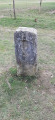
Kilometre Zero is the starting point of the front line established during theFirst World War. It is located on the current French-Swiss border, at a place called Le Largin. The Kilometre Zero trail explores three sections of the front line, the first kilometres of the French and German fronts, and the Swiss front at Le Largin, established along the border opposite the no man's land where boundary marker No. 111, considered the zero point of the Great War front line, is located.
Circular Three valleys in Lebetain
 6.98 mi
+925 ft
-909 ft
4h 00
Moderate
Departure from Lebetain (Territoire-de-Belfort)
6.98 mi
+925 ft
-909 ft
4h 00
Moderate
Departure from Lebetain (Territoire-de-Belfort)
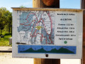
This superb hike allows you to discover the village of Lebetain and the surrounding valleys with their typical Jura landscape. The starting point is near the Swiss border, close to Delle, 25 km from Belfort via the expressway.
My favourite part: a very pretty section through the middle of a pasture in a narrow valley with a small stream and numerous little waterfalls. However, there is a fairly difficult section with a steep path for about 50 metres.
The hike is signposted
.
Aéroparc à Fontaine, Reppe et Larivière. Circuit des trois villages.
 7.86 mi
+98 ft
-102 ft
3h 40
Moderate
Departure from Fontaine (Territoire de Belfort) (Territoire-de-Belfort)
7.86 mi
+98 ft
-102 ft
3h 40
Moderate
Departure from Fontaine (Territoire de Belfort) (Territoire-de-Belfort)
This pleasant hike will allow you to discover three typical villages: Fontaine, Reppe and Larivière, as well as the former Fontaine aerodrome.You will also see magnificent countryside landscapes and beautiful views of the Vosges mountains.This walk is signposted.
01/2026: the path has been diverted at the exit of Reppe to avoid traffic on the main road.
Le Pré de la Caille, Frais route
 4.66 mi
+72 ft
-72 ft
2h 10
Easy
Departure from Frais (Territoire-de-Belfort)
4.66 mi
+72 ft
-72 ft
2h 10
Easy
Departure from Frais (Territoire-de-Belfort)
A pleasant hike near Frais, located 10 km east of Belfort.
You can admire a rich architectural and natural heritage, beautiful half-timbered houses and a superb view of the Southern Vosges.
The route is marked with a red ring.
The Bois de Bessoncourt, Fort Route
 8.67 mi
+203 ft
-200 ft
4h 10
Moderate
Departure from Bessoncourt (Territoire-de-Belfort)
8.67 mi
+203 ft
-200 ft
4h 10
Moderate
Departure from Bessoncourt (Territoire-de-Belfort)
A lovely circular walk 10 km east of Belfort. It will take you through Bessoncourt with its fort, Phaffans, its church and its former presbytery, and Denney with its superb town hall and a perfectly preserved wash house. Not to mention beautiful countryside scenery and a lovely view of the Vosges mountain range.
This walk is signposted.
Circular route of La Madeleine from the Étang du Moulin des Bois
4.52 mi
+69 ft
-69 ft
2h 10
Easy
Departure from Bessoncourt (Territoire-de-Belfort)
Starting from the Étang du Moulin car park, explore the villages of Phaffans and Lacollonge on an easy circular route around the River La Madeleine, offering beautiful views of the Southern Vosges from the Planche des Belles Filles to the Grand Ballon.
La légende de l'Évêque Désidérius au départ de Saint-Dizier-l'Évêque
7.94 mi
+892 ft
-925 ft
4h 25
Moderate
Departure from Saint-Dizier-l'Évêque (Territoire-de-Belfort)
Cette randonnée se distingue des deux autres proposées en ce qu'elle ne comporte que très peu de tronçons sur la route. Elle permet de rallier tous les hauts lieux de la légende de Saint-Dizier dont des extraits sont rapportés en italique dans le paragraphe À proximité, dans l'ordre du circuit mais pas dans l'ordre chronologique qui est : Pas du Diable - Oratoire de Saint-Martin (l'église) - Butte de Croix.
In the lands of Desiderius in Saint-Dizier-l'Évêque
 5.12 mi
+633 ft
-617 ft
2h 55
Easy
Departure from Saint-Dizier-l'Évêque (Territoire-de-Belfort)
5.12 mi
+633 ft
-617 ft
2h 55
Easy
Departure from Saint-Dizier-l'Évêque (Territoire-de-Belfort)
A very pretty hike that allows you to discover this small village with its superb church and beautiful vineyard.
The historical past is well highlighted with numerous information panels: in the church, at Au pas du Diable and at the small chapel.
The route is marked with a yellow ring.