Grandvillars family walk, Montrobert walk

A very pleasant walk that allows you to explore Grandvillars and its surroundings.
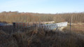
You’ll see countryside and woodland scenery with a lovely view of the Jura.
Grandvillars is easily accessible via the motorway, 15 km from Belfort.
This walk is signposted.

Details

n°1741777
Creation:
Last update:
Last review:
  • Walking
    Activity: Walking
  • ↔
    Distance: 4.11 mi
  • ◔
    Average duration: 2h 00 
  • ▲
    Difficulty: Easy

  • ⚐
    Back to start: Yes
  • ↗
    Ascent: + 118 ft
  • ↘
    Descent: - 118 ft

  • ▲
    Highest point: 1,263 ft
  • ▼
    Lowest point: 1,132 ft
  • ⚐ Country: France
  • ⚐ City: Grandvillars (90600)
  • ⚑
    Start/End: N 47.538413° / E 6.971433°
  • Accessible from the train station Gare de Grandvillars.
  • ❏
    IGN map(s): Ref. 3621OT
  • Hour-by-hour weather

Photos

Description of the walk

Car park at Place du 18 novembre 1944 in Grandvillars, opposite the cemetery.
The walk is signposted with a Green Ring.

(S/E) Set off along Rue du Général Leclerc heading east, towards Delle. Turn left into Rue de l’Arc, following the signs for the community hall. Walk past the fire station and then under the railway viaduct; ignore the road on the right.

(1) Turn left up Rue de Bellevue. Walk through the old Belle-vue housing estate. Note the small castle at number 23. Continue straight on along Rue des Versennes, between the two new housing estates of Les Versennes and Le Champ de la Fosse, until you reach the bend to the left.

(2) Take the Route de Froidefontaine, following the signs for the Cimetière de la Montagne.

(3) 200m after the cemetery, turn right onto the forest track which is circular and goes through the Bois Banal. Pass four tracks on your right and return to the tarmac road via a lovely forest track.

(4) Turn left onto the road and head back towards Grandvillars, passing the cemetery and the junction at point (2).

(2) Turn right and head down Rue de Froidefontaine. Cross the railway line at the level crossing. Continue to the roundabout.

(5) Carry on straight ahead at the roundabout towards the post office and Place de la Résistance.

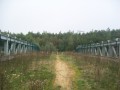
(6) Cross the canal bridge and turn left. Follow the riverbank along the ‘La Francovélosuisse’ shared pedestrian and cycle path. Continue up to the old Kléber Bridge, then carry on straight ahead on the cycle path.
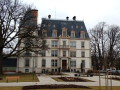
Admire the church on your right and pass to the left of the castle, which has become the new town hall.

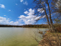
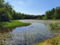
(7) Continue for 100 metres along the cycle path and turn left onto a footbridge crossing the canal. Turn right to go round the Étang des Forges, a superb spot in the heart of the town.
Turn right onto the third street, Rue de Montrobert, and return to the starting point (S/E).

Waypoints

  1. S/E : mi 0 - alt. 1,145 ft - Place du 18 Novembre in Grandvillars
  2. 1 : mi 0.21 - alt. 1,155 ft - Junction of Rue du Bois Lachat and Rue de Bellevue
  3. 2 : mi 0.63 - alt. 1,148 ft - Route de Froidefontaine
  4. 3 : mi 0.99 - alt. 1,188 ft - Barrier at the entrance to the forest road
  5. 4 : mi 2.13 - alt. 1,224 ft - Tarmac road
  6. 5 : mi 3.31 - alt. 1,135 ft - Roundabout and Place de la Résistance
  7. 6 : mi 3.4 - alt. 1,132 ft - Francovélosuisse cycle route
  8. 7 : mi 3.58 - alt. 1,135 ft - Old castle. New town hall. Close to the - Allaine (rivière)
  9. S/E : mi 4.11 - alt. 1,145 ft - Place du 18 Novembre in Grandvillars

Notes

Visorando was provided with information by Mr Chevalley, a volunteer at Balisage90, based on brochures published by the Sud Territoire community of communes.

Worth a visit

Notre Dame de Montrober:
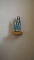
This is the cemetery chapel situated directly opposite the start and finish points of this walk. There you can admire
a magnificent 15th-century polychrome wooden statue of the Virgin Mary, listed as a historic monument.

Remarkable lime tree:
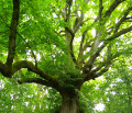
If you have a little time to spare, come and discover the remarkable lime tree situated beneath the Long Bois, below the old road to Delle. Over 400 years old, with a circumference of 5 metres, a height of 25 metres and a crown diameter of nearly 30 metres, this tree, which looks as fresh as ever, is sure to amaze you. To see it, after the checkpoint (7), continue along the cycle path and follow the signposts via the Chemin du Long Bois; before the junction leading to the pumping station, carry on for quite a while. The signposting is clear. The detour is 2 km there and 2 km back.

On your way to discover Grandvillars:
In Gallo-Roman times, the village was called Villario. It became Burgundian at the end of the 5th century, but it was not until the 12th century that the name Grand Villari first appeared. At that time, the lords of Grandvillars built the Château de la Motte.
Between 1330 and 1342, the walled market town and another fortified castle, owned by the House of Austria, were built.
In 1648, following the Treaty of Westphalia which brought the Thirty Years’ War to an end, the village became part of the province of Alsace and the Kingdom of France.
In 1787, the Peseux family, lords of Grandvillars, commissioned the architect Kléber to build a new château. This Château Kléber, now owned by the local council, has been restored (7). It has become the new town hall.
In 1848, the present church, dedicated to Saint Martin, was built by the architect Poisat de Belfort. On 18 November 1944, during fierce fighting for the liberation of the village, more than 500 shells fell on the village. Seven civilians were killed.
At the end of the 18th century, Grandvillars was a predominantly agricultural village. However, from the 19th century onwards – following the establishment of the forge under the leadership of Gaspard Barbaud as early as 1660 – and right up to the present day, it has become a major industrial centre.

Reviews and comments

5 / 5
Based on 1 review

Reliability of the description
5 / 5
Ease of following the route
5 / 5
Route interest
5 / 5
vero4400
vero4400

Overall rating : 5 / 5

Date of your route : Jan 22, 2024
Reliability of the description : ★★★★★ Very good
Ease of following the route : ★★★★★ Very good
Route interest : ★★★★★ Very good
Very busy route : Yes

I fell in love with the lovely little village of Granvillars thanks to this walk! It alternates between woodland and quiet roads, and takes you round the pond right in the heart of the town centre, where there are loads of ducks and coypu (I love these clever little creatures!). Perhaps not the best walk to do in very hot weather (as a good stretch of the route is exposed). And thank you!!!

Machine-translated

Other walks in the area

For more walks, use our search engine .

The GPS track and description are the property of this route's author. Please do not copy them without permission.