


Refine your search for walks in Santa Cecília de Voltregà
Santa Cecília de Voltregà walks


 Gorg Negre de Santa Cecilia de Voltregà
 Visorando Member
 5.53 mi
 +814 ft
 -814 ft
 3h 15
3h 15
 Moderate
 Departure from Santa Cecília de Voltregà (Barcelona)
This route is accessible to everyone. There are a few slightly steep sections that require some caution, but overall it is an easy hike. Keep in mind that you will cross the river about four times per trip. It takes about an hour to reach Gorge Negre.
Cabana Gorges circular loop starting from Pla de Niubo
6.42 mi
+873 ft
-886 ft
3h 45
Moderate
Departure from Campdevànol (Girona)
Here is an alternative route for exploring the Cabana Gorges if the official car park is full (especially in high season). The route climbs up the slope of the Torrent de Gausacs valley before descending into the Torrent de la Cabana valley, leading directly to the highest waterfall of the 7 Gorges of Campdevanol. Much of the outward journey takes place through pleasant, quiet woodland. The return journey allows you to enjoy the other waterfalls in the valley. There are no major difficulties, but some sections are narrow paths. Unlike the return journey, the ascent is barely signposted, but there is little risk of getting lost.
The Gorgs de la Cabana
4.98 mi
+656 ft
-676 ft
2h 50
 Easy
Departure from Campdevànol (Girona)
Easy
Departure from Campdevànol (Girona)
A spectacular hike in Southern Catalonia, along the Cabana stream, where seven magnificent waterfalls follow one another, forming seven natural pools of crystal-clear water… an irresistible invitation to take a dip.
Paid parking (€10)
The 3 Gorges of Planes d'Hostoles (Molí dels Murris, Can Poeti, Plana)
 4.83 mi
+282 ft
-282 ft
2h 30
Easy
Departure from les Planes d'Hostoles (Girona)
4.83 mi
+282 ft
-282 ft
2h 30
Easy
Departure from les Planes d'Hostoles (Girona)
Les Planes d'Hostoles is known for its gorges, natural pools where you can cool off in summer. Theaccess paths are well maintained and mostly easily accessible. Access is regulated: there is a charge and booking is compulsory (see the Practical Information section).
Short circular loop at Le Taga
4.65 mi
+2,306 ft
-2,306 ft
2h 10
Moderate
Departure from Ogassa (Girona)
A circular hike in Catalonia with an elevation gain of around 700 metres. The climb is steady from the start at the chapel to the summit of Taga. The distance is short, but the elevation gain and the steep gradient at the start make for a challenging hike. You need to set off very early in the morning between June and September, which allows me to be back by around 1 pm and means I don’t need to take a packed lunch. A small snack at the summit is enough.
Santa Margarida Volcano Loop, Fageda d'en Jordà, Croscat Volcano
7.28 mi
+1,112 ft
-1,119 ft
4h 20
Moderate
Departure from Santa Pau (Girona)
Between Olot and Santa Pau, this route takes you to three of the most visited sites in the Garrotxa Volcanic Zone Natural Park: the Santa Margarida volcano, the magnificent Fageda d'en Jorda beech forest, and the Croscat volcano.
Loop between Montagut and Pont del Llierca, via Sant Eudald and Planseslloses
 7.26 mi
+1,401 ft
-1,417 ft
4h 35
Moderate
Departure from Montagut i Oix (Girona)
7.26 mi
+1,401 ft
-1,417 ft
4h 35
Moderate
Departure from Montagut i Oix (Girona)
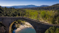
A circular route around the village of Montagut, where the first foothills of the Alta Garrotxa already offer some examples of Romanesque architecture. From the centre of Montagut, climb up to the church of Sant Eudald de Jou and then on to the oratory of Planselloses. You then descend towards the Pont del Llierca (where you can swim), passing under the Puig de l'Espigoler and Puig Sacreu, before returning to Montagut along the river.
The Puigmal d'Err
4.92 mi
+2,999 ft
-2,999 ft
4h 50
 Difficult
Departure from Err (Pyrénées-Orientales)
Difficult
Departure from Err (Pyrénées-Orientales)
A formidable and challenging climb, but still accessible despite the altitude of the summit. Thesecond highest peak in the Eastern Pyrenees offers an exceptional 360° panorama that is well worth the effort!
Puigmal d’Err – de Petit Sègre – de Llo – de Coma Dolça – Les Planes Mountain Hut
 10.13 mi
+3,839 ft
-3,848 ft
8h 00
Difficult
Departure from Err (Pyrénées-Orientales)
10.13 mi
+3,839 ft
-3,848 ft
8h 00
Difficult
Departure from Err (Pyrénées-Orientales)
A difficult and long mountain hike with no fewer than four peaks along the France-Spain border ridge. Passes by a charming hut and, after a very beautiful balcony path, leads to the pastoral refuge.
The section along the border ridge is absolutely stunning.
A GPX track on the app or a GPS is absolutely essential.
A hike best undertaken from late May until the first snows.
Part of the route is shared with one of my other hikes
Puigmal d'Err via Petit Puigmal de Segre
 6.05 mi
+3,136 ft
-3,110 ft
5h 30
Difficult
Departure from Err (Pyrénées-Orientales)
6.05 mi
+3,136 ft
-3,110 ft
5h 30
Difficult
Departure from Err (Pyrénées-Orientales)
A very tough climb to Petit Puigmal de Segre, then a steep final ascent to Puigmal d'Err via a ridge path. The descent after the summit is very challenging
There is a good path along the entire route. The border ridge crossing is beautiful.
I recommend having the GPX track on the app or on a GPS device. Fog and clouds on the day of the reconnaissance.This hike is best attempted from late May until the first snowfall.
Lamanère to Notre Dame du Coral
 Association / Club / Walk leader2.48 mi
+1,115 ft
-105 ft
2h 05
Moderate
Departure from Lamanère (Pyrénées-Orientales)
Association / Club / Walk leader2.48 mi
+1,115 ft
-105 ft
2h 05
Moderate
Departure from Lamanère (Pyrénées-Orientales)
A lovely walk up through the forest to the Ermitage de Notre Dame du Coral followed by lunch at the Auberge and the same walk back down to Lamanère.
Path of Remembrance in Lamanère
 Local authority3.62 mi
+784 ft
-761 ft
2h 20
Moderate
Departure from Lamanère (Pyrénées-Orientales)
Local authority3.62 mi
+784 ft
-761 ft
2h 20
Moderate
Departure from Lamanère (Pyrénées-Orientales)
This commemorative walk follows the route taken by Spanish refugees in 1939 after the fall of Barcelona.
You will pass through Pla de la Coma, where there is a commemorative plaque recalling the tragic events of that period. This walk is suitable for everyone and can be done in either direction.
St Christine’s Chapel in Lamanère
 2.60 mi
+627 ft
-604 ft
1h 45
Easy
Departure from Lamanère (Pyrénées-Orientales)
2.60 mi
+627 ft
-604 ft
1h 45
Easy
Departure from Lamanère (Pyrénées-Orientales)
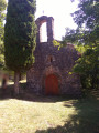
A lovely circular route through the forest, passing by the Capella Santa Cristina.
The first section up to the chapel is slightly uphill but is manageable for children aged 6.
Puig de Coma Negra from Lamanère
 9.13 mi
+2,779 ft
-2,772 ft
6h 35
Difficult
Departure from Lamanère (Pyrénées-Orientales)
9.13 mi
+2,779 ft
-2,772 ft
6h 35
Difficult
Departure from Lamanère (Pyrénées-Orientales)
A fairly challenging hike with a magnificent route along the border ridge.The walk starts from the southernmost village in France.The climb along the GRT83 (¹) towards the Col de Malrems on the border is very pleasant.Passes by the Capelle Santa Cristina.A good sense of direction is absolutely essential (rated as difficult). The route on the Visorando app or on a GPS is very useful. See the ‘Practical Information’ section.
The bench at the end of the world in Lamanère
 7.00 mi
+1,568 ft
-1,545 ft
4h 35
Moderate
Departure from Lamanère (Pyrénées-Orientales)
7.00 mi
+1,568 ft
-1,545 ft
4h 35
Moderate
Departure from Lamanère (Pyrénées-Orientales)
This hike is an opportunity to enjoy a picnic on a wooden bench while looking out over the Muga valley, from its source to its estuary in the Bay of Roses. Best done on a clear day to enjoy the view.
The Cabrenç towers starting from Lamanère
 8.04 mi
+1,952 ft
-1,932 ft
5h 25
Moderate
Departure from Lamanère (Pyrénées-Orientales)
8.04 mi
+1,952 ft
-1,932 ft
5h 25
Moderate
Departure from Lamanère (Pyrénées-Orientales)
Here is another classic hike starting from Lamanère: the three towers of Cabrenç. These signal towers, built in the 10th century, were used to warn of Saracen invasions from the sea. Magnificent views guaranteed.
Lamanère – Baget via the Col de Malrems
 10.39 mi
+3,438 ft
-3,438 ft
7h 45
Difficult
Departure from Lamanère (Pyrénées-Orientales)
10.39 mi
+3,438 ft
-3,438 ft
7h 45
Difficult
Departure from Lamanère (Pyrénées-Orientales)
This hike, which follows theGR®83, takes you from the southernmost village in France to a small, typically Spanish village that has been fully restored, via the Col de Malrems.
Pic Sec and Mir Tower from the Can Got forest hut (prats de mollo)
7.27 mi
+2,608 ft
-2,589 ft
5h 35
Moderate
Departure from Prats-de-Mollo-la-Preste (Pyrénées-Orientales)
A very beautiful circular on excellent, scenic trails, mostly through forest. Superb 360° view from the ridge, overlooking the Canigou massif, the peaks of Spain and the Costabonne.
Tours of Cabrenç from Serralongue
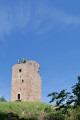 11.19 mi
+2,841 ft
-2,818 ft
7h 35
Difficult
Departure from Serralongue (Pyrénées-Orientales)
11.19 mi
+2,841 ft
-2,818 ft
7h 35
Difficult
Departure from Serralongue (Pyrénées-Orientales)
First, following the description, there is the Tower (signal tower), the Keep (garrison), then the Castle.Magnificent landscapes along the path connecting these buildings.- Do not underestimate this long hike. The GPX track will be a great help on this route with its many crossroads and junctions. The descent from the castle is very tricky.- There are many places and viewpoints from which to admire the landscape.- Short version options * in Practical Information.Classified as difficult because of the route between the tower, the keep, the castle and the descent from it.- The five fords ** may be problematic after heavy rain (observed on 15 June 2023).