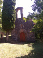
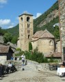
St Christine’s Chapel in Lamanère

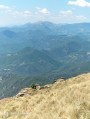
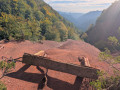
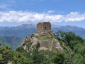
A lovely circular route through the forest, passing by the Capella Santa Cristina.
The first section up to the chapel is slightly uphill but is manageable for children aged 6.

Details

2425445
Creation:
Last update:
Last review:
  • Walking
    Activity: Walking
  • ↔
    Distance: 2.60 mi
  • ◔
    Average duration: 1h 45 
  • ▲
    Difficulty: Easy

  • ⚐
    Back to start: Yes
  • ↗
    Ascent: + 627 ft
  • ↘
    Descent: - 604 ft

  • ▲
    Highest point: 3,114 ft
  • ▼
    Lowest point: 2,552 ft

Photos

Description of the walk

From Le Boulou, take the D115 towards Céret, Amélie-les-Bains and Arles-sur-Tech. Before reaching Le Tech, turn left towards Serralongue and then Lamanère via the D44. Drive through Lamanère and park in the car park on the right, after crossing the Ribera de la Menera.

(S/E) Take the steps by the roadside opposite the car park and head up to the left (south-east). Follow the yellow markings.

(1) At the Sainte-Christine Chapel, cross the field to the right of the chapel (you’ll see a path) then follow the sign for “Lamanère” on the right.

(2) At the next junction, turn left.

(3) Cross the Còrrec del Prat d’en Battle, which is on your left.

(4) Please note: the path is blocked by barbed wire.
Back on the forest track, turn right and stay on it until the end of the walk. Ford the Ribera de la Menera via the concrete crossing. Continue along the Al Brousse track.

(5) At the second junction, turn right onto the tarmac road (Al Serrat d’els Rouills), GRT83.
At the junction, cross the bridge on the right. Follow the county road and return to the car park (S/E).

Waypoints

  1. S/E : mi 0 - alt. 2,552 ft - Car park
  2. 1 : mi 0.69 - alt. 3,110 ft - St Christine’s Chapel
  3. 2 : mi 0.8 - alt. 3,084 ft - Head left
  4. 3 : mi 1.34 - alt. 2,805 ft - Crossing a stream
  5. 4 : mi 1.39 - alt. 2,776 ft - Caution: barbed wire
  6. 5 : mi 2.27 - alt. 2,598 ft - Turn right at the fork.
  7. S/E : mi 2.6 - alt. 2,552 ft - Car park

Worth a visit

Reviews and comments

3.4 / 5
Based on 4 reviews

Reliability of the description
3.8 / 5
Ease of following the route
3.5 / 5
Route interest
3 / 5
User 29584979

Overall rating : 3.3 / 5

Date of your route : Jun 05, 2026
Reliability of the description : ★★★★☆ Good
Ease of following the route : ★★★☆☆ Average
Route interest : ★★★☆☆ Average
Very busy route : No

At point 4, I didn’t see the path blocked by barbed wire,

Be careful: the ford at Ribera de la Manera is very slippery; don’t be afraid to get your feet wet to avoid slipping......

Machine-translated

User 24216347

Overall rating : 2.7 / 5

Date of your route : Nov 18, 2025
Reliability of the description : ★★★☆☆ Average
Ease of following the route : ★★★☆☆ Average
Route interest : ★★☆☆☆ Disappointing
Very busy route : No

We consistently ended up on private land with video surveillance or electric fencing.

Machine-translated

Fulgur15
Fulgur15

Overall rating : 3.7 / 5

Date of your route : Nov 11, 2024
Reliability of the description : ★★★★☆ Good
Ease of following the route : ★★★★☆ Good
Route interest : ★★★☆☆ Average
Very busy route : No

A walk that takes place mainly in the woods; it’s certainly pleasant in summer, though a little less so in winter and in wet weather. Nevertheless, it offers a sense of tranquillity in unspoilt natural surroundings. Well worth doing for the sheer pleasure of it.

Machine-translated

kidiribererandonnées

Overall rating : 4 / 5

Date of your route : Aug 27, 2019
Reliability of the description : ★★★★☆ Good
Ease of following the route : ★★★★☆ Good
Route interest : ★★★★☆ Good

A nice little walk, easy to follow. No difficulties. Pleasant scenery
However, there is one slight downside: whilst walking through the pine forest, there were lots of small caterpillars that had fallen from their nests.

Machine-translated

Other walks in the area

For more walks, use our search engine .

The GPS track and description are the property of this route's author. Please do not copy them without permission.