Country:

 City:
City:


Start from the village car park.
Follow the signs for ‘Chemin de la Mémoire’, marked in yellow, walk no. 5.
(S/E) Follow the road out of the village, cross the bridge and turn left for a few dozen metres.
(1) Leave the road and take a path on your right: signposted ‘Col de Malrems’ and ‘Chemin de la Mémoire’. At the end of the path, cross the road and rejoin the path opposite, following the signs. This is the Col de Malrems path: marked with yellow No. 5 and red and white markings for the GRT83. You’ll reach the Pla de la Coma, where refugees were gathered before the descent to Lamanère. Take a moment to read the commemorative plaque marking these events, unveiled in 2022.
(2) Leave the path that continues towards the Col de Malrems and head down to your left, taking a small, stair-like path that leads you into the field. Pass between two pine trees and follow the yellow markings as you descend for about 50 metres towards a meadow and a stream below. This is a lovely spot to relax; you can take a break or have a picnic. A dead tree at the edge of the stream serves as a landmark to help you cross it. The path then climbs steeply: watch out for the barbed wire along the path between the trees. You’ll come to a track.
(4) Turn left and follow it to a field with a cow paddock.
(5) At the bend, facing this field, leave the track and turn left, heading uphill to a fence. Follow this fence; below, on your right, you’ll see the cow pen known as a ‘cornadis’. Looking towards this cow pen, you’ll see the Coma Negra rising up in front of you, marking the southernmost point of mainland France.
At the end of the fence, descend carefully. Leave the track on your left – which continues towards the house – and take the path opposite that leads into the bushes (yellow markings). This path descends slightly, so take care.
(6) At the end of the path, you’ll come out onto a track; turn left and follow it uphill until you reach a junction with a sign pointing to Lamanère on your right and a gate.
(7) Before heading downhill, look to your left for an unusual geological feature known as the ‘Mur du Géant’ (Giant’s Wall), consisting of an impressive wall made up of large boulders stacked one on top of the other. Then, ignore the track that continues to the right and head straight down the slope, following the yellow markings. This path winds its way through the bushes and rocks, so please take care. Continue to follow the yellow markings, which take you back to the left until you reach a fence blocking the path. Go through the fence and continue along the path, which leads onto a forest track.
(8) Caution: slippery and difficult descent. Use the rope to climb down, then turn left. Follow this track, pass a transformer and continue to the left as indicated. Walk for about 1 km until you reach a tarmac road.
(1) Carry on to the right towards the village, in the opposite direction to your outward journey, cross the bridge again and return to the car park (S/E).


 Association / Club / Walk leader
 Visorando Member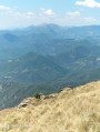
 Difficult
 Easy
Easy