


 Country:

 City:
City:


Park at the Can Toni car park.
(S/E) Navigate the hairpin bend to the left and continue along the wooded slope.
(1) Keep to the right at the junction and continue along the path which descends slightly before running along a balcony-like ridge overlooking the Ribera del Castell valley, passing an altitude of 973 metres.
(2) Take the path on the right to climb up the small valley parallel to the Ribera del Castell until you reach the bottom of the cirque. The path then climbs more steeply through woodland to reach the Pla del Castell, where it joins the GR® de Pays Ronde du Canigou.
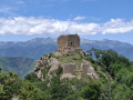
(3) Take a sharp right-hand bend to follow this GRP® route, which further on climbs in tight hairpin bends to reach the rocky ridge and the various sites of the Tours de Cabrenç: orientation table. Enjoy the sweeping panorama over the valley and the surrounding mountain ranges.
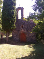
(4) Continue along the ridge, passing the first two towers on your right, then a third. You will then pass the foot of the Torre Alta de Cabrenç and the ruins of the feudal castle (1,292 m).
(5) Carry on to continue the descent along the signposted path. You’ll reach a crossroads.
(6) Turn right, leaving the GRP® markings behind, and follow the ridge of the Solana de les Torres, facing the valley from which you set out. Reach the Coll de Rastell.
(7) The path crosses over to the shaded slope (Bac de les Torres) and heads westwards to rejoin the track you started on. Follow it to the left for a few dozen metres to return to the Can Toni car park (S/E).
 Visorando Member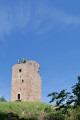
 Difficult
 Easy
Easy 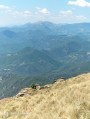
 Local authority
 Association / Club / Walk leader
