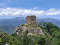
Ruta de les Tres Colades de Sant Joan les Fonts

A circular walk to explore the basalt cliffs formed by the cooling of lava flows from various volcanoes, and some areas of riparian forest with species of great botanical value. The route runs largely in the shade and alongside the river in the village of Sant Joan les Fonts, within the La Garrotxa Volcanic Zone Natural Park.

Details

n°58751336
Creation:
Last update:
Last review:
  • Walking
    Activity: Walking
  • ↔
    Distance: 3.47 mi
  • ◔
    Average duration: 1h 45 
  • ▲
    Difficulty: Easy

  • ⚐
    Back to start: Yes
  • ↗
    Ascent: + 135 ft
  • ↘
    Descent: - 138 ft

  • ▲
    Highest point: 1,184 ft
  • ▼
    Lowest point: 1,040 ft

Photos

Description of the walk

Travel to Sant Joan les Fonts via the A-26 and then the GI-522. Park in the car park on Carrer de Francesc Caula, near the old town centre.

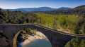
(S/E) Head to Plaça Major and walk towards the church along Carrer de Sant Antoni, then cross themedieval bridge to reach Carrer Sant Pere and the Ca l’Esquirolet tourist office.

(1) Take the path opposite the bridge, which climbs towards “Les Tres Colades towards Molí Fondo”.
Climb up and then down the steps to reach a small square with a viewpoint over Molí Fondo.
Steps on the right lead down to the foot of the Molí Fondo dam, where you can admire the waterfall up close and see the recently discovered volcanic tube.
Continue along the path down to Boscarró.

(2) Turn off onto the path that descends to the right towards the Boscarró viewpoint and the quarry.

(3)Head up to the right towards the Boscarró viewpoint and the Iberian settlement.
Walk around the Iberian settlement to return to the junction by the viewpoint.

(3) Continue straight ahead along the path you took on the way out until you reach the junction.

(2) Carry on straight ahead, heading west, towards the Fontfreda cliffs. Take the “Camí de Sant Joan les Fonts to Castellar de la Muntanya” straight ahead for 80 m.

(4) Take the path on the right at the bend towardsLes Fonts i Verlets. Follow the yellow markings to the Fontfreda cliffs. Carefully cross the River Bianya four times, wading across stony sections.
You will reach the access path to Sanandamaya and head up towards the Carretera del Camí Vell road.

(5) Take the road on the left towards Sant Joan les Fonts via the Canya volcano, until you reach the next junction.

(6) Turn right onto the Camí de les Molleres, heading south, and continue to a crossroads.

(7) Take the path on the left towards Font Freda, heading north-east. Passby the Font Freda fountain and continue along the path heading east. Follow a canal until you reach Carrer de Mas Marunys.

(8) Turn left onto the street and follow it until you reach the junction with Carrer del Castanyer.

(9) Continue along the road opposite, which runs alongside a picnic area, heading east towards the centre of Sant Joan les Fonts and its church.

(1) Cross the medieval bridge on the right, then take Carrer de Sant Antoni on the left to return to the car park where you started (S/E). 

Waypoints

  1. S/E : mi 0 - alt. 1,102 ft - Car park on Carrer de Francesc Caula
  2. 1 : mi 0.25 - alt. 1,086 ft - Ca l’Esquirolet Tourist Office – Signpost SJ12
  3. 2 : mi 0.34 - alt. 1,076 ft - Junction towards the Boscarró quarry
  4. 3 : mi 0.44 - alt. 1,043 ft - Boscarró viewpoint – Signpost SJ14
  5. 4 : mi 0.96 - alt. 1,102 ft - Camí de St Joan a Castellar de la Muntanya - SJ16
  6. 5 : mi 1.97 - alt. 1,168 ft - Carretera del Camí vell – Signpost SJ17
  7. 6 : mi 2.17 - alt. 1,158 ft - Junction of Camí de les Mulleres – Signpost SJ18
  8. 7 : mi 2.37 - alt. 1,165 ft - Font Freda Trail – Signpost SJ4
  9. 8 : mi 2.83 - alt. 1,119 ft - Junction of Carrer de Mas Marunys – SJ9 signpost
  10. 9 : mi 3.01 - alt. 1,125 ft - Carrer del Castanyer junction
  11. S/E : mi 3.47 - alt. 1,102 ft - Car park on Carrer de Francesc Caula

Notes

This route is particularly recommended in summer as, between points (4) and (5), the path is cool thanks to the river and its lush vegetation. The riparian forest is at its most magnificent. Caution! The section of the route starting from Fontfreda is not recommended in the event of heavy rain or when the River Bianya is in flood.

There is a fountain in the small park behind the church between points (1) and (2).

Worth a visit

Vall del Fluvià: three lava flows from different volcanoes in the region successively descended through this Fluvià valley. The flows followed the riverbeds before solidifying. Over the years, the river has deposited pebbles, sand and silt on each flow, which remained trapped beneath the subsequent flow.

Molí Fondo: thisartificial dam on the Riu Fluviàis also the name given to the former paper mill that gave rise to Torras Papel. At this site, three lava flows from different periods, deposited one on top of the other,canbe observed. The oldest (dating back some 600,000 years) originates from the Batet volcanoes.The second dates back to around 150,000 years ago and features a basaltic mosaic. Finally,the most recent (around 120,000 years old) comes from the Garrinada volcano in Olot. It allows visitors to observe the different shapes that lava takes on as it cools.

Iberian village of Boscarró: the volcanic rocks also contain archaeological remains. On this large esplanade, excavations have revealed the existence of an Iberian village that is unique in the Garrotxa region and in the inland areas of the province of Girona.

Fontfreda Cliffs:cleaned and restored in 1993, this site offers a different perspective on the solidified lava flow. The volcanic cliff here is spectacular.

Reviews and comments

5 / 5
Based on 1 review

Reliability of the description
5 / 5
Ease of following the route
5 / 5
Route interest
5 / 5
User 31590017

Overall rating : 5 / 5

Date of your route : Oct 19, 2026
Reliability of the description : ★★★★★ Very good
Ease of following the route : ★★★★★ Very good
Route interest : ★★★★★ Very good
Very busy route : No

An interesting route from a geological and historical point of view. Beautiful scenery.

Machine-translated

Other walks in the area

For more walks, use our search engine .

The GPS track and description are the property of this route's author. Please do not copy them without permission.