Country:

 City:


Access to the Nuria Valley is closed to cars. Visitors have two options: take the rack railway from Ribes or Queralbs stations (a 40-minute train journey from Ribes) or walk from Queralbs along a well-marked hiking trail (930 m elevation gain). The suggested walk is a return route, but it is possible to complete a circular route that leads to the Nuria mountain refuge: the trail is clearly visible, though the route is not signposted.
On arrival at Nuria station, take the cable car or the footpath to reach the start of the hike (alt. 2,120 m). It is situated right next to the mountain refuge.
(S/E) Follow the signs for Pic de l’Aliga. The path is clearly marked and the ascent is steady, covering the 300 m elevation gain to the peak (2,423 m).
(1) From this point, the hiking route is no longer signposted, but the path continues quite intuitively to the Pic de la Pala (alt. 2,473 m).
(2) Continue naturally along the path as it climbs towards the Puig de Fontnegra. The route first leads to the Collet de Fontnegra (alt. 2,665 m).
(3) Carry on for the final ascent, which is easy going, largely along the ridge, until you reach the Cim de la Coma del Clot, the highest point of the walk (alt. 2,741).
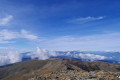
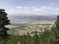
(4) From the summit, there is a stunning 360° panoramic view of the surrounding mountain ranges.
Turn back and follow the route in reverse down the ascent to (S/E).

 Visorando Member
 Difficult

 Easy