


Refine your search for walks in Saint-Allouestre
Saint-Allouestre walks
 Route from Kerguehennec to Bignan
 Visorando Member
 8.18 mi
 +318 ft
 -315 ft
 4h 00
4h 00
 Moderate
 Departure from Bignan (Morbihan)
Circular route starting from Bignan, including the Domaine de Kerguéhennec and, in particular, the Chapelle de la Trinité. This route is marked in yellow.
Route of the Landes de Lanvaux in Bignan
 7.83 mi
+719 ft
-745 ft
4h 15
Moderate
Departure from Bignan (Morbihan)
7.83 mi
+719 ft
-745 ft
4h 15
Moderate
Departure from Bignan (Morbihan)
A circular route starting from Bignan, crossing a rural landscape and moorland around the two large wind turbines in Bignan, then passing by the Sainte-Nolwenn fountain. This route is marked in yellow under the name "Circuit des Landes de Lanvaux".
Short circuit around the Sédon
 3.61 mi
+348 ft
-528 ft
1h 45
Moderate
Departure from Guéhenno (Morbihan)
3.61 mi
+348 ft
-528 ft
1h 45
Moderate
Departure from Guéhenno (Morbihan)
Starting from Guéhenno, famous for its monumental calvary, the route passes through several hamlets around the River Sédon, as well as through woods and along field edges. Most of the route is on paths and, occasionally, on a few quiet roads.
The Tarun Route starting from Locminé
 10.55 mi
+623 ft
-614 ft
5h 25
Moderate
Departure from Locminé (Morbihan)
10.55 mi
+623 ft
-614 ft
5h 25
Moderate
Departure from Locminé (Morbihan)
This route winds its way through forests and valleys, alongside the River Tarun. There is the option to shorten the route or take a detour via the ridges. A moment of tranquillity in a bucolic natural setting
Colpo - The Larcuste burial mounds
 5.20 mi
+200 ft
-207 ft
2h 35
5.20 mi
+200 ft
-207 ft
2h 35
 Easy
Departure from Colpo (Morbihan)
Easy
Departure from Colpo (Morbihan)
A short walk south of Colpo with varied scenery.
Short heritage trail in Josselin
 Association / Club / Walk leader
 1.97 mi
+148 ft
-135 ft
1h 00
Easy
Departure from Josselin (Morbihan)
1.97 mi
+148 ft
-135 ft
1h 00
Easy
Departure from Josselin (Morbihan)
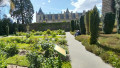
Take a stroll to discover what makes Josselin such a historic place. As you wander through the town's narrow cobbled streets, you can admire the many half-timbered houses, the oldest dating back to 1538, the churches and the castle (entrance fee). A very pleasant walk.
Along the Oust, from the Château de Josselin to the Chapelle Saint-Gobrien
 5.47 mi
+16 ft
-16 ft
2h 30
Easy
Departure from Josselin (Morbihan)
5.47 mi
+16 ft
-16 ft
2h 30
Easy
Departure from Josselin (Morbihan)
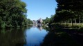
Dominated by the tall silhouette of the Château de Josselin, the River Oust is one of the sections of the Nantes-Brest Canal. This walk follows the shaded course of the river and leads to the charming Chapelle Saint-Gobrien.
Route from Saint-Gobrien to Guillac
8.85 mi
+279 ft
-289 ft
4h 20
Moderate
Departure from Guillac (Morbihan) (Morbihan)
A route offering beautiful green landscapes, partly near the Nantes–Brest Canal, which you follow along the GR® 37. Old chapels, churches and crosses also dot this route, which will undoubtedly give you a real change of scenery.
From La Chapelle Neuve towards the Floranges Forest
7.44 mi
+312 ft
-341 ft
3h 40
Moderate
Departure from La Chapelle-Neuve (Morbihan) (Morbihan)
Starting from La Chapelle-Neuve, home to the oldest chapel in the department, we invite you to discover the springs of all the neighbouring streams, some of which feature fountains, such as the one at Saint-Mamert near Locmaria. You will then walk through the Floranges Forest where, with a few short detours (not described below), there are three megalithic monuments to see.
Roh-Du Route
 Tourist office7.19 mi
+381 ft
-381 ft
3h 40
Moderate
Departure from La Chapelle-Neuve (Morbihan) (Morbihan)
Tourist office7.19 mi
+381 ft
-381 ft
3h 40
Moderate
Departure from La Chapelle-Neuve (Morbihan) (Morbihan)
In the heart of the Floranges state-owned forest, this route takes you to the Notre-Dame de la Fosse spring, the River Tarun, the Goyerdon stream and the Roh-Du dolmens. An immersion in the heart of nature and local history.
The Manéguen Route
2.57 mi
+420 ft
-427 ft
1h 35
Moderate
Departure from Guénin (Morbihan)
Set off to explore the Manéguen (or ‘White Mountain’ in Breton), a site rich in heritage. Here you will see the Chapel of Notre-Dame du Manéguen, the Chapel of Saint-Michel and the mysterious Stone of Sacrifice. The route also offers a superb view of the River Ével, a tributary of the Blavet.
The Goyerdon Route
1.47 mi
+151 ft
-151 ft
0h 50
Easy
Departure from La Chapelle-Neuve (Morbihan) (Morbihan)
Follow the Goyerdon stream for a peaceful stroll, accompanied by birdsong and the murmur of the clear water. Keep your eyes peeled… the Korrigans, mischievous Breton sprites, might well be hiding amongst the small granite boulders lining the path.
Route de la Colonne des Trente
5.28 mi
+230 ft
-249 ft
2h 40
Easy
Departure from Guillac (Morbihan) (Morbihan)
Set in the heart of the countryside, this route takes you along a number of easily accessible dirt tracks, small roads and a few grassy paths and sunken lanes on either side of the RN24.
Hedgerows between Monterblanc and Saint-Nolff
 3.94 mi
+341 ft
-341 ft
2h 05
Easy
Departure from Monterblanc (Morbihan)
3.94 mi
+341 ft
-341 ft
2h 05
Easy
Departure from Monterblanc (Morbihan)
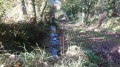
A short, very well-marked walk in the Vannes countryside. Highlights include: hedgerow landscapes, sunken paths, woodland, a bread oven, the little Saint-Amand Chapel, the hamlets of Grand Gillard and Scourboc, and the village of Monterblanc.
Bieuzy-Lanvaux
7.29 mi
+495 ft
-495 ft
3h 45
Moderate
Departure from Pluvigner (Morbihan)
A hike through forest and heritage: Lanvaux national forest, Saint-Mériadec chapel, Notre-Dame de Fatima aux Granges, the tomb of the seven holes and the forest pond.
The Roz Ponds
 2.32 mi
+112 ft
-112 ft
1h 10
Easy
Departure from Saint-Gérand (Morbihan)
2.32 mi
+112 ft
-112 ft
1h 10
Easy
Departure from Saint-Gérand (Morbihan)
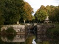
To the north-east of Pontivy, the Nantes–Brest Canal, on the River Douric, is fed by a series of ‘ponds’ which are in fact man-made basins designed to maintain a stable water level during lock operations.This route takes you past this succession of locks and ‘ponds’, passing by the Chapelle du Roz.A short, peaceful and tranquil walk along the water’s edge.
More walks in Saint-Allouestre
Select a point of interest below: