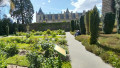
The canal bank and Sainte-Croix Church in Josselin

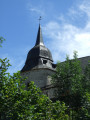
A walk along the banks of the canalised River Oust to explore Beaufort Island and its mill, as well as the austere ramparts of the Château des Rohan. After crossing the canal, a short climb leads to the Church of Sainte-Croix, the last remaining part of a priory founded in the 1050s–1060s by Josselin de Porhoët, founder of the castle and the town.

Details

23932185
Creation:
Last update:
Last review:
  • Walking
    Activity: Walking
  • ↔
    Distance: 2.03 mi
  • ◔
    Average duration: 1h 00 
  • ▲
    Difficulty: Easy

  • ⚐
    Back to start: Yes
  • ↗
    Ascent: + 49 ft
  • ↘
    Descent: - 49 ft

  • ▲
    Highest point: 154 ft
  • ▼
    Lowest point: 102 ft
  • ⚐ Country: France
  • ⚐ City: Josselin (56120)
  • ⚑
    Start/End: N 47.952777° / W 2.555108°
  • ❏
    IGN map(s): Ref. 0919SB, 1019SB
  • Hour-by-hour weather

Photos

Description of the walk

Park at the motorhome site on Rue Glatinier.

(S/E) Leave the car park, turn left, then left again onto Rue Glatinier and follow it to the first cul-de-sac on the left, Rue Beaufort. Turn into this street and follow it to the towpath and Beaufort Island.

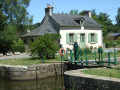
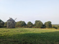
(1) Cross the lock footbridge to reach Île de Beaufort on the canalised section of the Oust and head straight towards the old Moulin de Beaufort (exterior view only; private property). Turn right and follow the path back to the towpath (lovely view of the lock keeper’s house).

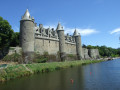
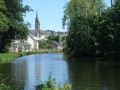
(1) Turn right and follow the canal, dominated by the towering silhouette of the bell tower of the Basilica of Notre-Dame du Roncier. Gradually, the high, austere walls of Josselin Castle come into view.

(2) Walk past the bridge over the canal, staying on the towpath, and continue to the water sports centre to get a general view of the exterior of the Château des Rohans. Retrace your steps back to the bridge.

(2) Cross the bridge and turn right into the first street, Rue de Caradec, walking past a hotel car park.

(3) Turn right into the cul-de-sac leading to Square du Tard and follow the path along the opposite bank of the canal. Carry on until you reach Rue de Caradec; follow this to the right until you come to a Fork in the road about a hundred metres further on. Take the sharp left-hand bend and head uphill towards the Church of Sainte-Croix, the last remaining part of a priory founded in the 1050s–1060s by Josselin de Porhoët, founder of the château and the town.

(4) Go through the small gate to cross the cemetery surrounding the church; note the wayside cross, then emerge onto a street opposite and continue to a flight of steps (not shown on the maps). Turn left to go down the steps and, at Rue de Caradec, turn right.
On this street, look out for some beautiful half-timbered houses (information panel).

(3) Carry on straight ahead to reach the bridge and cross it.

(2) Turn left onto the towpath, heading in the opposite direction to your outward journey, and, at the motorhome park, take the path on the right to access it (S/E).

Waypoints

  1. S/E : mi 0 - alt. 105 ft - Motorhome site, Rue Glatinier
  2. 1 : mi 0.25 - alt. 108 ft - Beaufort Island - Canal de Nantes à Brest
  3. 2 : mi 0.87 - alt. 105 ft - Bridge over the canal - Oust (rivière)
  4. 3 : mi 1.26 - alt. 108 ft - Junction on the Sainte-Croix Church circular loop
  5. 4 : mi 1.5 - alt. 144 ft - Sainte-Croix Church
  6. S/E : mi 2.03 - alt. 105 ft - Motorhome site, Rue Glatinier

Notes

Picnic tables on Beaufort Island and at Square du Tard.

Worth a visit

Beaufort Island: a small island on the channelled River Oust, the ideal spot for a picnic or a lie-in on a deckchair. The leafy setting and the ever-present water, closely linked to the mill, are perfect for relaxing.

Beaufort Mill.

Sainte-Croix Chapel.

Josselin Castle.

Reviews and comments

4.5 / 5
Based on 2 reviews

Reliability of the description
4 / 5
Ease of following the route
4.5 / 5
Route interest
5 / 5
Marie 22
Marie 22

Overall rating : 5 / 5

Date of your route : Apr 07, 2025
Reliability of the description : ★★★★★ Very good
Ease of following the route : ★★★★★ Very good
Route interest : ★★★★★ Very good
Very busy route : No

A very easy walk. No significant elevation gain. You need to return via the towpath to enjoy the view of Josselin Castle and the old town. A very enigmatic chapel – it’s a mystery why it’s divided into two parts.

Machine-translated

LA TURBALLE 44
LA TURBALLE 44

Overall rating : 4 / 5

Date of your route : Jan 22, 2024
Reliability of the description : ★★★☆☆ Average
Ease of following the route : ★★★★☆ Good
Route interest : ★★★★★ Very good
Very busy route : Yes

Is there a document detailing the full walking route along the Nantes–Brest Canal?
I haven’t been able to find one. I’ve only found sections…
Perhaps I haven’t looked properly…

Machine-translated

Other walks in the area

For more walks, use our search engine .

The GPS track and description are the property of this route's author. Please do not copy them without permission.