Saint-Claude route

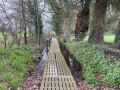
This peaceful walk takes you through woods, along the river and across meadows beside the Ével, starting from the ruined chapel of Saint-Claude. The route, which is shaded and flat, is ideal for families. You may spot roe deer, passerines and perhaps even a flock of mallards.
Not to be missed: the oak tree trunk incorporated into the chapel and the tranquillity of the woodland.

Details

106024097
Creation:
Last update:
Last review:
  • Walking
    Activity: Walking
  • ↔
    Distance: 4.08 mi
  • ◔
    Average duration: 2h 05 
  • ▲
    Difficulty: Easy

  • ⚐
    Back to start: Yes
  • ↗
    Ascent: + 246 ft
  • ↘
    Descent: - 233 ft

  • ▲
    Highest point: 292 ft
  • ▼
    Lowest point: 151 ft
  • ⚐ Country: France
  • ⚐ City: Remungol (56500)
  • ⚑
    Start/End: N 47.927004° / W 2.924561°
  • ❏
    IGN map(s): Ref. 0919SB
  • Hour-by-hour weather

Description of the walk

Park near the Saint-Claude Chapel.

(S/E) Walk round the chapel. Although in ruins, the chapel still retains some16th-century remains. You can admire a magnificent oak tree whose trunk forms one of the chapel’s pillars. Walk round the chapel, follow the embankment and enter a wooded area.

(1) At the river, turn right and follow the Ével, the river which gave its name to the commune of Evellys and which winds its way for over 55 km before flowing into the Blavet at Pont-Augan in Baud.

(2) At the road, turn left to cross the bridge. Immediately after the bridge, take the sunken path on the right to follow the river. Head up into the woods for 200 metres, then head back down towards the River Ével. After about 1 kilometre, head uphill to the left for 200 metres. Take a sunken path, then turn right before walking alongside a meadow. In the woods, turn right and go down a flight of steps to reach a small road.

(3) Follow the road to the left for 400 metres to return to the village of Saint-Claude. Head up to the right along a wide path, then turn slightly to the right onto an old sunken track lined with oak trees.

(4) At the end of the path, turn left for 150 m and then left again towards the village of Keroman.

(5) Carry on straight ahead; after the descent, at a bend, leave the farm track and enter the woods.

(6) Once you’ve passed through the woodland, follow a small stream to your left until you reach the farm track, which you’ll take on your right. After 150 m, turn left onto an old path through the undergrowth. Just before the junction, take the path that runs above the road. Head back down the road towards the River Ével. Cross the road bridge and you’ll come to a fork you passed on the way out.

(2) Cross the other bridge and turn right to return to your starting point via the same route you took on the way out (S/E).

Waypoints

  1. S/E : mi 0 - alt. 164 ft - Saint-Claude Chapel
  2. 1 : mi 0.18 - alt. 151 ft - Ével (rivière) - Affluent du Blavet
  3. 2 : mi 0.53 - alt. 154 ft - Pont St-Claude - Ével (rivière) - Affluent du Blavet
  4. 3 : mi 1.77 - alt. 220 ft - Route
  5. 4 : mi 2.27 - alt. 217 ft - Exit from the path
  6. 5 : mi 2.48 - alt. 292 ft - Keroman
  7. 6 : mi 2.87 - alt. 233 ft - Stream
  8. S/E : mi 4.08 - alt. 164 ft - Saint-Claude Chapel

Worth a visit

  • The Chapel of Saint-Claude: althoughin ruins, the chapel still retains vestiges fromthe 16th century. Despite its modest size, the building houses a seigneurial oratory opening onto the chancel to the north.
  • The River Ével:asmall, tranquil river, its waters are home to many species that you might spot along the way: grey wagtails, dragonflies and damselflies, or even the magnificent kingfisher. Keep your eyes peeled.
  • In the forest: it’snot uncommon to come across roe deer tracks, badger latrines or great spotted woodpecker holes. Look up and take the time to observe and listen to nature.

Other walks in the area

For more walks, use our search engine .

The GPS track and description are the property of this route's author. Please do not copy them without permission.