


Refine your search for walks in North Rhine-Westphalia
North Rhine-Westphalia walks


 Eignerbach Circular Walk
 Visorando Member
 4.63 mi
 +171 ft
 -180 ft
 2h 15
 Easy
 Departure from Velbert (Regierungsbezirk Düsseldorf)
This circular walk takes you through the Eignerbach area.
Attendorn Farm Track: ‘The Emergence of Attendorn’s Industry’
 Tourism professional1.85 mi
+33 ft
-33 ft
0h 55
Easy
Departure from Attendorn (Regierungsbezirk Arnsberg)
The Attendorn Industrial Trail enables a nuanced examination of industrial development in Attendorn. As a regional walking trail, it is designed to guide visitors past authentic sites that illustrate the economic character of the local landscape. The route passes through areas that reflect the architectural and infrastructural evidence of Attendorn’s industrial origins. This trail serves as an educational tool for illustrating the transition from a primarily agricultural structure to an industrial centre and fosters a sound understanding of the current socio-economic situation in the Olpe region. Walking this route thus offers a retrospective analysis of regional industrialisation.
Wild pastures on the outskirts of Hemer, Apricke
4.04 mi
+240 ft
-223 ft
2h 05
Easy
Departure from Hemer (Regierungsbezirk Arnsberg)
The former Apricke military training area in the Märkischer Kreis is now a refuge for rare animal species. Heck cattle, a breed modelled on the aurochs, and Dülmen horses, which resemble European wild horses, graze the land all year round. Their hardiness and frugality shape the landscape even during the winter months. From spring onwards, the area provides breeding grounds for specific bird species such as the meadow pipit, whinchat, tree pipit, yellowhammer and red-backed shrike. During the summer months, the distinctive calls of midwife toads can also be heard after dark.
Designed as a circular walk, this site offers insights into the ecological succession of a former military site and its current role as a valuable biotope.
Around Schlüchtern
3.38 mi
+587 ft
-571 ft
2h 05
Easy
Departure from Schalksmühle (Regierungsbezirk Arnsberg)
The regional A6 ‘Rund um Schlüchtern’ hiking trail in Schalksmühle showcases the diverse natural landscape of the Märkischer Kreis. The route leads through varied woodland areas and alongside tranquil streams, which are characteristic of the Sauerland. Hikers can expect a route that offers both relaxing sections and moderate inclines. The nature of the paths varies, creating a dynamic hiking experience that appeals to the senses. The scenic backdrop features a harmonious blend of dense greenery and open stretches, which continually offer new perspectives on the surroundings. The route is designed to allow for an in-depth exploration of the local flora and fauna. This walk represents a carefully planned opportunity to actively explore the region’s natural beauty.
Preußisch Oldendorf
4.25 mi
+417 ft
-440 ft
2h 20
Easy
Departure from Preußisch Oldendorf (Regierungsbezirk Detmold)
In Preußisch Oldendorf, the Wiehen Mountains are home to a number of circular walking routes. These routes lead through a landscape of gentle hills and offer sweeping panoramic views. Historic sites and nature reserves are accessible along the carefully signposted paths. The area offers a variety of options for walks and extended excursions, allowing visitors to experience the distinctive character of the Wiehen Mountains.
Walk through the Nieukerk Marsh
5.78 mi
+26 ft
-26 ft
2h 40
Easy
Departure from Kerken (Regierungsbezirk Düsseldorf)
The starting point of the A4 walk is at the car park on Dennemarkstraße in Nieukerk. From there, the route leads via the Loyendyck directly into the Nieukerker Bruch. A shelter, locally known as the ‘Rentnerbank’, offers a chance to rest along the way and take in the surrounding countryside. The route then heads towards Straelener Straße and continues via the Russenweg to the Neesendyck. There, on the left-hand side, lies the privately-owned Groenenhof estate. To the north of this, you cross the Gelderner Fleuth, after which the return journey to Nieukerk begins. Via the Fulkenbruchsweg, you link up with the Veenweg, which leads back to the starting point. You can then optionally explore the historic centre of Nieukerk, whose attractions can be discovered through the information provided.
Walk through the Aldekerker Bruch
5.52 mi
+23 ft
-23 ft
2h 35
Easy
Departure from Kerken (Regierungsbezirk Düsseldorf)
The A3 walk through the Aldekerker Bruch offers an opportunity for contemplation amidst unspoilt countryside. This regional circular walk is characterised by a diverse range of flora, with striking pollarded willows and an abundance of wildflowers and herbs defining the scenery along the route. The unique atmosphere of the German-Dutch border region between the Rhine, Waal and Meuse rivers fosters deep relaxation and promotes a sense of well-being.
Short loop with views of the Volme, Dahlerbrück
1.61 mi
+318 ft
-322 ft
1h 00
Easy
Departure from Schalksmühle (Regierungsbezirk Arnsberg)
The A10 ‘Kleine Runde mit Volmeblick’ is a regional walking trail that winds its way through the characteristic landscape of the Märkischer Kreis. This path offers walkers unique perspectives on the Volme Valley and its natural surroundings in Schalksmühle. The carefully designed route allows walkers to immerse themselves in the local flora and fauna, whilst experiencing a harmonious interplay of woodland sections and open vantage points. The route is designed to reflect the region’s topographical features whilst offering both relaxation and an experience of nature. The views of the Volme, nestled amongst the rolling hills, are a defining feature of this tour and invite you to explore the scenic diversity of this area. The route is characterised by its manageable nature, which encourages a deep appreciation of the surroundings and provides a comprehensive insight into the region’s distinctive features.
Around Voerde, Ennepetal
4.13 mi
+397 ft
-387 ft
2h 15
Easy
Departure from Ennepetal (Regierungsbezirk Arnsberg)
The circular walking route around Ennepetal-Voerde begins and ends at the fairground. The route leads through Lindenstraße, along Friemannweg and via Vilvoorder Straße into the rural surroundings featuring fields, hills, farmsteads and wooded hillsides. Further stops include Störringen, Gut Braband and the Ferdinand Bilstein site. The circular route then leads back to the starting point.
To the left and right of the Heilenbecke, Ennepetal
5.13 mi
+702 ft
-702 ft
3h 00
Easy
Departure from Ennepetal (Regierungsbezirk Arnsberg)
The regional walking route “Left and Right of the Heilenbecke” is a circular walk from Uhlenbart via Rüggeberg, the Heilenbecke Dam, Ravenschlag and Wittenstein back to the starting point. Dense forests, meadows, quiet woodland paths and views of the Bergisch landscape characterise the route. The historic village of Wittenstein adds a touch of regional history to the scenic impressions.
Airy heights and babbling brooks, Ennepetal
9.16 mi
+1,148 ft
-1,135 ft
5h 15
 Moderate
Departure from Ennepetal (Regierungsbezirk Arnsberg)
The partly redesigned circular walk offers views of the Heilenbecke valley and two of its tributaries. At the start, the walk follows the Heilenbecker-Hangweg with virtually no incline. Other stops along the route include the village of Wittenstein with its old half-timbered houses, the Grimmelsberg and the Königsfeld spa clinic.
Circular route towards Kutenhard and Reinartzhof
 12.60 mi
+656 ft
-650 ft
6h 20
 Difficult
Departure from Roetgen (Cologne Government Region)
Set off to explore the North-Eastern Hautes Fagnes plateau from Roetgen, where the Vesdre, Eschbach and Steinbach rivers flow, feeding the northern branch of the Eupen Dam – which serves as both a drinking water reservoir and a hydroelectric power station. Kutenhard is the area of the Fagnes where the Eschbach has its source. The Steinbach, a tributary of the Eschbach which you will cross twice, rises a little further east in the Imgenbroicher Venn. Forests, heathland and peat bogs form the main theme of this circular walk. Reinhartzhof is a former hamlet consisting of a few farms, situated on the pilgrimage route between Trier and Aachen. First mentioned inthe 14th century, it was forced to cease its livestock farming activities to preserve water quality following the construction of the Vesdre dam. The Vesdre diversion canal serves the same purpose: to protect water quality should pollution be detected in the built-up area of Roetgen.
Circular at Rursee
 13.84 mi
+1,886 ft
-1,893 ft
8h 00
Difficult
Departure from Simmerath (Cologne Government Region)
The hike takes you on a long tour of the Obersee, the central part of the Rursee complex, which consists of three stepped lakes and three dams. The Obersee is located between the Urftsee and the Rursee itself.Located in the heart of the Eifel National Park, the Rursee guarantees magnificent landscapes. In addition to lakes and forests, this hike takes you through moorland to the ghost village of Wollseifen, with its St. Roch Church and school museum.Located near the large Nazi elite training centre in Volgelsang, Wollseifen was heavily damaged by bombing during the Second World War and then completely razed by the British army to make way, just after the war, for the Vogelsang military training camp, which,since the withdrawal of British and then Belgian troops from Germany, has been converted into a memorial centre.
Luisenpfad adventure trail
 1.58 mi
+325 ft
-299 ft
1h 00
Easy
Departure from Neunkirchen (Regierungsbezirk Arnsberg)
A beautiful family trail with interactive stations such as a wooden organ or basketball hoop, plenty of seating and sweeping views, which leads along a mixture of beautiful narrow paths and slightly wider trails.
Muttental Mining Circular Walk
 6.32 mi
+653 ft
-636 ft
3h 30
Moderate
Departure from Witten (Regierungsbezirk Arnsberg)
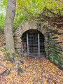
The historic Muttental Mining Circular Walk passes not only the Hardenstein Castle ruins on the banks of the Ruhr but also the Nachtigall Colliery. Here you’ll find a museum with an interesting exhibition.
Kölner Weg - Stage 17 - Rottbitze, Siebengebirge, Drachenfels, Königswinter
 Association / Club / Walk leader12.61 mi
+1,007 ft
-1,870 ft
6h 40
Moderate
Departure from Bad Honnef (Cologne Government Region)
The last stage of the Cologne Trail will remain unforgettable for many hikers. On its long journey from Cologne through the Bergisches Land and the Westerwald, the Cologne Trail leads to Himmerich, which offers wonderful views. After that, the trail approaches its last and perhaps most beautiful sections. We wander along beautiful forest paths through the Siebengebirge and can make a detour to the Löwenburg. Finally, we visit the Drachenfels and hike through the famous Nachtigallental valley to Königswinter.
Kölner Weg – Stage 6 – Leuscheid, the Beulskopf and Marienthal Monastery
8.71 mi
+955 ft
-1,125 ft
4h 50
Moderate
Departure from Windeck (Cologne Government Region)
The section between Leuscheid and Marienthal Monastery offers many highlights. We hike through a hilly landscape on a wide, tree-lined path. Again and again, new and surprising views open up before us. Behind Ehrentalsmühle, we have a slightly longer climb through the forest to Ückertseifen, but we are rewarded for our efforts with a view of the Hammer Ländchen. Passing the Wunderbuche (miracle beech) near Birkenbeul, we finally climb the Beulskopf with the Raiffeisen Tower. Along the edge of the forest, we pass Hilgenroth, reach another beautiful forest and finally Marienthal with its former monastery.
Kölner Weg - Stage 5 - From the Siegtal valley to the Leuscheid ridge
6.28 mi
+1,257 ft
-571 ft
4h 00
Moderate
Departure from Windeck (Cologne Government Region)
On this hike, we leave Herchen on the Höhenweg trail above Siegtalstraße. On narrow paths and through deep gorges, over narrow bridges and through numerous hairpin bends, we hike high above the Sieg to Herchen railway station. Here we cross the Sieg and climb uphill again. Soon we find ourselves high above the river again. We have to tackle another steep climb before we reach Schneppe. On the way to Kuchhausen, we can make a detour to an impressive basalt crater. The hike ends in Leuscheid.
Kölner Weg – Stage 4 – Via Nutscheid to Herchen/Sieg
10.75 mi
+801 ft
-1,198 ft
5h 40
Moderate
Departure from Ruppichteroth (Cologne Government Region)
This section of the Cologne Trail differs significantly from the previous sections. In Winterscheid, we reach the heights of the Nutscheid and only have one climb to tackle before reaching Altenherfen. We walk along wide forest paths and enjoy magnificent views of the mountains beyond the Siegtal valley, the Westerwald and the Siebengebirge mountains. Only after Altenherfen does the Cologne Trail descend into the valley, before we have to climb steeply again behind Rieferath. Our varied hike ends in Herchen, a climatic health resort in one of the most beautiful spots in the Siegtal valley.
Kölner Weg - Stage 3 - From the Agger through the Naafbach Valley to Winterscheid
10.38 mi
+1,398 ft
-906 ft
6h 00
Moderate
Departure from Lohmar (Cologne Government Region)
This route first takes us into the dreamy Naafbach Valley. On ascending paths, we cross Deesem, enter a large forest area, hike to the Wahnbach and reach Neunkirchen. There, the Church of St. Margareta is worth a visit. Via Ingersau, we reach the Bröltal valley. Behind Winterscheiderbröl, we tackle another strenuous climb before arriving at St. Servatius Church in Winterscheid.
About the Hoppenbruch and Hoheward spoil heaps
 6.03 mi
+525 ft
-499 ft
3h 15
Moderate
Departure from Gelsenkirchen (Regierungsbezirk Münster)
On this walk, you’ll experience the traces of mining at the Hoppenbruch and Hoheward spoil heaps, as well as on the site of the former Ewald colliery, first-hand.
Kölner Weg - Stage 2 - From the Sülztal valley via the Lüderich to Kreuznaaf
11.36 mi
+1,243 ft
-1,306 ft
6h 20
Moderate
Departure from Rösrath (Cologne Government Region)
We hike along beautiful paths over the Lüderich, which has an eventful mining history, pass the winding tower of the Franziska shaft and skirt Hoffnungsthal. Later, we pass a grain distillery in Hofferhof, hike through the valley of the Kupfersiefer Bach and reach a viewpoint behind Oberschönrath with a view of the Cologne Bay and the Siebengebirge mountains. Via the Gammersbacher Mühle mill and the picturesque half-timbered village of Muchensiefen, we reach Kreuznaaf on the Naafbach stream.
The Cologne Trail
162.66 mi
+16,781 ft
-16,804 ft
17 days
Moderate
Departure from Cologne (Cologne Government Region)
The long-distance hiking trail opens up the Königsforst, the southern Bergisches Land, leads through the Westerwald to the monasteries of Marienthal and Marienstatt and into the Kroppacher Schweiz, one of the most charming areas of the Westerwald. We hike through Hachenburg and the Hoher Westerwald and reach the highest point of the Cologne Trail at 567 metres on the Marienberger Höhe. An impressive basalt park near Bad Marienberg and the Stöffel Tertiary Industry Adventure Park near Stockum-Püschen explain the importance of basalt mining. We will be transported to the unique cultural landscape of the Westerwald Lake District near Dreifelden and pass through Metteshahner Schweiz to Neustadt (Wied). On the last section, we will hike to the Drachenfels and Königswinter.
Kölner Weg - Stage 1 - Rath-Heumar through the Königsforst to Rösrath-Sülze
9.56 mi
+591 ft
-482 ft
4h 55
Moderate
Departure from Cologne (Cologne Government Region)
Königsforst is the name of the stop where tram line 9 ends in Cologne-Rath-Heumar, and this is where the Cologne Trail begins. The markings for the Cologne Trail, a white K on a black mirror, which we see for the first time at this point, will guide us safely through the southern Bergisches Land and the Westerwald for 253 kilometres to Königswinter.
We first stroll through a park-like landscape, then through unspoilt forest. On wide, gently ascending paths, we pass a water treading pool, the Kaisereiche oak tree and cross the former Bensberg-Rösrath railway line, hiking through the quiet Wahlbach valley until we reach Lehmbach and Sülze via the Tütberg.
7. Stage Natursteig Sieg: Herchen–Schladern
 Tourist office11.40 mi
+1,965 ft
-1,886 ft
6h 55
Moderate
Departure from Windeck (Cologne Government Region)
Up close and personal with the Sieg
A varied tour with numerous scenic highlights and sights. The seventh stage is a little more strenuous than its predecessors, but very adventurous. Over hill and dale, up and down, with magnificent views of the Sieg river and Windeck Castle.
• Beautiful routes along the Sieg
• Adventurous route along many narrow paths, otherwise riverside, forest and meadow trails
• Finish at the Sieg waterfall in Schladern
Around the Dhünn Dam
 13.73 mi
+1,440 ft
-1,444 ft
7h 35
Moderate
Departure from Odenthal (Cologne Government Region)
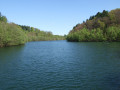
This tour takes you around the Dhünn Dam, Germany’s second-largest drinking-water reservoir, in the Bergisches Land.The Bergisches Land does not take its name from its landscape, as one might suppose, but from its former rulers, the Dukes of Berg.
Herbringhauser Acht
 9.71 mi
+817 ft
-794 ft
5h 10
Moderate
Departure from Remscheid (Regierungsbezirk Düsseldorf)
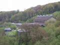
This walk starts in Remscheid-Lüttringhausen, near the A1 motorway, crosses the Herbringhausen Dam, follows the Herbringhausen Stream to the River Wupper and back, circles round Herbringhausen, then follows a figure-of-eight route back up to the dam and returns to the starting point. Parts of the route follow the Röntgenweg and the Wuppertal Circular Walk.
Through the Muttental and Bommerholz to the Mining Trail
 10.15 mi
+915 ft
-935 ft
5h 30
Moderate
Departure from Witten (Regierungsbezirk Arnsberg)
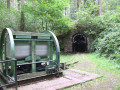
The route takes you through Muttental and Bommerholz, partly along the so-called Mining Trail, which offers small, museum-like insights into mining, down to the Hardenstein ruins on the River Ruhr and back to the starting point.
Bergisch Panoramasteig, Stage 2
 11.95 mi
+1,545 ft
-1,762 ft
6h 50
Moderate
Departure from Kürten (Cologne Government Region)
From Biesfeld around the Wiesenberg, via Hommerich to Oberheiligenhoven at the LVR Lindlar Open-Air Museum.
Through the Siebengebirge
 7.90 mi
+1,844 ft
-1,841 ft
5h 15
Moderate
Departure from Königswinter (Cologne Government Region)
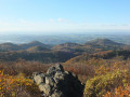
A lovely circular walk through the Siebengebirge, with plenty of trails, from Margarethenhöhe over the Großer Ölberg, past the Rosenau and Milchhäuschen, over the Schellenberg and Geisberg, past Jungfernhard, over the Erpelntalskopf to Löwenburg and back to Margarethenhöhe. A must for walkers who enjoy plenty of woodland and distant views.
Westruper Heide, Haard near Haltern am See
 12.09 mi
+518 ft
-531 ft
6h 00
Moderate
Departure from Haltern am See (Regierungsbezirk Münster)
A walk through the Westruper Heide, a nature reserve and Westphalia’s largest area of dwarf shrub heathland near Haltern am See, and through parts of the Haard, a hilly landscape of sandstone in the Hohe Mark Nature Park, north of Recklinghausen.
Rosenau – Großer Ölberg – Nachtigallental
10.89 mi
+1,532 ft
-1,558 ft
6h 20
Moderate
Departure from Königswinter (Cologne Government Region)
In the Siebengebirge, the route runs from Oberdollendorf via the Rosenau ruins and the Großer Ölberg, past the Milchhäuschen and Drachenburg, through the Nachtigallental to Königswinter and back along the Rhine to Dollendorf.
More walks in North Rhine-Westphalia
Select an area below: