


 Country:
 City:
City:


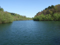
The start and finish of the tour is a hiking car park near Neschen Eichholz, on the Eichholzer Weg as you leave the village.
(S/E) The walk begins at the car park behind Eichholz on the A2, as you leave the village. At the second opportunity, we turn left onto the D8, which winds its way through a wooded area. After a while, we come to the Wasserroute, which we follow to the right.
(1) We reach the dam, cross it and, on the other side, follow the Wasserroute to the left until we reach the next road. Here, we turn right. Passing through the hamlet of Lindscheid, we follow the D1 to the right and soon leave the village behind. After the car park at the end of the village, we continue straight on and arrive at Grünenbäumchen. In the village, we keep to the left and walk until the second opportunity to turn right.
(2) We reach the entrance to Engerfeld and follow the road to the right. We soon reach Ketzbergerhöher and pass the Hindenburg Tower. Just under 500 metres after the tower, we turn right and continue along the D1 and D2 until the next junction.
(3) The D1 continues straight ahead. However, we leave it here by turning left and follow the D2 to the second junction.
(4) Here, at the Frenkhauser Bach, we turn right and continue to follow the D2. At the next junction, we turn left. Then, at the next junction, we turn right onto the D3. We now follow the D3 until we meet the D4.
(5) At the Kleine Dhünn weir, we follow the D4 to the right and cross another dam. At the fork at the end of the dam, we turn left and continue on the D4 until we reach the country road at Unterberg.
(6) Once we reach Unterberg, we need to turn right. We carry on straight ahead along the tarmac path at the edge of the forest and follow the path. We now stay on the tarmac path until it turns into a gravel track. Shortly after a left-hand bend heading east, we leave the gravel track to the right and take a path into the woods. After a while, we come across the Bergischer Panoramasteig. Here, we turn right and then immediately left again.
(7) We reach the Große Dhünn weir, cross it and, on the other side, turn left and then sharply right again. We follow the path until we come to the ‘K, Rund um Kürten’ sign. There, we turn right.
(8) We arrive at the Hutsherweg car park, turn right onto the A3 and continue along the D5 for approx. 1.5 km, then leave the D5 by turning right and stay on the A3. Soon we cross the Oberstockberger Bach.
(9) At Königsspitzer Straße, we turn right and then left at the next junction, continuing to follow the D6 and the K until we reach Richerzhagen.
(10) At the end of the main road through Richerzhagen, we leave the D6 and the K and follow the Bergisches Panoramasteig to the left. We then keep to the right twice, leave Richerzhagen and take the next left, where we join the A2 and then the K again. We reach a country road, turn left, go down a flight of steps and continue on the A2, following the country road.
(11) At the car park behind the Hohemühle forebay, we turn right into the woods. We now follow the K again. At the first cross-path, we turn right. From here, we follow the K for about one kilometre, until the track joins the narrow country road known as Große Heide. We then continue for about 200 metres through an S-bend until we reach the back of the copse.
(12) Here, we leave the Große Heide to the right, walking along the edge of the wood. We now follow the Talsperrenweg for about 1.3 km, then continue straight on to join the Höhenroute. We follow this to the village of Eichholz, turn right onto Eichholzer Weg and, on leaving the village, return to the starting point
(S/E).
 Visorando Member

 Association / Club / Walk leader
 Tourism professional
 Easy
Easy 
