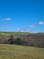
Eignerbach Circular Walk

This circular walk takes you through the Eignerbach area.

Details

n°61506653
Creation:
Last update:
Last review:
  • Walking
    Activity: Walking
  • ↔
    Distance: 4.63 mi
  • ◔
    Average duration: 2h 15 
  • ▲
    Difficulty: Easy

  • ⚐
    Back to start: Yes
  • ↗
    Ascent: + 171 ft
  • ↘
    Descent: - 180 ft

  • ▲
    Highest point: 830 ft
  • ▼
    Lowest point: 679 ft

Photos

Description of the walk

Start: We park in the paid visitor car park at the Kleine Schweiz restaurant, Wimmersberger Str. 125, 42553 Velbert.

(S/E) From the car park, we follow the Eigenerbach circular walk, initially passing the restaurant.

(1) Then turn right and walk uphill along the stream, following the winding path. Follow the circular walking trail to the junction at the edge of the wood, just before the Heiderhofbach.

(2) Keep to the left before the Heiderhofbach and continue to follow the circular walk.

(3) At the end of the path, at the edge of the forest, keep left and continue to follow the Eignerbach circular walk. It winds through moorland and pond landscapes.

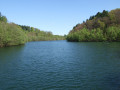
(4) At the fork at the edge of the forest, keep left and continue to follow the circular walking trail along the Schlammteich. The path circles the Schlammteich all the way round.

(5) At the end of the Schlammteich, turn left and continue along the circular walk.

(6) When you reach the end of the Schlammteich, keep left at the fork in the woods and continue to follow the circular walking trail. The circular walking trail leads through the woods and runs parallel to Rützkausener Straße.

(7) At the end of the woodland, there is a fork in the path. Keep left here and continue along the circular walk back into the woodland until you reach the Eignerbach stream again.

(1) You’ll reach the junction from the outward journey again; this time, carry straight on.

(S/E) You’ll then soon arrive at the Kleine Schweiz restaurant and the restaurant’s visitor car park.

Waypoints

  1. S/E : mi 0 - alt. 689 ft - Restaurant Kleine Schweiz visitor car park
  2. 1 : mi 0.13 - alt. 725 ft - Joint junction, outbound and return routes
  3. 2 : mi 0.81 - alt. 784 ft - Junction at the Heiderhofbach
  4. 3 : mi 1.2 - alt. 787 ft - End of the trail at the edge of the forest
  5. 4 : mi 1.94 - alt. 781 ft - Fork in the path at the edge of the forest
  6. 5 : mi 2.32 - alt. 791 ft - Junction at the end of the mud pond
  7. 6 : mi 3.04 - alt. 804 ft - Junction at the end of the mud pond
  8. 7 : mi 4.04 - alt. 715 ft - Fork in the path at the end of the forest
  9. S/E : mi 4.63 - alt. 686 ft - Restaurant Kleine Schweiz visitor car park

Notes

You can also find this walk on our blog.

Worth a visit

(S/E) There is a charge for parking at the restaurant. If you wish, you can also stop for a bite to eat at the restaurant.

Reviews and comments

5 / 5
Based on 1 review

Reliability of the description
5 / 5
Ease of following the route
5 / 5
Route interest
5 / 5
User 27565538

Overall rating : 5 / 5

Date of your route : Sep 07, 2025
Reliability of the description : ★★★★★ Very good
Ease of following the route : ★★★★★ Very good
Route interest : ★★★★★ Very good
Very busy route : No

the circular route, which is on very well-maintained paths, was used as a running track yesterday!
It's great to see how many people also use this circular route as a training route.

Machine-translated

Other walks in the area

For more walks, use our search engine .

The GPS track and description are the property of this route's author. Please do not copy them without permission.