


 Country:
 City:
City:


(Start/Finish) The start and finish point is a small car park, St. Augustiner Platz, on Heisterbacher Straße in Oberdollendorf, Königswinter, on the Rhine.
We set off uphill towards the north-east, curving to the left past St. Laurentius Church, then turn left onto Cahn’s Berg and, at the next junction, right into Mühlental, onto the Rheinsteig access path at Niederdollendorf. From here, continue straight on through Mühlental. We follow the Rheinsteig access path until we reach Heisterbacher Straße.
(1) We cross the road and continue on to Heisterberg Monastery. In front of the monastery, we turn right and follow the path along the monastery wall. After about 200 metres, the path continues southwards and we move away from the monastery until we reach a wider gravel track, which we follow to the left (south-east).
(2) We follow the gravel track to the first junction, where we take the second path on the right. We follow this path straight on, past the Waidmannsruh rest house, until we reach the next fork.
(3) Here, we turn slightly to the right towards Rosenau, which we reach after about 300 metres. After walking around the castle ruins, we continue to follow the B1 Beethoven Walking Trail.
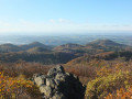
(4) At the next junction, we carry on straight ahead, follow the bend to the left and, after about 70 metres, leave the gravel track to the right onto a footpath. We follow the path until we come back onto a gravel track. After a further 90 m, we take the second option to the left and follow the footpath up to the viewing terrace on the Großer Ölberg. We reach this by turning right once and then immediately left again.
(5) On the way back down into the valley, we turn right onto a path heading south. We head south for about 200 m and reach Margarethenhöhe, where we cross Königswinterer Straße straight ahead.
(6) We come to Löwenburger Straße, which we follow for about 140 m before turning right onto a gravel track. After a right-hand bend, this track heads west. At the next set of five signposts, we keep slightly to the left. About 150 m further on, at the next five-way junction, we turn right (west) and head west for about 1.8 km, following the signs to the Milchhäuschen.
(7) Behind the Milchhäuschen, we turn left onto the Beethoven Wanderweg and, a few metres further on, follow the path to the right. We stay on the Beethoven Wanderweg for another 1 km and then leave it via a path to the right, heading down to Drachenfelsstraße.
(8) We cross Drachenfelsstraße and, a few metres further on, leave it to the right, heading steeply downhill to the Burghof. At the Burghof, we follow the path to the left, pass under the rack-and-pinion railway, turn right and continue downhill past Drachenburg Castle.
(9) Behind Drachenburg Castle, we turn right, go down a few steps and this time cross over the rack railway. We then turn right and immediately left again into Nachtigallental.
(10) We now walk through the whole of the Nachtigallental valley, keeping to the stream the whole way. We cross the B42 and arrive in the town of Königswinter on Bahnhofsstraße. We follow the road across the tracks and come out onto the main road. Here we walk a few metres to the right and then left again into Clemens-August-Straße, until we cross the tram tracks and follow the path to the right along the Rhine until we automatically come onto Godesberger Straße in Niederdollendorf.
(11) We walk up Godesberger Straße until we reach the main road. Here we turn left and then right again at the next junction, into Heisterbacher Straße. We then follow Heisterbacher Straße until we return to our starting point. (Start/Finish)
 Visorando Member
 Difficult
 Association / Club / Walk leader
 Tourist office
