Country:
 City:
City:


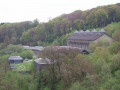
The start and finish of this tour is a small car park at Olper Höhe, between house number 2 and the motorway bridge.
(S/E) We set off in a south-easterly direction along a gravel path into the woods. At the next junction, turn left, past a pond, then left again. After a few metres, we cross Olper Höhe road and continue straight on into the small residential area of Olper Höhe.
(1) In Olper Höhe, just past the houses at the right-hand bend, we leave the road to the left onto a gravel path into the woods, on the A5. We follow the path until we reach the country road.
(2) At the road to Windgassen, we cross the country road and walk past the Windgassen farm, continuing on to the next crossroads. There, we turn right and then go straight on to the dam wall of the Herbringhausen Reservoir. Behind the dam wall, at the junction, we walk straight on along the A3, past the waterworks. Then into the woods.
(3) We reach the junction by the Herbringhauser stream and walk straight on, switching to the A4; we soon cross a car park and Herbringhausen Road. Beyond the road, we continue following the A4.
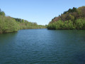
(4) We come to a fork by the Herbringhauser Bach, where we keep to the left and leave the A4. We carry on to a small dammed lake or pond. There, we switch to the parallel path on the right, ‘Rund um Wuppertal’, and continue northwards.
(5) Just before the Wupper, we turn left onto the A1. We follow the A1 to the left, keep to the right at the fork and leave the A1 again at the next fork by continuing straight ahead. After about 700 m, we come to a fork where we keep to the right. We now follow the gravel path until we briefly leave the so-called Welbernbusch.
(6) Behind the Welbernbusch, we keep to the left until we disappear back into the woods on the A4 at the shelter. A few steps further on, the path runs along the edge of the woods, then across a meadow. Behind the two houses, we turn left onto a path and continue to Herbringhausen Road. We cross the road and, after just under 100 m, turn left onto a footpath and then immediately right again. A little further on, we follow the A4 to the right along a meadow path until we reach the woods. At the junction, we go straight on and briefly leave the A4.
(7) At the next junction, we rejoin the A4 and follow it to the right. We now follow the A4 until we reach the country road.
(8) Once we reach the country road, we follow the path to the left, running parallel to the road. After 600 m along the road, turn right, cross the road and continue along the edge of the woodland. Here, we rejoin the A4, which soon turns right and leads into the woodland. At the next opportunity, turn right; at the fork, keep right again, cross a stream and, at the junction, follow the path to the left.
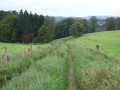
(9) At the country road by Lusebuschsiefen, we turn right, walk along the road for about 130 m, and then another path branches off to the right. At the fork, we keep to the right. The path leads uphill into the woods and ends at a gravel track. Here we continue straight ahead, crossing a stream, until we reach the next fork, where we keep to the left. We come out onto a meadow again and carry on straight ahead.
(10) We reach a junction and come to Röntgenweg; turn left and then immediately left again. At the next opportunity, we turn right and then straight back to the left. Now just a few metres straight on and we’re back at the starting point of this walk (S/E).
 Tourism professional
 Easy
Easy 
 Visorando Member