


 Country:
 City:
City:



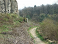
(Start/Finish) We start the circuit in Oberdollendorf at the car park by St Laurentius Church and walk clockwise along Heisterbacher Straße to the other side of the church, then follow the footpath ‘Cahn’s Berg’, which branches off to the left. At the junction, we turn right into Mühlental. We follow the road straight on – the Rheinsteig access path – through the wood until we cross Heisterbacher Straße. We continue along the path to Heisterbach Abbey.
(1) On the other side of Heisterbacher Straße, we continue along a dirt track, passing a pond on the left. The track curves to the left and, about 100 metres past the bend, we turn right. Here we are also on the Rheinsteig access route ‘Heisterbacherrott’, which we leave after about 280 metres by turning left onto the Weilberg circular trail. From here, we take a short loop around the summit of the Weilberg. We follow the well-maintained gravel path, circling the Weilberg in a clockwise direction. After about 1.1 km, a slightly hidden path branches off to the right at an angle of about 135°. We follow this path. Please take the utmost care here! We pass quite close to the upper edge of a former quarry. We follow the path – which, towards the end, requires some climbing skill and a steady footing – until we rejoin a wider gravel track. Here we turn left and can admire the former basalt quarry from below.
(2) We follow the path to the right, past a viewing platform with a rest area, and rejoin the gravel track at a junction. Here we turn left and walk straight on for about 130 metres until we reach the next junction. We then turn right onto a path. After a right-hand bend, we come to a car park and, a few steps further on, to Heisterbacher Straße. Here, follow the road 40 m to the right, then turn left towards a larger hiking car park. We follow the path which leads left from the car park into the woods. At the next junction, we turn left again and reach the Beethoven Hiking Trail. We follow this straight on, past the next junction, keeping to the right at the second junction and turning right again 50 metres further on. Here we reach the Felsenmeer rock formation on the Stenzelberg.
(3) Here are some rocks that are perfect for climbing. We continue along the path, past high rocky cliffs, to the next junction. Here we turn right and follow the main path straight on to the mountain hut.
(4) At the large star-shaped junction, we walk about 40 metres westwards and then turn slightly left onto a path. We follow this path down into the valley via long hairpin bends for about 1.5 km until we cross a track. Shortly afterwards, the path forks. We keep to the left until, after a gentle left-hand bend, we come back onto a gravel track heading west after about 80 metres; after just over 80 metres, this track leads straight onto a path where we wind our way uphill again.
(5) Here we reach Petersberg Road. We continue uphill along the road, going round the Hotel Petersberg.
(6) Behind the buildings, we head back down into the valley via the Beethoven Hiking Trail. After about 620 m, we cross a farm track and continue down into the valley. After a further 370 m, we cross two paths in quick succession and carry on straight ahead, heading downhill. After about 330 m, we turn right. 200 m further on, we cross a gravel path and pass a woodland cemetery as we enter the village of Oberdollendorf; we continue downhill to the left, running parallel to Heisterbacher Straße, then turn left onto Rennenbergstraße and follow it to the starting point at St Laurentius Church. (Start/Finish)
 Visorando Member
 Moderate

 Association / Club / Walk leader
 Tourist office
