Country:
 City:
City:


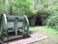
(S/E) The starting point is a walkers’ car park opposite Bommerholzer Straße 59. From there, we walk a short distance along Bommerholzer Straße towards the north-east and, after the first buildings, turn left into Schlagbaumstraße onto the X4 trail. We now walk as far as the junction with Am Masling and turn left there.
We follow the road until we reach Kohlseggenstraße.
(1) Here, we walk a few metres further to the left along Am Masling and, just past the next junction, turn right onto a path into the woods along the Fritz-Golte-Weg Witten. At the next opportunity, we turn right, following the path to Rauendahlstraße. We cross this road to the left after a few metres and immediately turn right again. We follow the path to Berghauser Straße. Here, we turn right onto the A1, which we leave again to the right after about 300 metres. We follow the path until, after a large right-hand bend, we rejoin the Muttental Mining Trail. Here, we continue to the right and follow the path to the fork at the small car park. There, we turn left, past a shelter, to the X4 Höhlenweg cross-path.
(2) Here, we follow the GeoRoute and the X4 northwards. At the next fork, we keep to the right on the Muttental Mining Trail and the A2.
(3) We reach the spoil heap. It’s worth taking a quick look around here before continuing northwards. At the junction, we keep left on the Muttental Mining Trail, following the Muttenbach stream. Continuing straight on, we leave the A1 and join the A3, heading towards the Nachtigall Colliery.
(4) We continue along the A3 on Nachtigallstraße, cross the railway line and soon reach the Mining and Light Railway Museum (5). We carry on along the A3 to the car park, where we turn sharply right onto the A1. At the second junction, we turn left towards Steinhausen. Not far on, we see the Muttenbach again.
(6) At the Nachtigallstollen, we turn left off the A1 onto the Mining Trail and follow it to the Hardenstein ruins.
(7) From the ruins, we continue southwards on the A1. At the next junction, we carry on straight ahead along a path and leave the Muttental Circular Trail A1 at this point. Shortly after the junction, we keep to the right.
(8) At the second fork, we turn right again, then slightly to the left and straight back to the right. After a few hundred metres, we rejoin the Muttental Circular Trail A1.
(9) After just under 500 m, we turn sharply left onto the A1. We follow this path straight on until we reach a field and bridle path. Here, we turn left, following the gravel path past a car park.
(10) At Rauendahlstraße, we turn right and walk along the road for a short distance, then leave it again at the next junction by turning left. At the next junction, we cross the road and continue along a path heading south-east. Continuing straight on, the path soon becomes a field track again. We follow this to the next crossroads. Here, we turn left. After almost 300 metres, a footpath leads off to the right.
(11) The path takes us to the Vorm Holz Circular Walk A2. We turn right onto it, leave it after a few metres by continuing straight ahead, and follow it for almost a kilometre.
(12) The path curves to the right, then turns 90° to the left, continuing along a path. We follow this path straight on until we reach a dirt track. We follow this to the left and soon reach Bommerholzer Straße (13). We walk a few metres along this to the left and then turn right onto a path. This leads us to the Elbschetal Circular Trail A6.
(14) At Elbschestraße, we turn left and continue straight ahead on the A7 at the X-junction. After an S-bend, a path branches off to the left. After a few metres, this takes us back to the starting point (S/E).
 Visorando Member

 Tourism professional
 Easy
Easy