Country:
 City:
City:


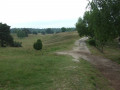
(Start/Finish) The walk starts on Hullerner Straße in Haltern am See, heading east. We keep to the right and soon cross the River Stever. 1.2 km past the bridge at the Hotel Seehof, we turn right immediately behind the building. From here, we head south for almost 200 m into the woods, then take a sharp left, followed by another left after about 145 m and straight back to the right. At the second junction, we keep to the left. We then take the next right-hand turn, walk straight on to the junction just past the bend to the right. There, we take the left-hand option twice in quick succession. At the next crossroads, we turn left again and then right three times. At the next fork, keep left and then turn left again. Now walk straight on, across the Flaesheimer Damm.
(1) We walk around the car park there in an anti-clockwise direction for about a third of the way round, leave it heading south onto the A5 and turn right shortly afterwards. After about 360 m, we turn right and then take the next left-hand option. At the next junction, we turn right again until we reach Flaesheimer Damm once more. We turn left and follow the road across the River Lippe; just before the next bridge, we turn left and now walk eastwards along the Wesel-Datteln Canal until we reach Kanalstraße, where we cross the canal. We follow the road on to the cemetery and turn right to walk round it.
(2) We follow the path straight on right through the village until we re-enter the woodland and pass a car park and a playground. About 25 metres beyond them is a turn-off to the left, which we follow for approximately 650 metres before turning left there. About 240 metres further on, we turn right onto a path. We walk 650 m straight ahead along the path and come to a dirt track, which we leave immediately by turning right. Then, at the next junction, we turn sharply left and, at the next crossroads, turn right, then continue straight ahead to the junction with the Dachsberg – Die Haard (orange) walking trail. Here, we walk a few metres south and follow the marked path to the right.
(3) We follow the path until it runs parallel to the Dachsberg – Die Haard (blue) trail and reach the viewing tower on the Rennberg.
(4) We now walk along the Dachsberg – Die Haard (blue) trail, which we leave after a few metres and continue to follow the X16. At the next junction, we go straight on and, a little further on, we turn right towards the north. After about 650 m, at the second junction, we keep to the left, heading north-west. We now walk straight on for 820 m and then turn left, heading west.
(5) We walk straight on, crossing the A2 after a few metres, and turn right – or north – at the next opportunity. After 540 m, we reach a junction where we turn left. After a further 270 m, we reach a junction where we turn right and walk a short distance along the Reitweg. After 550 m, we reach a junction where we continue to the right. After a few metres, we come onto a gravel track, the A1, which we follow to the left across the Bossendorfer Damm, passing a rainwater retention basin. We carry on straight ahead into the village of Bossendorf along Herzogsweg until we reach Holtkampweg, where we turn right. We then cross Flaesheimer Straße and turn right again onto Bossendorfer Weg. At the next opportunity, turn left and cross the Wesel-Datteln Canal.
(6) Now we turn left again, following the X5 for a short distance to Recklinghäuser Straße. Here we turn right, walking parallel to the road, and switch to the X6, crossing the River Lippe into an industrial estate. After about 400 m, we follow the X6 to the left, passing under the road, and continue north along it for a further 470 m. There, we leave the X6 by turning right into Wasserwerkstraße, pass under Recklinghäuser Straße again and turn left immediately afterwards; we soon reach the River Stever and turn right at the next junction.
(7) We now follow the River Stever for about 1.6 km to Lake Halten, where we turn left one last time and, after a few hundred metres, reach our destination. (Start/Finish)
 Visorando Member